Old Maps of Castalia Township, South Dakota
Explore 25 old maps of Castalia Township, spanning from 1955 to today. These high-resolution historic maps reveal how streets, neighborhoods, landmarks, and natural features evolved over time — perfect for genealogy, metal detecting, research, and local history exploration.
What you can do with these maps:
- See how Castalia Township changed over time: Compare historical maps to modern-day views to trace roads, homesites, rail lines & more.
- View detailed metadata: Each map includes creators, publishers, year, scale, and archive source.
- Overlay maps with satellite & LiDAR: Visualize the past alongside modern tools to explore terrain & human change.
- Trusted historical sources: Maps sourced from the USGS, Library of Congress, and other archives.
- Access maps your way: View online, download high-res files, or order prints for personal or research use.
Start exploring old maps of Castalia Township to uncover forgotten places, hidden landmarks, and the deep history beneath your feet.
Castalia Township, SD maps
(25)- 1955 Map of Mitchell, 1973 Print
 1955 Mitchell1973 Print · USGSThe Missouri River valley undergoes a massive transformation in the mid-1950s as the Fort Randall Dam creates Lake Francis Case. You can trace the rail lines of the Chicago Milwaukee St Paul and Pacific through Mitchell or locate local landmarks like Butler Town Hall.2 unique versions available
 - 1959 Map of Mitchell
 1959 Mitchell1959 Print · USGSSouth Dakota’s river and rail corridors come alive in the late fifties as the Missouri River valley undergoes dramatic change. Genealogists and historians can trace family roots through numerous small towns and schools such as Academy, Stickney, and Gregory.2 unique versions available
 - 1971 Map of Academy, 1974 Print
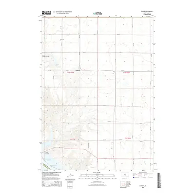
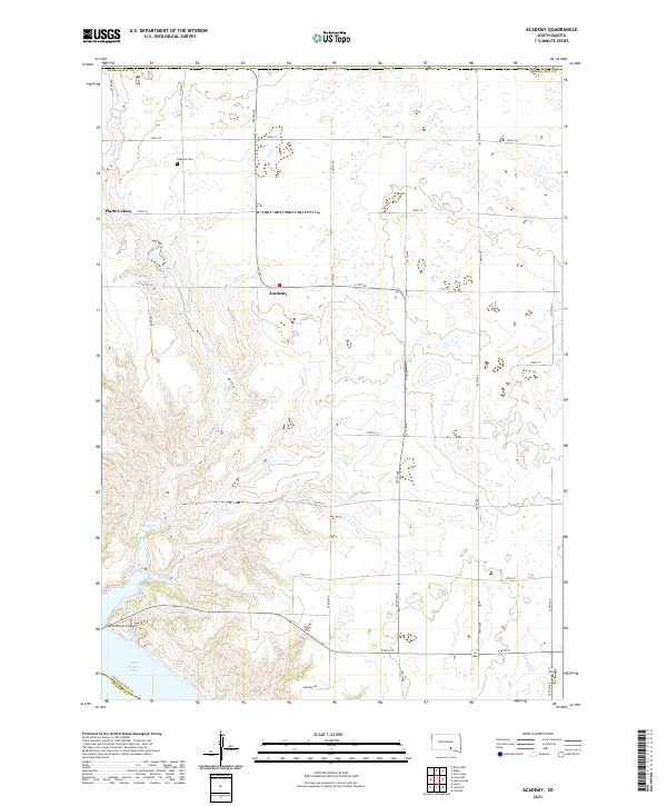
 1971 Academy1974 Print · USGSThe South Dakota prairie meets the Missouri River in the early seventies, capturing the rural character of Charles Mix County. Genealogists and local historians can trace family roots through sites like Platte Colony, Academy, and the La Roche Cem.
 - 1971 Map of Lucas SE, 1974 Print
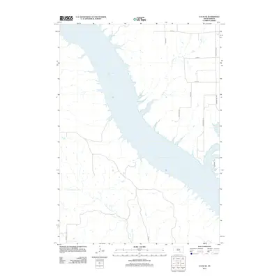
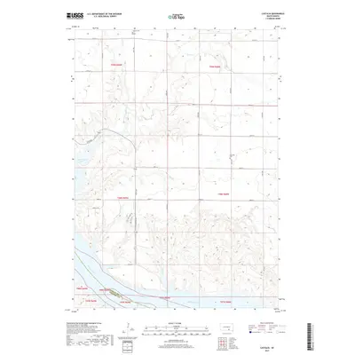
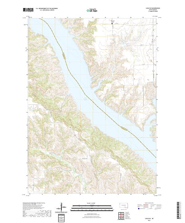
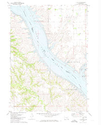 1971 Lucas SE1974 Print · USGSThe Missouri River breaks into the reservoir of Lake Francis Case during the early seventies, defining the border of the Rosebud Indian Reservation. Local history researchers can locate Trinity Ch, a hilltop Cem, and drainage points like Whetstone Creek.
 - 1979 Map of Castalia, 1980 Print
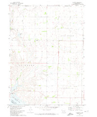
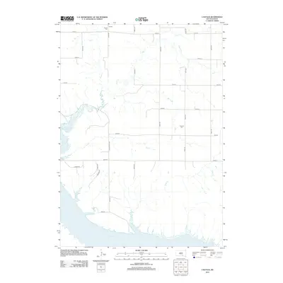
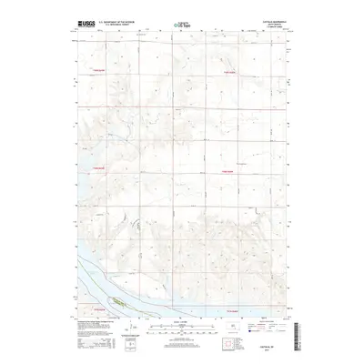
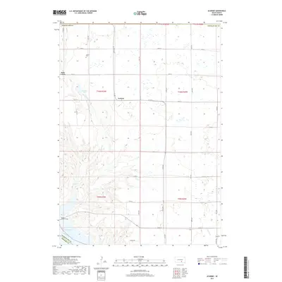
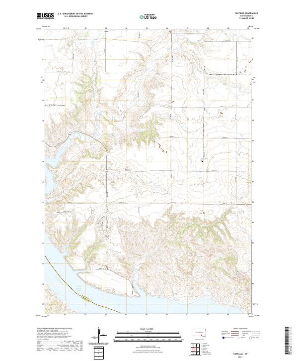
 1979 Castalia1980 Print · USGSCharles Mix County's prairie and river landscape are captured here in the late 1970s, as the Missouri River transition defines the local terrain. Genealogists and researchers can locate Friesland Cem, the settlement of Castalia, and several Flowing Wells tucked into the creek breaks.
 - 1979 Map of Lake George, 1980 Print
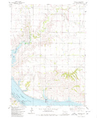
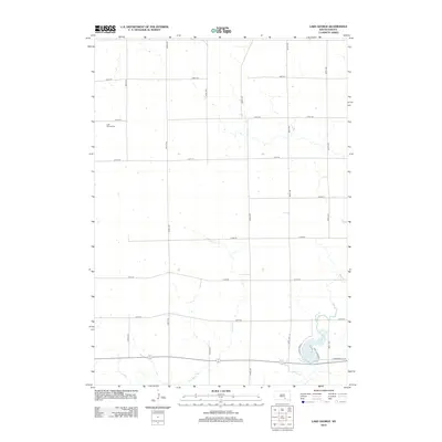
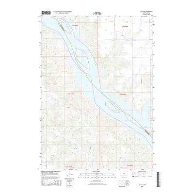
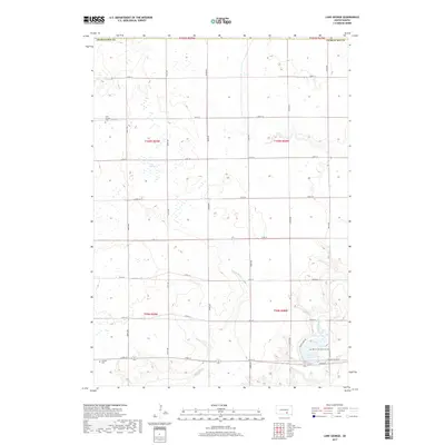
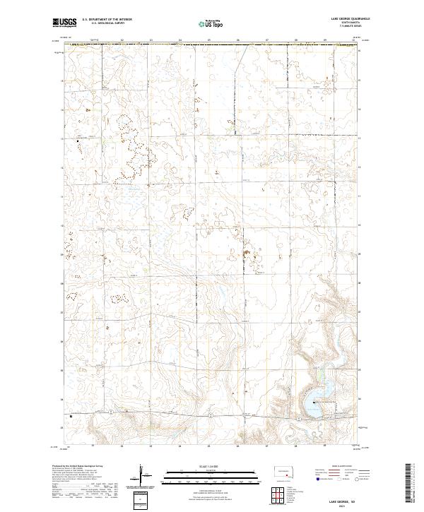
 1979 Lake George1980 Print · USGSCharles Mix and Brule counties are shown here in the late seventies, a landscape of prairie sections and vital water sources. Researchers can locate the Lake George Cem, the Castalia Sch, and the small cluster at Townhall.
 - 1986 Map of Winner
 1986 Winner1986 Print · USGSTripp and Gregory Counties are captured in the mid-eighties as the agricultural heartland centered on the Chicago and North Western line. Genealogists can trace family footprints near St Charles, Paxton, and Winner, or explore the shoreline of Lake Francis Case.2 unique versions available
 - 1986 Map of Lake Andes
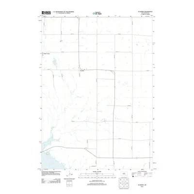
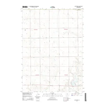
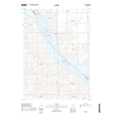
 1986 Lake Andes1986 Print · USGSThe Yankton Indian Reservation and the vast Missouri River impoundments define this South Dakota landscape in the mid-eighties. Researchers can trace old township lines and the Old Railroad Grade, or locate sites like Fort Randall and the Pleasant Ridge Cem.3 unique versions available
 - 1990 Map of Mitchell, 1991 Print
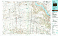
 1990 Mitchell1991 Print · USGSThe Missouri River and the surrounding South Dakota plains are captured here in the early nineties, showing a landscape shaped by water and wire. Genealogists and historians can trace the gridded townships from Mitchell to the Bijou Hills, locating sites like the Platte Colony and Academy.
 - 2012 Map of Castalia, 2012 Print
 2012 Castalia2012 Print · USGSCovers Castalia Township, including Hamilton Township, Platte Township, and other nearby areas
 - 2012 Map of Lake George, 2012 Print
 2012 Lake George2012 Print · USGSCovers Castalia Township, including Torrey Lake Township, Lake George Township, and other nearby areas
 - 2012 Map of Lucas SE, 2012 Print
 2012 Lucas SE2012 Print · USGSCovers Castalia Township, including Hamilton Township, La Roche Township, and other nearby areas
 - 2012 Map of Academy, 2012 Print
 2012 Academy2012 Print · USGSCovers Castalia Township, including Lake George Township, La Roche Township, and other nearby areas
 - 2015 Map of Lake George, 2015 Print
 2015 Lake George2015 Print · USGSCovers Castalia Township, including Torrey Lake Township, Lake George Township, and other nearby areas
 - 2015 Map of Castalia, 2015 Print
 2015 Castalia2015 Print · USGSCovers Castalia Township, including Hamilton Township, Platte Township, and other nearby areas
 - 2015 Map of Lucas SE, 2015 Print
 2015 Lucas SE2015 Print · USGSCovers Castalia Township, including Hamilton Township, La Roche Township, and other nearby areas
 - 2015 Map of Academy, 2015 Print
 2015 Academy2015 Print · USGSCovers Castalia Township, including Lake George Township, La Roche Township, and other nearby areas
 - 2017 Map of Lake George, 2017 Print
 2017 Lake George2017 Print · USGSCovers Castalia Township, including Torrey Lake Township, Lake George Township, and other nearby areas
 - 2017 Map of Lucas SE, 2017 Print
 2017 Lucas SE2017 Print · USGSCovers Castalia Township, including Hamilton Township, La Roche Township, and other nearby areas
 - 2017 Map of Castalia, 2017 Print
 2017 Castalia2017 Print · USGSCovers Castalia Township, including Hamilton Township, Platte Township, and other nearby areas
 - 2017 Map of Academy, 2017 Print
 2017 Academy2017 Print · USGSCovers Castalia Township, including Lake George Township, La Roche Township, and other nearby areas
 - 2021 Map of Lake George, 2021 Print
 2021 Lake George2021 Print · USGSCharles Mix County in the early twenty-first century remains a landscape of rolling prairie and vital water bodies. Researchers can trace family history at the Lake George Cem or explore the drainage patterns of Castalia Cr and Platte Cr.
 - 2021 Map of Academy, 2021 Print
 2021 Academy2021 Print · USGSThe Missouri River bluffs of Charles Mix County are captured here in 2021, showing the modern expanse of Lake Francis Case. Trace local roots near the LaRoche Cem or explore the rural settlements of Academy and Platte Colony.
 - 2021 Map of Lucas SE, 2021 Print
 2021 Lucas SE2021 Print · USGSThe Missouri River breaks of Gregory County are captured here in the early twenty-first century as they meet the expansive Lake Francis Case. Researchers can locate rural landmarks like the West Trinity Lutheran Church or trace the transition from Old 1806 Rd to modern township highways.
 - 2021 Map of Castalia, 2021 Print
 2021 Castalia2021 Print · USGSCharles Mix County's prairie and river bluffs are captured here in the early twenty-first century as they overlook the Missouri. Genealogists and local historians can locate Friesland Cem and the settlement of Castalia, or trace the path of the Lewis and Clark Trl above Lake Francis Case.
End of results
Showing maps 1-25 of 25
Top cities near Castalia Township
Frequently asked questions
- What are the different types of historical maps available for Castalia Township?
- What is the oldest map of Castalia Township?
- Where can I purchase historical maps of Castalia Township for my home or office?
- Where can I download high-res historical maps of Castalia Township?
- Are there historical topographic maps available for Castalia Township?
- Is there historical aerial imagery available for Castalia Township?
- Where are historical maps of Castalia Township sourced from?