2020s Maps of Clark County, South Dakota
Explore 29 historic maps of Clark County from the 2020s. These maps offer a rare glimpse into what life looked like during the 2020s — showing old roads, neighborhoods, homes, and landmarks that have changed or disappeared over time.
Whether you're researching your family's past, planning a metal detecting trip, or studying how Clark County's landscape evolved across the 2020s, these high-resolution maps are a powerful tool for exploring the history of this region.
- Focus on a specific era: All maps on this page are from the 2020s, giving you a focused view of this time period.
- See what’s changed: Compare century-old streets, trails, and buildings to today's modern landscape using overlays and satellite layers.
- Research with precision: Use these maps for genealogy, historical research, land use analysis, or educational projects.
- View, download, or print: Maps are fully viewable online in high resolution, and can be downloaded or printed for your own records.
Start exploring Clark County's history through authentic maps from the 2020s. This is your window into the past.
Clark County, SD maps
(29)- 2021 Map of Hazel, 2021 Print
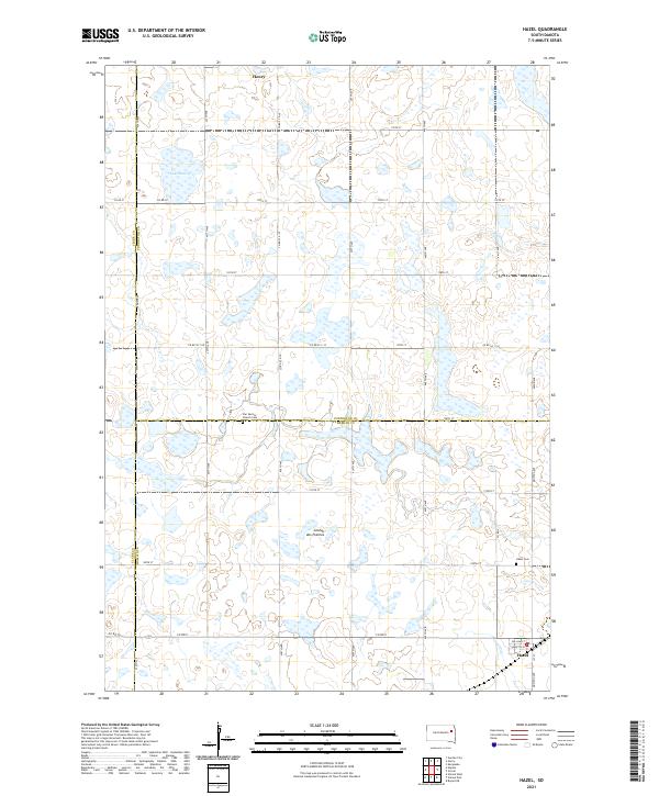 2021 Hazel2021 Print · USGSThe prairie plateau of eastern South Dakota is shown here as it appeared recently, centered on the rural hub of Hazel. Researchers can locate family sites near Hazel Cem, the waters of Lake Henry, and the crossroads of Henry.
 - 2021 Map of Carpenter NE, 2021 Print
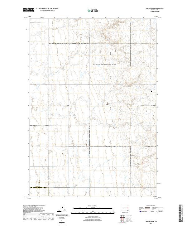 2021 Carpenter NE2021 Print · USGSEastern South Dakota’s glacial plateau is captured here in the early twenty-first century, showing the rural section-line grids of Clark and Beadle counties. Researchers can locate family heritage sites like Hague Cem and Woodland Cem along the headwaters of Shue Cr.
 - 2021 Map of Clark South, 2021 Print
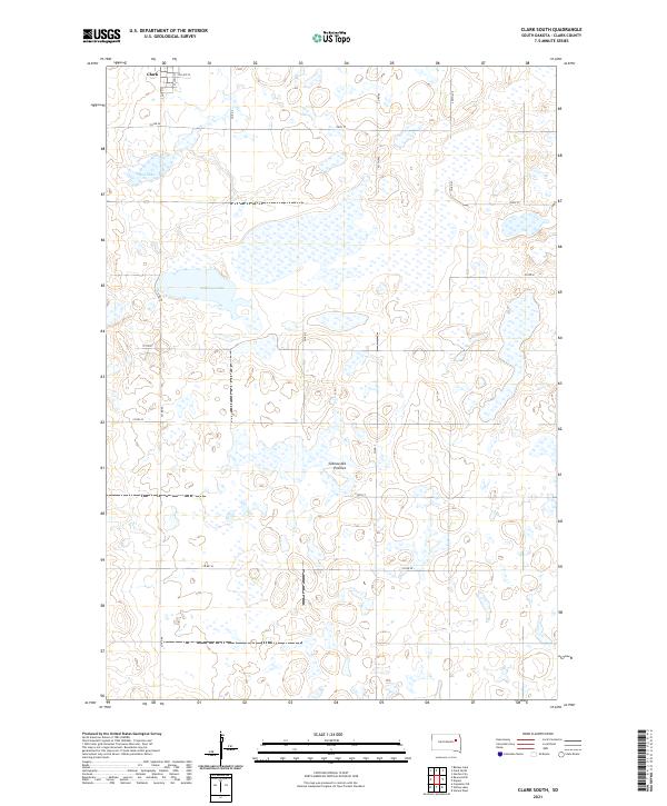 2021 Clark South2021 Print · USGSThe southern edge of Clark meets the high prairie plateau in the early twenty-first century. Genealogists and land researchers can trace the section-line roads and rural boundaries surrounding Antelope Lake, Mud Lake, and the distinctive Coteau des Prairies.
 - 2021 Map of Raymond, 2021 Print
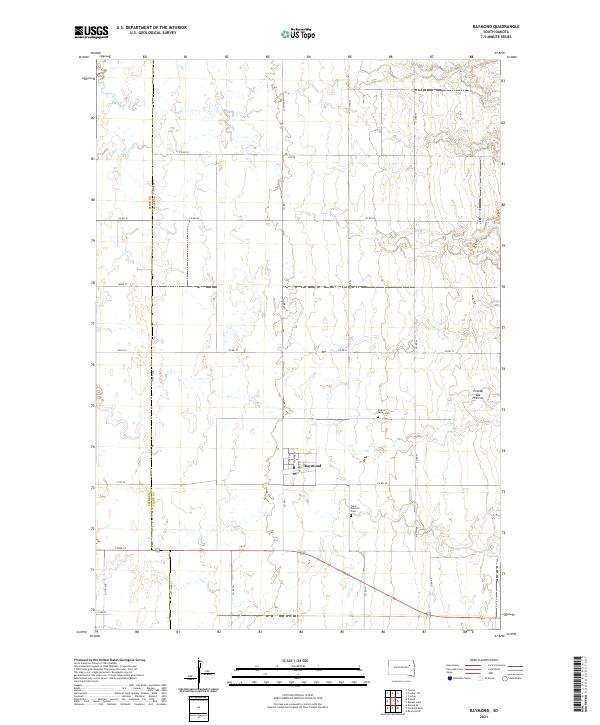 2021 Raymond2021 Print · USGSRaymond sits amidst the high plains of Clark County during the early twenty-first century, showing a landscape of organized section lines and prairie plateaus. Genealogists and local historians can locate Saint Patricks Cem and Prairie Valley Cem or trace the township boundaries of T117N R59W.
 - 2021 Map of Garden City, 2021 Print
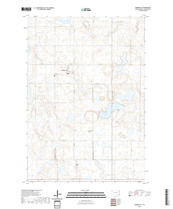 2021 Garden City2021 Print · USGSThe upland plateau of the Coteau des Prairies is captured here in the early twenty-first century, showing the rural landscape around Garden City. Researchers can trace the layout of local landmarks like the Garden City Cem and the extensive network of wetlands including Mankey Slough.
 - 2021 Map of Bryant, 2021 Print
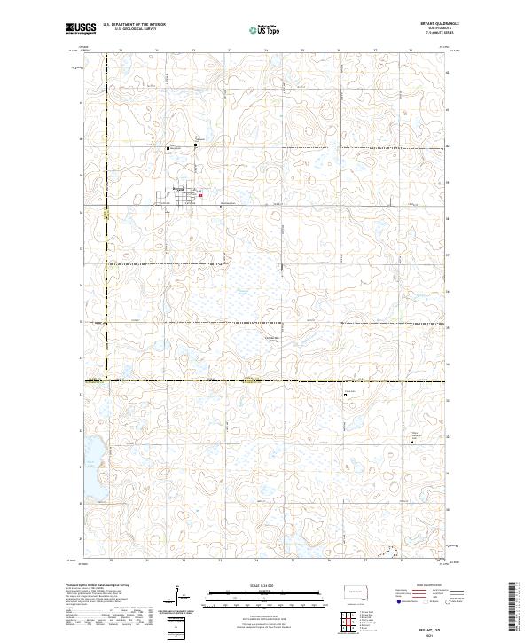 2021 Bryant2021 Print · USGSThe upland prairie around Bryant is shown here in the early twenty-first century, documenting a region defined by its Lutheran heritage and glacial geography. Researchers can locate five local burial grounds, including Woodlawn Cem and Clara Lutheran Cem, alongside natural features like Johnsons Slough.
 - 2021 Map of Henry, 2021 Print
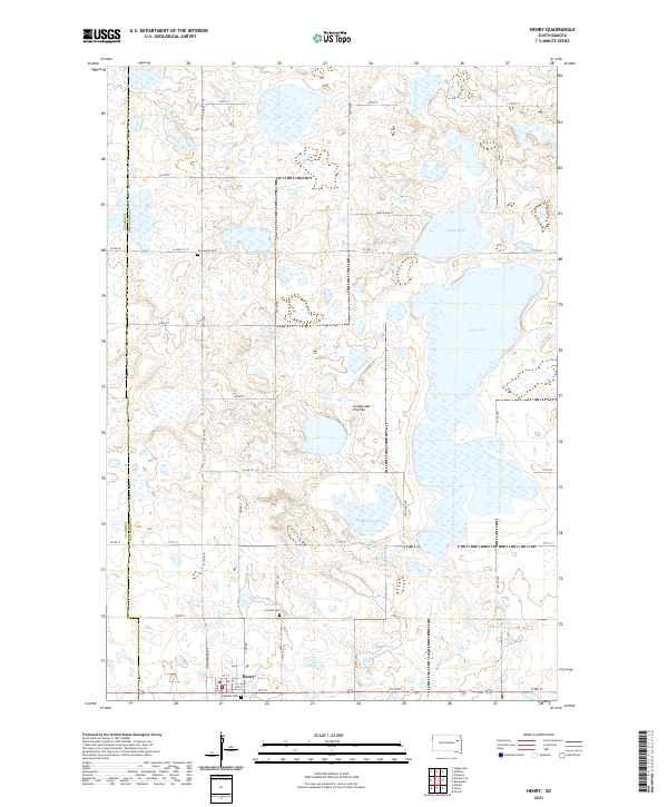 2021 Henry2021 Print · USGSCodington County at the start of the 2020s shows a landscape of glacial prairie lakes and settled family farmsteads. Researchers can trace local roots at Saint Henry Catholic Cem or explore the water boundaries of Long Lake and Stink Lake.
 - 2021 Map of Baileys Lake, 2021 Print
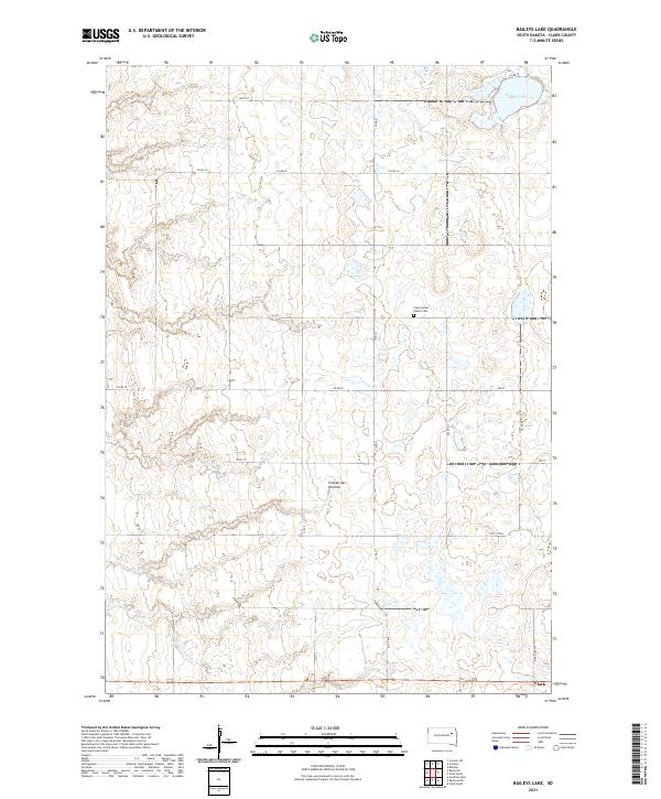 2021 Baileys Lake2021 Print · USGSThe upland plateau of the South Dakota prairie is captured here in the early 2020s, showing a landscape defined by glacial potholes and rural township grids. Researchers can locate family sites near Clark or trace local heritage at the Clark Center Church Cem.
 - 2021 Map of Vienna West, 2021 Print
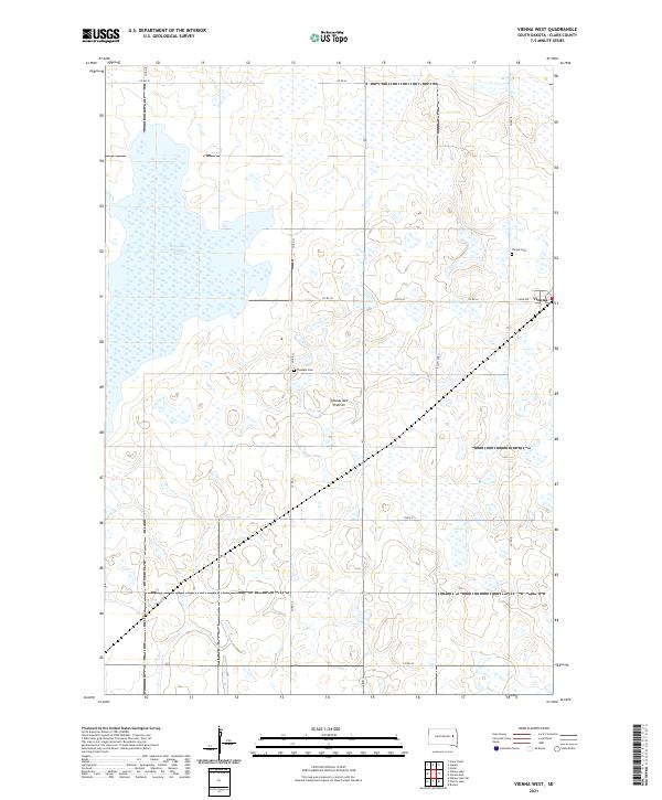 2021 Vienna West2021 Print · USGSThe agricultural plains of Clark County appear in the early 21st century as a landscape defined by the Coteau des Prairies and its glacial wetlands. Researchers can trace the town of Vienna and locate local landmarks like Pleasant Cem and Dry Lake Number Two.
 - 2021 Map of Carpenter SE, 2021 Print
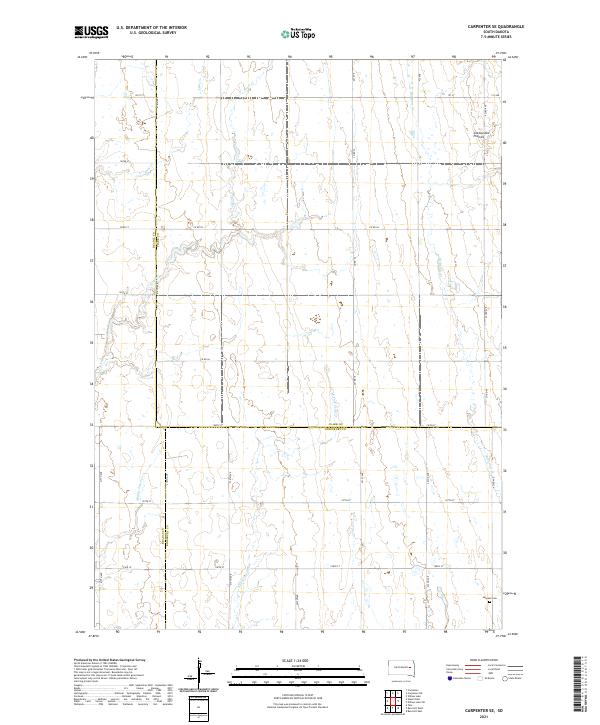 2021 Carpenter SE2021 Print · USGSEastern South Dakota's agricultural heartland is documented here in the early twenty-first century, where Beadle, Clark, and Kingsbury counties converge. Genealogists can locate LeSueur Cem and trace the drainage of Pearl Cr and Redstone Cr.
 - 2021 Map of Willow Lake, 2021 Print
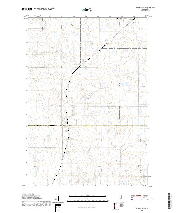
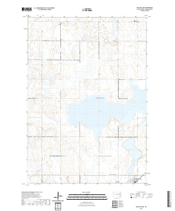 2021 Willow Lake2021 Print · USGSThe prairie pothole region of Clark County comes into focus here in the early twenty-first century. Genealogists and local historians can locate rural burial grounds like Good Hope Lutheran Cem and trace the shores of Dry Lake Number Two and Willow Lake.
 - 2021 Map of Raymond SE, 2021 Print
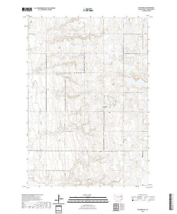 2021 Raymond SE2021 Print · USGSThe Clark County prairie is shown here in the early twenty-first century, revealing a landscape defined by glacial topography and family farms. Researchers can locate the Darlington Cem and trace the course of Foster Cr through the Coteau des Prairies.
 - 2021 Map of Naples, 2021 Print
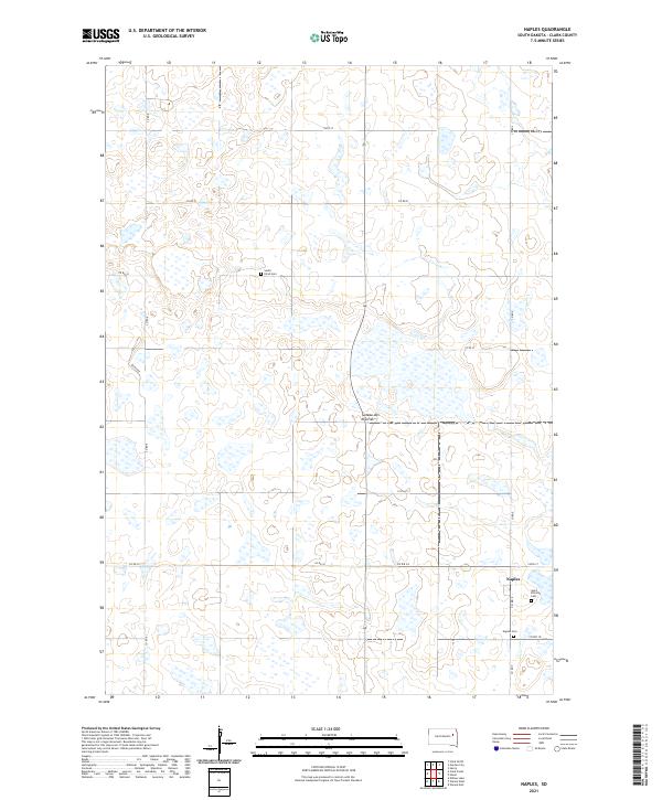 2021 Naples2021 Print · USGSThe eastern South Dakota prairie is captured here in the twenty-first century, showing the rural community of Naples and the surrounding farmland. Researchers can locate family heritage sites at Saint Patricks Cem and South Elrod Cem among the wetlands of the Coteau des Prairies.
 - 2021 Map of Cherry Lake, 2021 Print
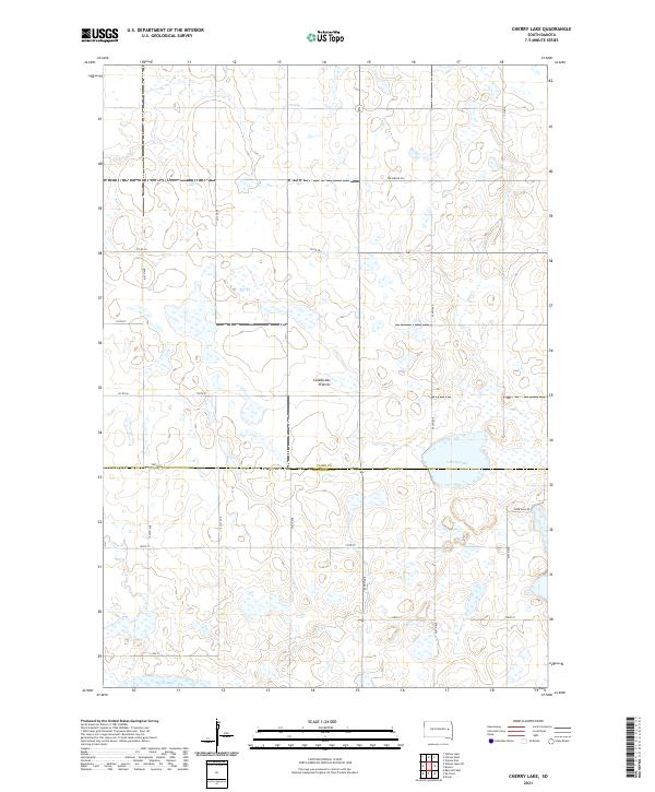 2021 Cherry Lake2021 Print · USGSThe high glacial plateau of South Dakota is captured here in the early twenty-first century, showing a landscape defined by the Coteau des Prairies. Genealogists and researchers can trace local land patterns and rural routes like Efraimson Dr near the shores of Cherry Lake.
 - 2021 Map of Swan Lake, 2021 Print
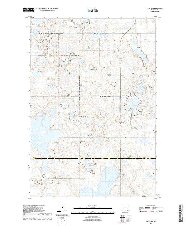 2021 Swan Lake2021 Print · USGSThe glacial wetlands of the Coteau des Prairies are captured here in the early twenty-first century. Genealogists and local historians can trace the rural grid between Swan Lake and Mud Lake, identifying local landmarks like Highland Cem and Hosanger Cem.
 - 2021 Map of Lone Tree Lake, 2021 Print
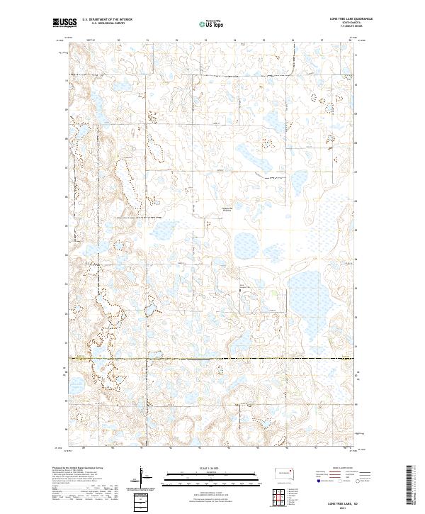 2021 Lone Tree Lake2021 Print · USGSThe glacial plateau of the South Dakota prairie is captured here in the early twenty-first century, spanning the border of Day and Clark counties. Local historians can trace the rural landscape around Lone Tree Lake and the grounds of Saint Ansgaar Cem.
 - 2021 Map of Crocker SW, 2021 Print
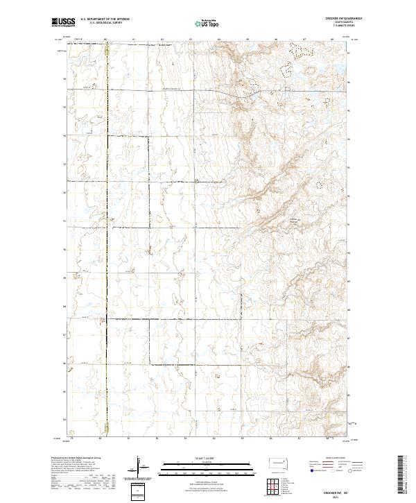 2021 Crocker SW2021 Print · USGSThe high glacial plateau of eastern South Dakota is captured here in the early twenty-first century. Genealogists and land researchers can trace property boundaries and section lines along the Spink Co Clark Co line and S Dakota Highway 20.
 - 2021 Map of Lily, 2021 Print
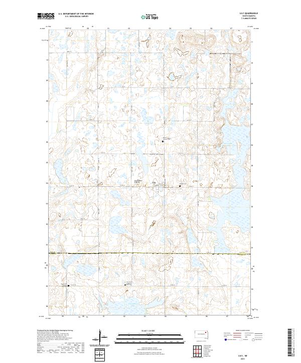 2021 Lily2021 Print · USGSDay County and Clark County meet in this modern survey of a quiet agricultural corner of South Dakota. Genealogists can trace family connections at Hillside Cem, Saint Joseph's Catholic Cem, and the dual grounds of Our Saviors Lutheran West Cem near Lily.
 - 2021 Map of Crandall, 2021 Print
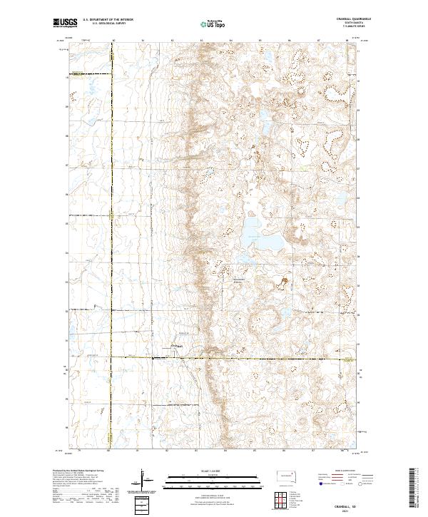 2021 Crandall2021 Print · USGSDay County and the surrounding prairie lands are captured here during the early twenty-first century. Researchers can trace the layout of Crandall and locate the Crandall Cem or the waters of Sweetwater Lake along the glacial Coteau des Prairies.
 - 2021 Map of Crocker, 2021 Print
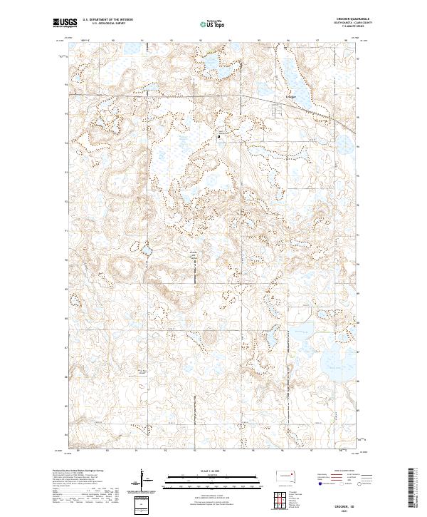 2021 Crocker2021 Print · USGSThe high prairie of Clark County is shown here in the modern era, where the glacial terrain of the Coteau des Prairies meets the small community of Crocker. Researchers can locate Saint Thomas Cem and trace the drainage patterns of Mallard Slough and Round Lake.
 - 2021 Map of Bradley, 2021 Print
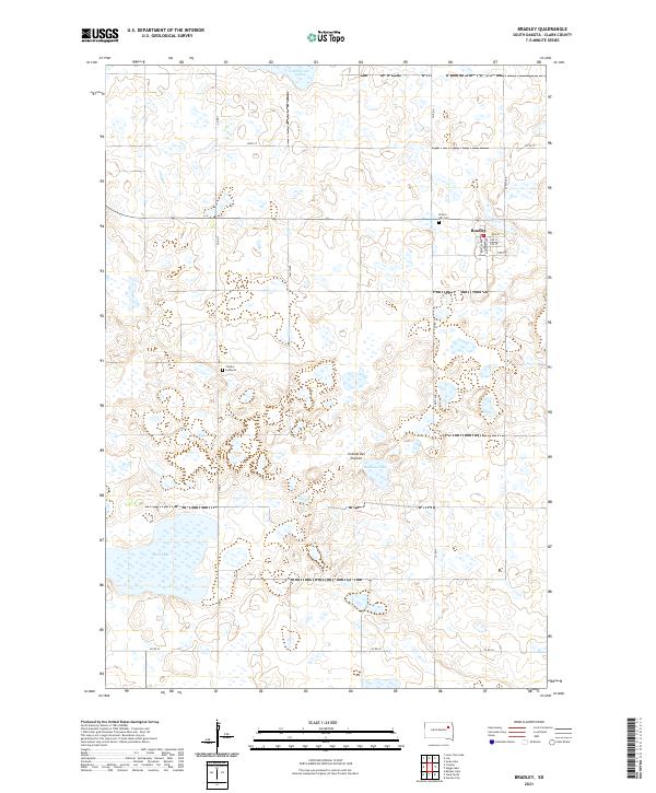 2021 Bradley2021 Print · USGSIn the early twenty-first century, the town of Bradley remains a focused agricultural hub atop the glacial Coteau des Prairies. Genealogists and local historians can locate the Prairie Hill Cem and Calvary Lutheran church amidst a landscape of prairie potholes and named waters like Reid Lake.
 - 2021 Map of Florence NW, 2021 Print
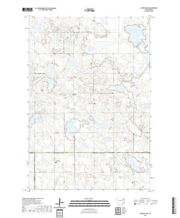 2021 Florence NW2021 Print · USGSNortheastern South Dakota's glacial landscape is documented here in the early twenty-first century where Day, Clark, and Codington counties intersect. Genealogists and local historians can locate early burial sites including Saint Pauli Lutheran Cem and Goodhue Cem set against the Coteau des Prairies.
 - 2021 Map of Fordham Dam, 2021 Print
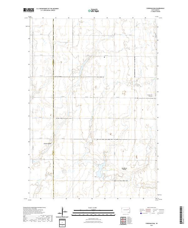 2021 Fordham Dam2021 Print · USGSAgricultural life in eastern South Dakota is centered here at the base of the Coteau des Prairies in the early twenty-first century. Genealogists and researchers can locate Clark Colony, Fordham Colony, and the rural Logan Cem.
 - 2021 Map of Willow Lake SW, 2021 Print
 2021 Willow Lake SW2021 Print · USGSThe prairie pothole region of the South Dakota plains is captured here in the early twenty-first century. Genealogists can trace family roots at St. James Catholic Cem and German Presbyterian Cem near the town of Willow Lake.
 - 2021 Map of Carpenter, 2021 Print
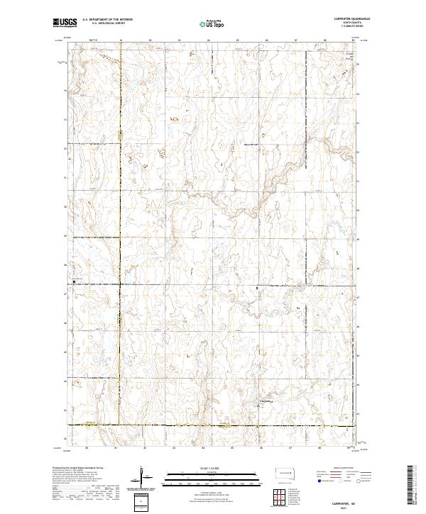 2021 Carpenter2021 Print · USGSThe eastern South Dakota plains near the Clark and Spink county line are captured here in the early twenty-first century. Researchers can locate the small settlement of Carpenter and trace family sites near Union Cem and Richland Cem.
Showing maps 1-25 of 29
Top cities of Clark County
- Clark historical maps
- Willow Lake historical maps
- Bradley historical maps
- Elrod historical maps
- Raymond historical maps
- Vienna historical maps
See more
Frequently asked questions
- What are the different types of historical maps available for Clark County?
- What is the oldest map of Clark County?
- Where can I purchase historical maps of Clark County for my home or office?
- Where can I download high-res historical maps of Clark County?
- Are there historical topographic maps available for Clark County?
- Is there historical aerial imagery available for Clark County?
- Where are historical maps of Clark County sourced from?