Old Maps of Clay County, South Dakota for Academic Research
Study the evolution of Clay County with 90 high-resolution historic maps. Whether you're teaching, researching, or modeling changes in land use, these maps provide essential visual documentation of urban, environmental, and geographic change.
- Analyze long-term change: Track patterns in development, transportation, and natural features.
- Ideal for environmental or urban studies: Support academic projects with primary historical map data.
- Use in the classroom or lab: Educators and researchers rely on these maps to bring historical context to life.
These maps are a powerful tool for teaching, research, and visualizing how Clay County has changed over the decades.
Clay County, SD maps
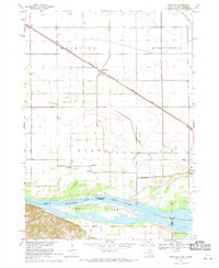
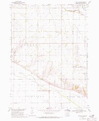
(90)- 1897 Map of Canton, 1954 Print
 1897 Canton1954 Print · USGSSoutheastern South Dakota and the Iowa borderlands were undergoing a railway-driven expansion during the 1890s. Genealogists and historians can trace early settlements like Beloit, Centerville, and Lennox as they grew along the Big Sioux River.
 - 1898 Map of Parker
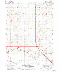
 1898 Parker1898 Print · USGSSoutheastern South Dakota in the late nineteenth century shows a landscape defined by the expansion of the Chicago and Northwestern railroad. Genealogists and local historians can trace early settlements and pioneer-era post offices like Idylwilde, Hurley, and the prominent rise of Turkey Ridge.4 unique versions available
 - 1898 Map of Elk Point, 1960 Print
 1898 Elk Point1960 Print · USGSThe tri-state borderlands of South Dakota, Nebraska, and Iowa are captured here in the late nineteenth century as a landscape of ferries and river-fed commerce. Researchers can trace the early foundations of Elk Point and Vermillion or locate vanished crossings like Ionia Ferry and the Ponca Ferry.2 unique versions available
 - 1900 Map of Canton
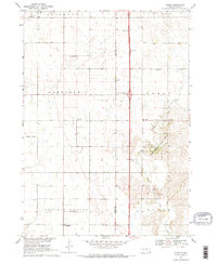
 1900 Canton1900 Print · USGSSoutheastern South Dakota and the Iowa borderlands are captured here at a peak of late-nineteenth-century rail expansion. Genealogists can trace the early foundations of towns like Canton, Centerville, and Beresford along the Big Sioux River.2 unique versions available
 - 1901 Map of Elk Point
 1901 Elk Point1901 Print · USGSThe tri-state borderlands of South Dakota, Nebraska, and Iowa are captured here at the turn of the century during the peak of the steam rail era. Researchers can trace the original paths of the Chicago Milwaukee and St. Paul Ry. and locate early settlements like Spirit Mound, Newcastle, and Burbank.
 - 1907 Map of Elk Point
 1907 Elk Point1907 Print · USGSThe tri-state borderlands of South Dakota, Nebraska, and Iowa are shown here at the start of the century, centered on the Missouri and Big Sioux river valleys. Researchers can trace the river's old path through oxbows like Mc Cook Lake and locate early river crossings including Vermilion Ferry and Ponca Ferry.6 unique versions available
 - 1955 Map of Sioux City, 1959 Print
 1955 Sioux City1959 Print · USGSThe Missouri River valley in the mid-fifties is captured here during a time of major engineering and social transition. Genealogists and historians can trace the foundations of Gavins Point Dam, tribal boundaries on the Santee Sioux Indian Reservation, and local landmarks like the Norfolk State Hospital.4 unique versions available
 - 1955 Map of Sioux Falls, 1967 Print
 1955 Sioux Falls1967 Print · USGSThe eastern South Dakota and western Minnesota borderlands come alive in the mid-fifties, showing the vital rail-to-river connections of the era. Genealogists can trace family footprints across townships like Madison and Pipestone, while following the paths of the Big Sioux River and the Chicago and North Western line.3 unique versions available
 - 1957 Map of Gayville, 1958 Print
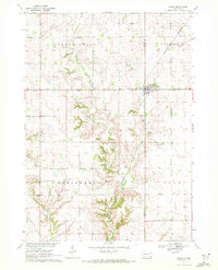
 1957 Gayville1958 Print · USGSYankton and Clay counties come alive in the mid-1950s, showing a landscape of small prairie towns and school districts tied together by the Missouri River Basin development. Trace the routes of two major railroads or locate rural landmarks like Zion Ch and Saybrook Sch (Abandoned).2 unique versions available
 - 1958 Map of Sioux City
 1958 Sioux City1958 Print · USGSThe Missouri River valley in the late fifties was a bustling intersection of tribal lands, rail corridors, and river towns. Genealogists can trace family roots through specific rural sites like Daisy Valley School, St Johns Church and School, and Yankton State Hospital.
 - 1958 Map of Sioux Falls
 1958 Sioux Falls1958 Print · USGSThe tri-state borderlands of South Dakota, Minnesota, and Iowa are captured here during the mid-century peak of the regional rail network. Genealogists and historians can trace local landmarks like Augustana Academy, the St Marys Cem, and the path of the Illinois Central through Rock Rapids.
 - 1959 Map of Sioux City
 1959 Sioux City1959 Print · USGSThe tri-state region surrounding the Missouri River is captured here in the late fifties, showing the convergence of Nebraska, South Dakota, and Iowa. Researchers can trace rural lineages through numerous country schoolhouses like Cemetery School and the many numbered Washington School districts.
 - 1964 Map of Burbank, 1966 Print
 1964 Burbank1966 Print · USGSThe Missouri River valley at the South Dakota and Nebraska border is captured here in the mid-1960s, showing the intersection of river transport and rail. Researchers can trace family history at Ionia Cem or locate the South Bend Sch and Lembke Landing.
 - 1964 Map of Maskell, 1966 Print
 1964 Maskell1966 Print · USGSNorthern Dixon County and the Missouri River bluffs are captured in the 1960s, showing a landscape of upland farms and river bottomlands. Researchers can trace rural lineages through Maskell, Newcastle, and local burial sites like Maskell Cem.
 - 1968 Map of St. Helena, 1971 Print
 1968 St. Helena1971 Print · USGSThe Nebraska-South Dakota borderlands along the Missouri River come alive in the late sixties, showing the river's path around St Helena Island. Genealogists can trace local roots at Bow Valley Mills, St Marys Sch, and St Helena Cem.
 - 1968 Map of Beresford, 1971 Print
 1968 Beresford1971 Print · USGSBeresford and the surrounding prairie townships are captured in the late sixties as modern highway interchanges began to reshape the rural landscape. Researchers can locate numerous country schools and cemeteries like Glenwood Sch, St Johns Cem, and Brooklyn Ch.
 - 1968 Map of Wakonda, 1971 Print
 1968 Wakonda1971 Print · USGSDakota farmland near Wakonda comes into focus during the late sixties, revealing the organized grid of townships and rural waterways. Genealogists and historians can trace family locations near Columkill Cem, Holland Cem, and the quiet crossroads of Colfax Corner.
 - 1968 Map of Meckling, 1971 Print
 1968 Meckling1971 Print · USGSThe Missouri River bottomlands in the late sixties are anchored by the settlement of Meckling and the prominent Goat Island. Trace local family history through the sites of Bergen Ch, Norway Sch, and multiple country cemeteries.
 - 1968 Map of Centerville, 1971 Print
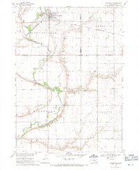 1968 Centerville1971 Print · USGSCenterville was a bustling agricultural hub in the late sixties, where the railroad and the Vermillion River intersect. Genealogists can trace family roots through the rural townships to find Ivey Sch, Komstad Ch, and Hovde Cem.
 - 1969 Map of Hub City, 1971 Print
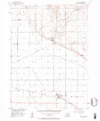
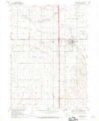
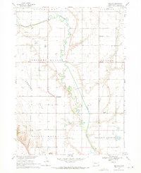 1969 Hub City1971 Print · USGSClay County farming life in the late sixties is centered here on the winding Vermillion River. Genealogists can trace ancestral sites at Lodi Cem, the Dalesburg Sch, and the landmark Spirit Mound.
 - 1969 Map of Vermillion, 1971 Print
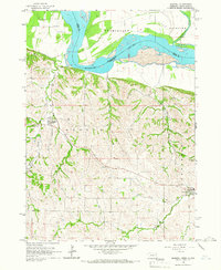
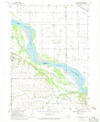
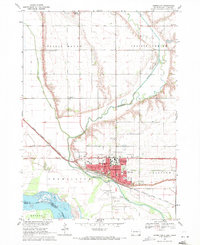 1969 Vermillion1971 Print · USGSThe university campus and Missouri River floodplain meet in this late-sixties portrait of Vermillion. Genealogists and historians can trace local landmarks like Spirit Mound, Bluff View Cemetery, and the University of South Dakota.2 unique versions available
 - 1969 Map of Gayville NE, 1971 Print
 1969 Gayville NE1971 Print · USGSClay County's rural townships are captured here in the late sixties, showcasing a landscape of section-line roads and family-centered landmarks. Genealogists can trace property roots through features like Westreville, St Patricks Cem, and the historic townhall.
 - 1969 Map of Alsen, 1971 Print
 1969 Alsen1971 Print · USGSSoutheast South Dakota's prairie townships are captured here in the late sixties as the new interstate era began to reshape the rural landscape. Genealogists and local researchers can trace the locations of the Rockfield Cem, Roseni Ch, and multiple schoolhouses including Brule Sch.2 unique versions available
 - 1969 Map of Vermillion SE, 1971 Print
 1969 Vermillion SE1971 Print · USGSSoutheast of Vermillion in the late sixties, this survey shows the rural settlements of Junction City and Midway along the county line. Genealogists can locate several remote burial grounds and churches, including St Peters Cem, St Peter Ch, and Ahlsborg Ch Cem.
 - 1970 Map of Irene, 1972 Print
 1970 Irene1972 Print · USGSIrene and the surrounding townships of Turner and Yankton counties are captured in the early 1970s during a period of steady agricultural tradition. Researchers can trace local history through landmarks like Trondhjem Ch, Salem Cem, and the Burlington Northern rail line.
Showing maps 1-25 of 90
Frequently asked questions
- What are the different types of historical maps available for Clay County?
- What is the oldest map of Clay County?
- Where can I purchase historical maps of Clay County for my home or office?
- Where can I download high-res historical maps of Clay County?
- Are there historical topographic maps available for Clay County?
- Is there historical aerial imagery available for Clay County?
- Where are historical maps of Clay County sourced from?