Old Maps of State Game Lodge, South Dakota for Metal Detecting
Plan your next treasure hunt with 11 historic maps of State Game Lodge. Find old homesites, ghost towns, trails, and gathering spots that may be lost to time — perfect for identifying promising metal detecting locations.
- Locate forgotten sites: Uncover places like long-lost settlements, abandoned rail lines, or gathering spots.
- Plan better hunts: Use map overlays combined with LiDAR or satellite views to narrow in on historically rich areas.
- Made for detectorists: Thousands of hobbyists use these maps to discover relics, coins, and hidden history.
Use these historic maps to boost your research and find new opportunities beneath the surface of State Game Lodge.
State Game Lodge, SD maps
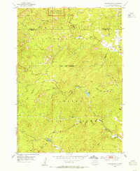
(11)- 1894 Map of Hermosa
 1894 Hermosa1894 Print · USGSThe Black Hills gold and ranching frontier comes into focus during the late nineteenth century as mining camps and rail lines began to anchor the territory. Genealogists and historians can trace early families in Keystone, Rockerville, and around the Etta Mine.2 unique versions available
 - 1901 Map of Hermosa
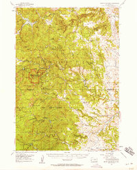
 1901 Hermosa1901 Print · USGSThe Black Hills frontier comes alive in this survey of Pennington and Custer counties during the height of the regional mining boom. Researchers can trace the early footprints of Keystone, Rockerville, and Wind Cave, along with vanished industrial sites like Etta Mill.4 unique versions available
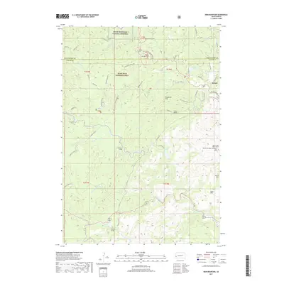
 - 1954 Map of Iron Mountain, 1955 Print
 1954 Iron Mountain1955 Print · USGSThe Black Hills in the mid-fifties are captured here during a period of established mining and growing tourism. Researchers can trace the layout of the Spokane Mine settlement or locate institutional landmarks like the Black Hills Playhouse and State Park Sch.5 unique versions available
 - 1954 Map of Mount Rushmore, 1958 Print
 1954 Mount Rushmore1958 Print · USGSThe Black Hills in the mid-fifties reveal a rugged landscape defined by both mining history and national monuments. Researchers can trace the legacy of the Gold Rush through sites like Etta Mine, Spokane, and the Boulder Hill Lookout Tower.3 unique versions available
 - 1955 Map of Hot Springs, 1958 Print
 1955 Hot Springs1958 Print · USGSThe Black Hills and South Dakota badlands are captured here in the mid-fifties, during a peak of military and industrial activity. Researchers can locate the Black Hills Ordnance Depot, early Uranium Mines, and historic rail stops like Pringle or Oglala.5 unique versions available
 - 1977 Map of Mount Rushmore, 1978 Print
 1977 Mount Rushmore1978 Print · USGSThe Black Hills landscape of the late 1970s is shown here at a moment when historic mining and modern tourism converged. Genealogists and researchers can trace the rail lines of the Burlington Northern and find sites like Spokane Mine or the town of Pringle.2 unique versions available
 - 1998 Map of Iron Mountain, 2001 Print
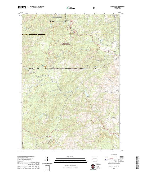
 1998 Iron Mountain2001 Print · USGSThe Black Hills landscape at the close of the century reveals the complex overlapping boundaries of national memorials, state parks, and forest lands. Researchers can trace the layout of Custer State Park and locate historic sites like the Hugo Mine, Black Hills Playhouse, and Camp Remington.
 - 2012 Map of Iron Mountain, 2012 Print
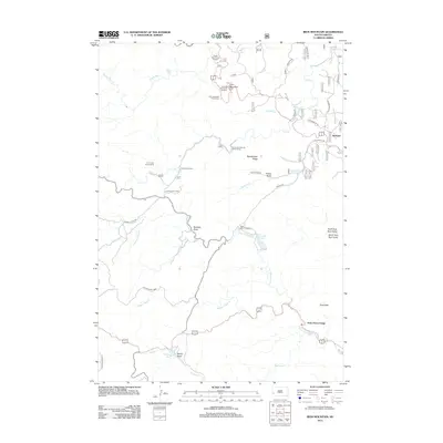 2012 Iron Mountain2012 Print · USGSCovers State Game Lodge, including Spokane, Pennington County, and other nearby areas
 - 2015 Map of Iron Mountain, 2015 Print
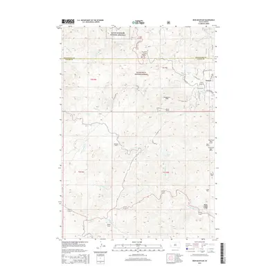 2015 Iron Mountain2015 Print · USGSCovers State Game Lodge, including Spokane, Pennington County, and other nearby areas
 - 2017 Map of Iron Mountain, 2017 Print
 2017 Iron Mountain2017 Print · USGSCovers State Game Lodge, including Spokane, Pennington County, and other nearby areas
 - 2021 Map of Iron Mountain, 2021 Print
 2021 Iron Mountain2021 Print · USGSThe Black Hills of South Dakota appear here in modern detail, from the heights of Iron Mtn to the shoreline of Legion Lake. Researchers can trace the winding Iron Mountain Rd through historic passages like the Doane Robinson Tunnel and the settlement at Spokane.
End of results
Showing maps 1-11 of 11
Top cities near State Game Lodge
- Custer historical maps
- Hill City historical maps
- Hermosa historical maps
- Keystone historical maps
- Pringle historical maps
- Fairburn historical maps
Frequently asked questions
- What are the different types of historical maps available for State Game Lodge?
- What is the oldest map of State Game Lodge?
- Where can I purchase historical maps of State Game Lodge for my home or office?
- Where can I download high-res historical maps of State Game Lodge?
- Are there historical topographic maps available for State Game Lodge?
- Is there historical aerial imagery available for State Game Lodge?
- Where are historical maps of State Game Lodge sourced from?