Old Maps of Andover, South Dakota for Academic Research
Study the evolution of Andover with 8 high-resolution historic maps. Whether you're teaching, researching, or modeling changes in land use, these maps provide essential visual documentation of urban, environmental, and geographic change.
- Analyze long-term change: Track patterns in development, transportation, and natural features.
- Ideal for environmental or urban studies: Support academic projects with primary historical map data.
- Use in the classroom or lab: Educators and researchers rely on these maps to bring historical context to life.
These maps are a powerful tool for teaching, research, and visualizing how Andover has changed over the decades.
Andover, SD maps
(8)- 1953 Map of Milbank, 1958 Print
 1953 Milbank1958 Print · USGSThe tri-state border region of South Dakota, North Dakota, and Minnesota is shown here during the early fifties, a landscape defined by glacial lakes and the Sisseton Indian Reservation. Researchers can trace the legacy of the western railroads, locating old stops along the Great Northern and settlements like Milbank, Webster, and Sisseton.3 unique versions available
 - 1958 Map of Milbank
 1958 Milbank1958 Print · USGSThe northern Great Plains in the late fifties show a landscape of glacial lakes and reservation lands shaped by the Great Northern railroad. Genealogists and local historians can trace the grid of settlements from Britton to Milbank and locate landmarks like Enemy Swim Lake and the Sisseton Indian Reservation.
 - 1958 Map of Andover, 1960 Print
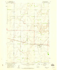 1958 Andover1960 Print · USGSAndover was a vital railroad hub in Day County during the late 1950s, centered on the Chicago Milwaukee St Paul and Pacific line. Genealogists can trace local roots at Andover Cem and All Saints Cem or locate the old Gravel Pit.2 unique versions available
 - 1985 Map of Webster
 1985 Webster1985 Print · USGSNortheastern South Dakota in the mid-eighties reveals a landscape of prairie potholes and rail-line towns centered on the Webster region. Genealogists and historians can trace rail-town development along the Burlington Northern and find early conservation boundaries like the Waubay National Wildlife Refuge.2 unique versions available
 - 2012 Map of Andover, 2012 Print
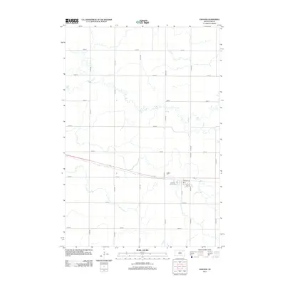 2012 Andover2012 Print · USGSCovers Andover, including East Hanson Township, Groton Township, and other nearby areas
 - 2015 Map of Andover, 2015 Print
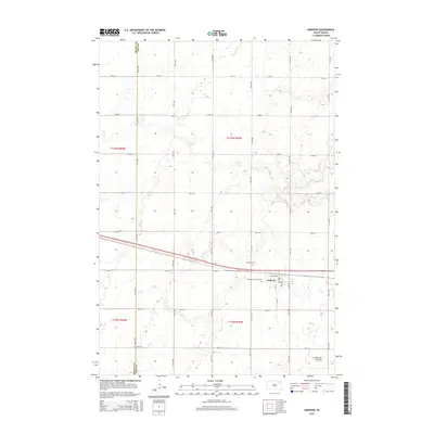 2015 Andover2015 Print · USGSCovers Andover, including East Hanson Township, Groton Township, and other nearby areas
 - 2017 Map of Andover, 2017 Print
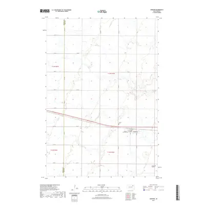 2017 Andover2017 Print · USGSCovers Andover, including East Hanson Township, Groton Township, and other nearby areas
 - 2021 Map of Andover, 2021 Print
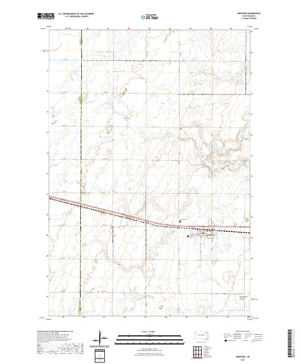 2021 Andover2021 Print · USGSAndover and the glaciated heights of the eastern plains are captured here in the early twenty-first century. Genealogists and local historians can trace family plots at Andover Cem or follow the township grid along the Brown Co Day Co line.
End of results
Showing maps 1-8 of 8
Top cities near Andover
- Groton historical maps
- Bristol historical maps
- Langford historical maps
- Pierpont historical maps
- Lily historical maps
- Butler historical maps
See more
Frequently asked questions
- What are the different types of historical maps available for Andover?
- What is the oldest map of Andover?
- Where can I purchase historical maps of Andover for my home or office?
- Where can I download high-res historical maps of Andover?
- Are there historical topographic maps available for Andover?
- Is there historical aerial imagery available for Andover?
- Where are historical maps of Andover sourced from?