2020s Maps of Roslyn, South Dakota
Explore 2 historic maps of Roslyn from the 2020s. These maps offer a rare glimpse into what life looked like during the 2020s — showing old roads, neighborhoods, homes, and landmarks that have changed or disappeared over time.
Whether you're researching your family's past, planning a metal detecting trip, or studying how Roslyn's landscape evolved across the 2020s, these high-resolution maps are a powerful tool for exploring the history of this region.
- Focus on a specific era: All maps on this page are from the 2020s, giving you a focused view of this time period.
- See what’s changed: Compare century-old streets, trails, and buildings to today's modern landscape using overlays and satellite layers.
- Research with precision: Use these maps for genealogy, historical research, land use analysis, or educational projects.
- View, download, or print: Maps are fully viewable online in high resolution, and can be downloaded or printed for your own records.
Start exploring Roslyn's history through authentic maps from the 2020s. This is your window into the past.
Roslyn, SD maps
(2)- 2021 Map of Eden, 2021 Print
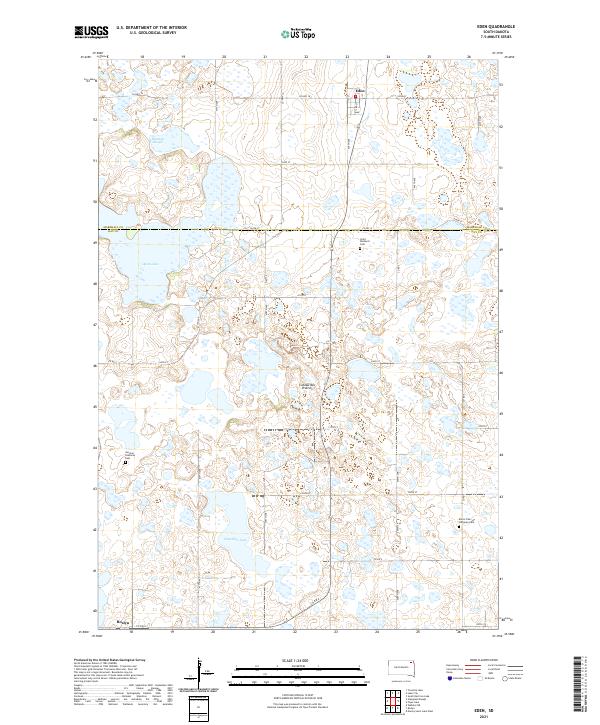 2021 Eden2021 Print · USGSNortheastern South Dakota's glacial landscape is meticulously detailed here, showing the rural communities of Eden and Roslyn in the early 2020s. Researchers can trace family roots through landmarks like Saint Michael's Cem, German Lutheran Cem, and Hazelden Lake.
 - 2021 Map of Roslyn, 2021 Print
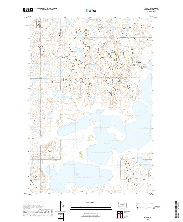 2021 Roslyn2021 Print · USGSDay County settlements and glacial lakes are the focus of this recent survey of the Coteau des Prairies. Researchers can trace local heritage sites like the Roslyn Lutheran Cem and Saint Joseph Catholic Cem near Grenville.
End of results
Showing maps 1-2 of 2
Top cities near Roslyn
- Webster historical maps
- Waubay historical maps
- Eden historical maps
- Grenville historical maps
- Lake City historical maps
Frequently asked questions
- What are the different types of historical maps available for Roslyn?
- What is the oldest map of Roslyn?
- Where can I purchase historical maps of Roslyn for my home or office?
- Where can I download high-res historical maps of Roslyn?
- Are there historical topographic maps available for Roslyn?
- Is there historical aerial imagery available for Roslyn?
- Where are historical maps of Roslyn sourced from?