1970s Maps of Faulk County, South Dakota
Explore 3 historic maps of Faulk County from the 1970s. These maps offer a rare glimpse into what life looked like during the 1970s — showing old roads, neighborhoods, homes, and landmarks that have changed or disappeared over time.
Whether you're researching your family's past, planning a metal detecting trip, or studying how Faulk County's landscape evolved across the 1970s, these high-resolution maps are a powerful tool for exploring the history of this region.
- Focus on a specific era: All maps on this page are from the 1970s, giving you a focused view of this time period.
- See what’s changed: Compare century-old streets, trails, and buildings to today's modern landscape using overlays and satellite layers.
- Research with precision: Use these maps for genealogy, historical research, land use analysis, or educational projects.
- View, download, or print: Maps are fully viewable online in high resolution, and can be downloaded or printed for your own records.
Start exploring Faulk County's history through authentic maps from the 1970s. This is your window into the past.
Faulk County, SD maps
(3)- 1978 Map of Bald Hills
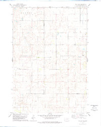 1978 Bald Hills1978 Print · USGSCentral South Dakota in the late seventies reveals a landscape of high prairie townships and quiet rural corners. Genealogists and local historians can trace the early boundaries of Canton and Ellisville, or locate the Pleasant View Sch near the Bald Hills.
 - 1978 Map of Tolstoy
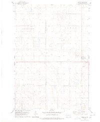
 1978 Tolstoy1978 Print · USGSThe town of Tolstoy and the surrounding Potter County prairie are captured in the late seventies. Researchers can trace the heritage of local families at St Jacobs Cem, follow the Old Railroad Grade, or locate old township lines in Hudson and Madison.
 - 1978 Map of Seneca
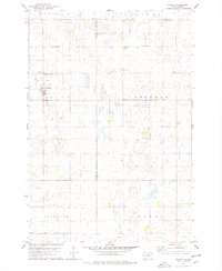
 1978 Seneca1978 Print · USGSSeneca and the surrounding prairie of Faulk County are captured here in the late seventies as the local landscape transitioned. Researchers can trace the Old Railroad Grade, locate the historic St Boniface Cem, and map the rural townships of Fairview and Canton.
End of results
Showing maps 1-3 of 3
Top cities of Faulk County
- Faulkton historical maps
- Cresbard historical maps
- Zell historical maps
- Seneca historical maps
- Orient historical maps
- Rockham historical maps
See more
Frequently asked questions
- What are the different types of historical maps available for Faulk County?
- What is the oldest map of Faulk County?
- Where can I purchase historical maps of Faulk County for my home or office?
- Where can I download high-res historical maps of Faulk County?
- Are there historical topographic maps available for Faulk County?
- Is there historical aerial imagery available for Faulk County?
- Where are historical maps of Faulk County sourced from?