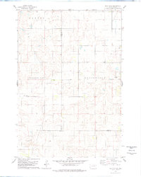
1978 Map of Bald Hills
USGS Topo · Published 1978About this map
The Bald Hills dominate the southwestern landscape of this prairie region, where the borders of Potter, Faulk, and Hyde counties meet. This late-1970s survey illustrates a rural township structure defined by the civil boundaries of Canton, Pleasant View, and Ellisville. The map captures a moment when the vast agricultural tracts of central South Dakota remained largely open, punctuated only by occasional homesteads and local landmarks like the Pleasant View Sch. The intricate contour lines around the Bald Hills reveal a landscape of subtle glacial depressions and high points, typical of the Missouri Coteau region, providing a clear view of the area's natural drainage and terrain before significant modern development altered the rural school and township network.
Find a feature on this map
8 named features on this map. Tap any name to fly to it.
Don’t see what you’re looking for? This feature index may not catch every label — zoom into the map to look around manually.
Map Details
Editions of this 1978 Bald Hills Map
This is the sole edition of this map. No revisions or reprints were ever made.
Other maps of this area

1951 · Rice Lake
USGS Topo · 1:24,000

1951 · Rezac Lake NW
USGS Topo · 1:24,000

1952 · Onaka SW
USGS Topo · 1:24,000

1953 · Huron
USGS Topo · 1:250,000

1954 · Aberdeen
USGS Topo · 1:250,000

1954 · Huron
USGS Topo · 1:250,000

1956 · Aberdeen
USGS Topo · 1:250,000
1978 · Thomas Lake
USGS Topo · 1:24,000
1978 · Thomas Lake SW
USGS Topo · 1:24,000
1978 · Seneca SW
USGS Topo · 1:24,000