Old Maps of Potter County, South Dakota
Explore 127 old maps of Potter County, spanning from 1953 to today. These high-resolution historic maps reveal how streets, neighborhoods, landmarks, and natural features evolved over time — perfect for genealogy, metal detecting, research, and local history exploration.
What you can do with these maps:
- See how Potter County changed over time: Compare historical maps to modern-day views to trace roads, homesites, rail lines & more.
- View detailed metadata: Each map includes creators, publishers, year, scale, and archive source.
- Overlay maps with satellite & LiDAR: Visualize the past alongside modern tools to explore terrain & human change.
- Trusted historical sources: Maps sourced from the USGS, Library of Congress, and other archives.
- Access maps your way: View online, download high-res files, or order prints for personal or research use.
Start exploring old maps of Potter County to uncover forgotten places, hidden landmarks, and the deep history beneath your feet.
Potter County, SD maps
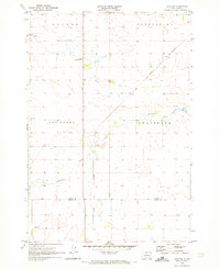
(127)- 1953 Map of Huron, 1959 Print
 1953 Huron1959 Print · USGSCentral South Dakota comes alive in the mid-1950s as a thriving rail and agricultural corridor between the Missouri and James Rivers. Trace the legacy of family farms and prairie towns like Huron, Faulkton, and Wessington Springs along the historic Chicago and North Western rail lines.3 unique versions available
 - 1953 Map of McIntosh, 1965 Print
 1953 McIntosh1965 Print · USGSThe north-central Dakota prairie is captured here during the mid-fifties, showing the vast Standing Rock Indian Reservation and the newly formed Oah E Reservoir. Genealogists and historians can trace the Chicago Milwaukee St Paul and Pacific rail line through stops like McIntosh, Walker, and Eagle Butte.3 unique versions available
 - 1954 Map of Aberdeen, 1964 Print
 1954 Aberdeen1964 Print · USGSNortheastern South Dakota in the mid-fifties remains a world of rail-dependent prairie towns and sweeping waterfowl refuges. Genealogists can trace family roots through settlements like Eureka and Ipswich or locate rural landmarks near Richmond Lake.2 unique versions available
 - 1954 Map of Pierre, 1968 Print
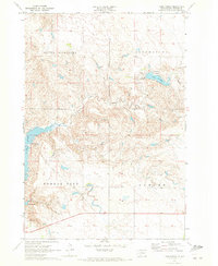
 1954 Pierre1968 Print · USGSThe Missouri River and the newly formed Oahe Reservoir define central South Dakota in the 1950s. Genealogists and local historians can trace early settlements and rail stops like Eakin Siding, Mission Ridge, and Ottumwa.2 unique versions available
 - 1954 Map of Huron, 1977 Print
 1954 Huron1977 Print · USGSCentral South Dakota was a landscape of grain elevators and river bends during the mid-fifties. Genealogists and historians can trace the development of the James River valley through railroad towns like Redfield and the sprawling Crow Creek Indian Reservation.
 - 1956 Map of Aberdeen
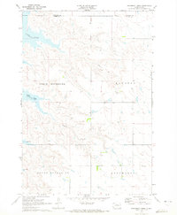
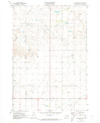
 1956 Aberdeen1956 Print · USGSUpper South Dakota during the mid-fifties remains a landscape of rail-connected farming towns and expansive glacial lake basins. Genealogists and historians can trace the paths of the Minneapolis and St Louis railroad through Gettysburg or locate vanished stops near Elm Lake and Richmond Lake.
 - 1958 Map of Pierre
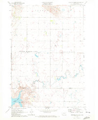
 1958 Pierre1958 Print · USGSCentral South Dakota is documented during the mid-fifties, just as the Missouri River valley was being transformed by the massive Oahe Dam project. Researchers can trace the early Oahe Reservoir shoreline and find remote outposts like Milesville, Onida, and Giddings Flat.
 - 1958 Map of McIntosh
 1958 McIntosh1958 Print · USGSThe north-central Dakotas appear here in the mid-1950s as massive engineering projects and rail lines shaped the plains. Researchers can trace tribal lands within the Standing Rock Indian Reservation and locate local landmarks like the Keller Mine or the Virginia Siding.
 - 1969 Map of Artichoke Butte NW, 1972 Print
 1969 Artichoke Butte NW1972 Print · USGSThe Missouri River Basin undergoes a massive transition in the late sixties as the waters of Lake Oahe rise along the Cheyenne River Indian Reservation Boundary. You can trace the shorelines near Forest City and follow prairie drainages like Pascal Creek and Alberts Creek.
 - 1969 Map of Patch Skin Buttes SW, 1972 Print
 1969 Patch Skin Buttes SW1972 Print · USGSThe Missouri River breaks of South Dakota are shown here in the late sixties, just after the waters of Lake Oahe reshaped the valley. You can trace the Cheyenne River Indian Reservation Boundary and locate local landmarks like Marksville and the Swift Bird Day Sch.
 - 1969 Map of Four Bear Creek, 1972 Print
 1969 Four Bear Creek1972 Print · USGSThe Missouri River breaks into a series of wide bays along the Dewey and Potter county lines during the late sixties. Researchers can trace the flooded reaches of Four Bear Creek and Buck Creek or locate the Indian Reservation Boundary as it stood at this mid-century moment.
 - 1969 Map of Patch Skin Buttes SE, 1972 Print
 1969 Patch Skin Buttes SE1972 Print · USGSPotter County and the Missouri River bluffs are captured here in the late sixties as the newly formed reservoir reshaped the valley. Researchers can trace the submerged riverbanks and locate local landmarks like the Swift Bird Training Center and Forest City.
 - 1970 Map of Steamboat Creek, 1972 Print
 1970 Steamboat Creek1972 Print · USGSPotter and Walworth Counties at the dawn of the seventies show a landscape reshaped by the rising Missouri River. Genealogists can locate family landmarks like the Appomattox Sch and trace early reservoir shorelines at Dodge Bay and Latin Bay.
 - 1970 Map of Lake Hurley, 1972 Print
 1970 Lake Hurley1972 Print · USGSThe Potter County riverfront in the early seventies shows a landscape redefined by the Missouri River reservoir system. Genealogists and historians can trace local landmarks like the Forest City Sch, Lake Hurley, and the Ebach Landing Strip.
 - 1970 Map of Lake Hurley NE, 1972 Print
 1970 Lake Hurley NE1972 Print · USGSPotter and Walworth Counties come into focus during the early seventies, showing a prairie landscape of townships and creeks. Genealogists can locate family landmarks like Hanson Cem or trace the rural life around Fayette Sch and Little Cheyenne Creek.
 - 1970 Map of Agar NW, 1973 Print
 1970 Agar NW1973 Print · USGSPotter and Sully Counties are captured in the early 1970s, showcasing the rural township structure of central South Dakota. Researchers can locate the East Cattron Sch and follow the path of Artichoke Creek to the Gorman Dam.
 - 1970 Map of Agar NE, 1973 Print
 1970 Agar NE1973 Print · USGSPotter and Sully counties are captured here in the early seventies, showing a landscape defined by organized townships and prairie agriculture. Researchers can locate the Schreiber Cem, the settlement of Gorman, and rural landmarks like Artichoke Sch.
 - 1970 Map of Lake Hurley SE, 1973 Print
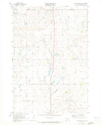
 1970 Lake Hurley SE1973 Print · USGSPotter County at the start of the seventies reveals a rural prairie landscape defined by its agricultural townships. Genealogists can locate Mascher Sch, trace the Old Grade Railroad, and follow the banks of Little Cheyenne Creek.
 - 1970 Map of Artichoke Butte NE, 1973 Print
 1970 Artichoke Butte NE1973 Print · USGSThe Potter County uplands and the rising waters of the Missouri River reservoir system are captured here in the early seventies. Local historians and researchers can trace the shoreline of Lake Oahe and find landmarks like the Sutton Bay Recreation Area and Artichoke Creek.
 - 1974 Map of Hoven, 1978 Print
 1974 Hoven1978 Print · USGSThe town of Hoven and its surrounding townships are captured in the 1970s as a quiet plains community on the Walworth and Potter county line. Genealogists and researchers can trace the Old RR Grade, locate the town Cem, and find local landmarks like Simons Dam.
 - 1974 Map of Flight Lake, 1978 Print
 1974 Flight Lake1978 Print · USGSPotter and Walworth counties are shown in the mid-1970s as a landscape of prairie schools and glacial waters. Researchers can trace the Old Railroad Grade and locate local landmarks like Prairie Grove Cem and Arena Sch.
 - 1974 Map of Gettysburg Muni. Airport NE, 1978 Print
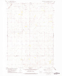
 1974 Gettysburg Muni. Airport NE1978 Print · USGSThe rural prairie landscape along the border of Potter and Sully counties is captured here during the mid-1970s. Local researchers can trace the course of Okobojo Creek, locate Potts Dam, and explore the limits of the Stone Lake State Public Shooting Area.
 - 1978 Map of Bald Hills
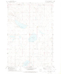
 1978 Bald Hills1978 Print · USGSCentral South Dakota in the late seventies reveals a landscape of high prairie townships and quiet rural corners. Genealogists and local historians can trace the early boundaries of Canton and Ellisville, or locate the Pleasant View Sch near the Bald Hills.
 - 1978 Map of Gettysburg Muni. Airport
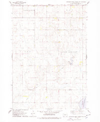
 1978 Gettysburg Muni. Airport1978 Print · USGSPotter and Sully Counties are captured in the late seventies as the agricultural landscape surrounds the growing town of Gettysburg. Researchers can trace the Chicago and North Western rail line and locate rural landmarks like Sacred Heart Cem and Elida.
 - 1978 Map of Tolstoy
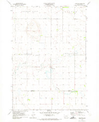
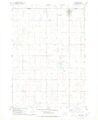
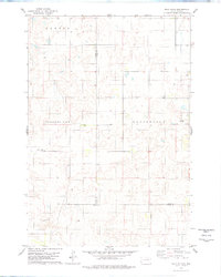
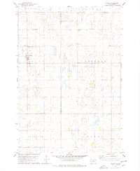 1978 Tolstoy1978 Print · USGSThe town of Tolstoy and the surrounding Potter County prairie are captured in the late seventies. Researchers can trace the heritage of local families at St Jacobs Cem, follow the Old Railroad Grade, or locate old township lines in Hudson and Madison.
Showing maps 1-25 of 127
Top cities of Potter County
Frequently asked questions
- What are the different types of historical maps available for Potter County?
- What is the oldest map of Potter County?
- Where can I purchase historical maps of Potter County for my home or office?
- Where can I download high-res historical maps of Potter County?
- Are there historical topographic maps available for Potter County?
- Is there historical aerial imagery available for Potter County?
- Where are historical maps of Potter County sourced from?