Old Maps of Marvin, South Dakota for Metal Detecting
Plan your next treasure hunt with 8 historic maps of Marvin. Find old homesites, ghost towns, trails, and gathering spots that may be lost to time — perfect for identifying promising metal detecting locations.
- Locate forgotten sites: Uncover places like long-lost settlements, abandoned rail lines, or gathering spots.
- Plan better hunts: Use map overlays combined with LiDAR or satellite views to narrow in on historically rich areas.
- Made for detectorists: Thousands of hobbyists use these maps to discover relics, coins, and hidden history.
Use these historic maps to boost your research and find new opportunities beneath the surface of Marvin.
Marvin, SD maps
(8)- 1953 Map of Milbank, 1958 Print
 1953 Milbank1958 Print · USGSThe tri-state border region of South Dakota, North Dakota, and Minnesota is shown here during the early fifties, a landscape defined by glacial lakes and the Sisseton Indian Reservation. Researchers can trace the legacy of the western railroads, locating old stops along the Great Northern and settlements like Milbank, Webster, and Sisseton.3 unique versions available
 - 1958 Map of Milbank
 1958 Milbank1958 Print · USGSThe northern Great Plains in the late fifties show a landscape of glacial lakes and reservation lands shaped by the Great Northern railroad. Genealogists and local historians can trace the grid of settlements from Britton to Milbank and locate landmarks like Enemy Swim Lake and the Sisseton Indian Reservation.
 - 1970 Map of Marvin, 1973 Print
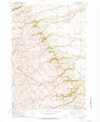 1970 Marvin1973 Print · USGSThe Marvin area and the coteau landscape of South Dakota appear in this 1970s survey as a mix of religious sites and rail corridors. Genealogists and local historians can trace the Milwaukee Road route past Blue Cloud Abbey and the Eastman Cem.
 - 1985 Map of Milbank
 1985 Milbank1985 Print · USGSThe South Dakota and Minnesota border region comes into focus during the mid-eighties as a hub of prairie lakes and rail transport. Genealogists and researchers can trace the lakeside settlements of Hiawatha Beach, the streets of Milbank, and legacy rail lines like the Burlington Northern.
 - 2012 Map of Marvin, 2012 Print
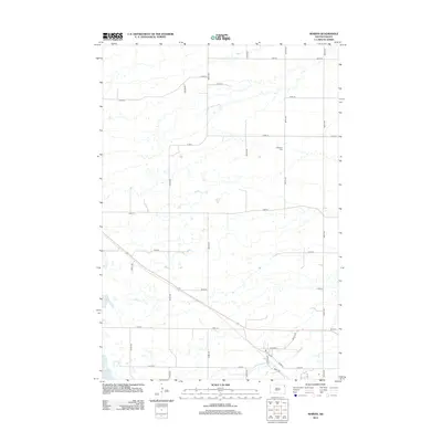 2012 Marvin2012 Print · USGSCovers Marvin, including Big Course District, Grant County, and other nearby areas
 - 2015 Map of Marvin, 2015 Print
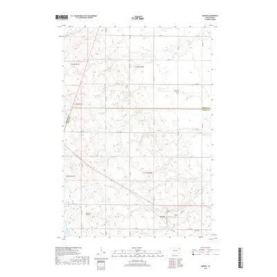
 2015 Marvin2015 Print · USGSCovers Marvin, including Big Course District, Grant County, and other nearby areas
 - 2017 Map of Marvin, 2017 Print
 2017 Marvin2017 Print · USGSCovers Marvin, including Big Course District, Grant County, and other nearby areas
 - 2021 Map of Marvin, 2021 Print
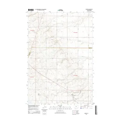
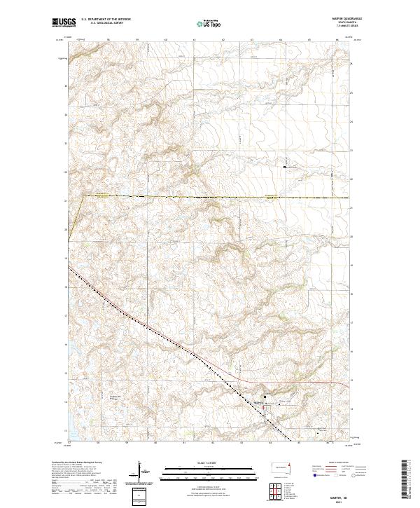 2021 Marvin2021 Print · USGSThe upland plateau of the Coteau des Prairies defines this contemporary study of the Marvin area. Researchers can locate several burial grounds, including Eastman Cem, Blue Cloud Abbey Cem, and the two Osceola cemeteries near the town center.
End of results
Showing maps 1-8 of 8
Top cities near Marvin
- Wilmot historical maps
- Summit historical maps
- South Shore historical maps
- Spring Grove historical maps
- Corona historical maps
- Stockholm historical maps
See more
Frequently asked questions
- What are the different types of historical maps available for Marvin?
- What is the oldest map of Marvin?
- Where can I purchase historical maps of Marvin for my home or office?
- Where can I download high-res historical maps of Marvin?
- Are there historical topographic maps available for Marvin?
- Is there historical aerial imagery available for Marvin?
- Where are historical maps of Marvin sourced from?