1970s Maps of Hamlin County, South Dakota
Explore 8 historic maps of Hamlin County from the 1970s. These maps offer a rare glimpse into what life looked like during the 1970s — showing old roads, neighborhoods, homes, and landmarks that have changed or disappeared over time.
Whether you're researching your family's past, planning a metal detecting trip, or studying how Hamlin County's landscape evolved across the 1970s, these high-resolution maps are a powerful tool for exploring the history of this region.
- Focus on a specific era: All maps on this page are from the 1970s, giving you a focused view of this time period.
- See what’s changed: Compare century-old streets, trails, and buildings to today's modern landscape using overlays and satellite layers.
- Research with precision: Use these maps for genealogy, historical research, land use analysis, or educational projects.
- View, download, or print: Maps are fully viewable online in high resolution, and can be downloaded or printed for your own records.
Start exploring Hamlin County's history through authentic maps from the 1970s. This is your window into the past.
Hamlin County, SD maps
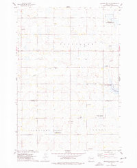
(8)- 1970 Map of Kranzburg SW, 1972 Print
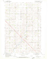 1970 Kranzburg SW1972 Print · USGSEastern South Dakota’s agricultural landscape is documented here just as modern highway expansion was beginning to reshape the prairie in the early seventies. Genealogists can locate the local Townhall or trace the winding path of Stray Horse Creek through the townships of Kranzburg and Hamlin.2 unique versions available
 - 1970 Map of Estelline, 1972 Print
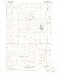 1970 Estelline1972 Print · USGSEstelline at the start of the 1970s shows a classic prairie rail town defined by the Big Sioux River and the Chicago and North Western line. Genealogists and local historians can locate family plots at the local Cem or trace landmarks like the Estelline Municipal Airport and numerous rural Gravel Pits.
 - 1973 Map of Bryant NE, 1978 Print
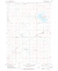
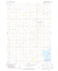 1973 Bryant NE1978 Print · USGSHamlin County's prairie wetlands are documented here in the early 1970s, showcasing a landscape of rural townships and scattered farmsteads. Researchers can locate family landmarks like Pioneer Cem, Zion Cem, and New Hope Ch near the banks of Lake Marsh.
 - 1973 Map of Bryant, 1978 Print
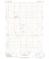 1973 Bryant1978 Print · USGSBryant sits at a vital railroad crossroads in the mid-1970s, surrounded by the wetlands and waterfowl production areas of eastern South Dakota. Researchers can locate early township cemeteries like St Marys Cem and trace the Milwaukee Road tracks.
 - 1973 Map of Gertson Slough, 1978 Print
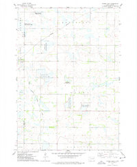
 1973 Gertson Slough1978 Print · USGSHamlin and Kingsbury counties are captured here in the early seventies, showing a landscape defined by prairie wetlands and rural townships. Genealogists can locate several family landmarks and community sites, such as the Scandinavian Cemetery, Garfield Church, and St Peters Cemetery.
 - 1973 Map of Grover, 1978 Print
 1973 Grover1978 Print · USGSCodington and Hamlin Counties were characterized by a vast network of glacial sloughs and rail lines in the 1970s. Researchers can locate specific rural landmarks like the Townhall, Emmanuel Church, and the tracks of the Chicago and North Western.
 - 1973 Map of Vienna East, 1978 Print
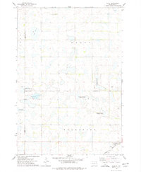
 1973 Vienna East1978 Print · USGSRail lines and wildlife conservation areas define this part of Hamlin County in the early 1970s. Researchers can locate the Dixon Cem, the settlement of Vienna, and numerous hunting grounds like the Rasmussen State Public Shooting Area.
 - 1973 Map of Hazel, 1978 Print
 1973 Hazel1978 Print · USGSHamlin County and its surrounding prairie townships are captured here in the early 1970s as a hub for both rail transit and wildlife conservation. Genealogists and local historians can trace the community around Hazel, including Our Saviours Ch and the Hazel Cem near the Burlington Northern tracks.
End of results
Showing maps 1-8 of 8
Frequently asked questions
- What are the different types of historical maps available for Hamlin County?
- What is the oldest map of Hamlin County?
- Where can I purchase historical maps of Hamlin County for my home or office?
- Where can I download high-res historical maps of Hamlin County?
- Are there historical topographic maps available for Hamlin County?
- Is there historical aerial imagery available for Hamlin County?
- Where are historical maps of Hamlin County sourced from?