1950s Maps of Hanson County, South Dakota
Explore 9 historic maps of Hanson County from the 1950s. These maps offer a rare glimpse into what life looked like during the 1950s — showing old roads, neighborhoods, homes, and landmarks that have changed or disappeared over time.
Whether you're researching your family's past, planning a metal detecting trip, or studying how Hanson County's landscape evolved across the 1950s, these high-resolution maps are a powerful tool for exploring the history of this region.
- Focus on a specific era: All maps on this page are from the 1950s, giving you a focused view of this time period.
- See what’s changed: Compare century-old streets, trails, and buildings to today's modern landscape using overlays and satellite layers.
- Research with precision: Use these maps for genealogy, historical research, land use analysis, or educational projects.
- View, download, or print: Maps are fully viewable online in high resolution, and can be downloaded or printed for your own records.
Start exploring Hanson County's history through authentic maps from the 1950s. This is your window into the past.
Hanson County, SD maps
(9)- 1955 Map of Sioux Falls, 1967 Print
 1955 Sioux Falls1967 Print · USGSThe eastern South Dakota and western Minnesota borderlands come alive in the mid-fifties, showing the vital rail-to-river connections of the era. Genealogists can trace family footprints across townships like Madison and Pipestone, while following the paths of the Big Sioux River and the Chicago and North Western line.3 unique versions available
 - 1957 Map of Alexandria, 1958 Print
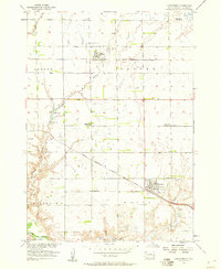 1957 Alexandria1958 Print · USGSMid-century Hanson County reveals a rural landscape shaped by competing rail lines and small-town commerce. Genealogists and historians can locate several decommissioned schoolhouses and family-named landmarks like Fulton Lake, St Marys Cem, and the Rosedale Colony.2 unique versions available
 - 1957 Map of Ethan, 1958 Print
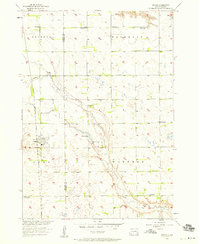 1957 Ethan1958 Print · USGSSouth Dakota's agricultural heartland is captured here in the mid-fifties, centered on the rail-aligned town of Ethan. Genealogists and historians can trace the transition of rural education via active and defunct sites like Coyne Sch and Clark Sch.
 - 1957 Map of Milltown, 1958 Print
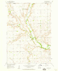 1957 Milltown1958 Print · USGSHutchinson and Hanson Counties during the late fifties reveal a landscape of river-bottom farms and communal colonies. Researchers can locate the New Elm Springs Colony, the Colony of Mercy Home for the Aged, and local landmarks like Milltown Cem.
 - 1957 Map of Clayton, 1958 Print
 1957 Clayton1958 Print · USGSHutchinson County prairie life in the late fifties is defined here by the winding James River and a distributed network of rural schoolhouses. Genealogists can trace family roots through sites like Rademacher Cem, Clayton Sch, and the Congregational Ch.2 unique versions available
 - 1957 Map of Rockport Colony, 1958 Print
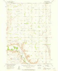
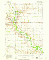
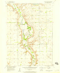 1957 Rockport Colony1958 Print · USGSHanson County in the late 1950s is defined by the sharp bends of the James River and its communal homesteads. Trace the footprints of the Rockport Colony or locate several local schoolhouses, including School No 3 and a noted School (Abandoned).
 - 1957 Map of Riverside, 1959 Print
 1957 Riverside1959 Print · USGSThe James River valley near the Hanson and Davison county line comes into focus during the late fifties, showing a landscape defined by rail and river. Genealogists can trace rural school districts like Bard Sch and family-named landmarks like Enemy Creek.2 unique versions available
 - 1957 Map of Farwell, 1959 Print
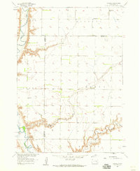 1957 Farwell1959 Print · USGSHanson County's prairie townships are captured here in the late fifties, showing a rural landscape defined by the winding James River. Genealogists can locate family landmarks such as the Rock Creek Cem, Farwell Ch, and several local schools including Grant Sch.2 unique versions available
 - 1958 Map of Sioux Falls
 1958 Sioux Falls1958 Print · USGSThe tri-state borderlands of South Dakota, Minnesota, and Iowa are captured here during the mid-century peak of the regional rail network. Genealogists and historians can trace local landmarks like Augustana Academy, the St Marys Cem, and the path of the Illinois Central through Rock Rapids.
End of results
Showing maps 1-9 of 9
Top cities of Hanson County
Frequently asked questions
- What are the different types of historical maps available for Hanson County?
- What is the oldest map of Hanson County?
- Where can I purchase historical maps of Hanson County for my home or office?
- Where can I download high-res historical maps of Hanson County?
- Are there historical topographic maps available for Hanson County?
- Is there historical aerial imagery available for Hanson County?
- Where are historical maps of Hanson County sourced from?