1960s Maps of LaValley Township, South Dakota
Explore 4 historic maps of LaValley Township from the 1960s. These maps offer a rare glimpse into what life looked like during the 1960s — showing old roads, neighborhoods, homes, and landmarks that have changed or disappeared over time.
Whether you're researching your family's past, planning a metal detecting trip, or studying how LaValley Township's landscape evolved across the 1960s, these high-resolution maps are a powerful tool for exploring the history of this region.
- Focus on a specific era: All maps on this page are from the 1960s, giving you a focused view of this time period.
- See what’s changed: Compare century-old streets, trails, and buildings to today's modern landscape using overlays and satellite layers.
- Research with precision: Use these maps for genealogy, historical research, land use analysis, or educational projects.
- View, download, or print: Maps are fully viewable online in high resolution, and can be downloaded or printed for your own records.
Start exploring LaValley Township's history through authentic maps from the 1960s. This is your window into the past.
LaValley Township, SD maps
(4)- 1962 Map of Harrisburg, 1964 Print
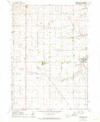 1962 Harrisburg1964 Print · USGSHarrisburg and the surrounding Lincoln County townships are captured in the early 1960s, showing a prairie landscape still defined by rail lines and rural school districts. Researchers can find long-standing local landmarks like Pleasant View Cem, various country schoolhouses including Shindler Sch, and the recreation grounds at Lake Alvin.
 - 1962 Map of Tea, 1964 Print
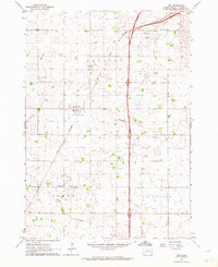 1962 Tea1964 Print · USGSThe rural landscape of Lincoln County appears in the early sixties as a network of section roads and small-town commerce. Researchers can trace the heritage of local school districts at Dewey School and Rader School or follow the tracks of the Great Northern railroad.2 unique versions available
 - 1964 Map of Canton SW, 1965 Print
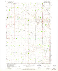 1964 Canton SW1965 Print · USGSLincoln County townships such as Lynn and Dayton are shown here in the mid-1960s, still defined by a dense network of country schools and rail lines. Genealogists can locate family landmarks like Grand Valley Church, Forest Hill Cemetery, and Kerley School.
 - 1964 Map of Worthing, 1965 Print
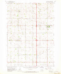 1964 Worthing1965 Print · USGSLincoln County farmland is documented here in the mid-1960s as Interstate 29 began to reshape the local travel landscape. Genealogists and historians can locate numerous rural schools like Gedstad Sch and early landmarks including the Skie Air Service Landing Field.
End of results
Showing maps 1-4 of 4
Top cities near LaValley Township
- Sioux Falls historical maps
- Brandon historical maps
- Harrisburg historical maps
- Tea historical maps
- Hartford historical maps
- Canton historical maps
See more
Frequently asked questions
- What are the different types of historical maps available for LaValley Township?
- What is the oldest map of LaValley Township?
- Where can I purchase historical maps of LaValley Township for my home or office?
- Where can I download high-res historical maps of LaValley Township?
- Are there historical topographic maps available for LaValley Township?
- Is there historical aerial imagery available for LaValley Township?
- Where are historical maps of LaValley Township sourced from?