2020s Maps of Clear Lake, South Dakota
Explore 6 historic maps of Clear Lake from the 2020s. These maps offer a rare glimpse into what life looked like during the 2020s — showing old roads, neighborhoods, homes, and landmarks that have changed or disappeared over time.
Whether you're researching your family's past, planning a metal detecting trip, or studying how Clear Lake's landscape evolved across the 2020s, these high-resolution maps are a powerful tool for exploring the history of this region.
- Focus on a specific era: All maps on this page are from the 2020s, giving you a focused view of this time period.
- See what’s changed: Compare century-old streets, trails, and buildings to today's modern landscape using overlays and satellite layers.
- Research with precision: Use these maps for genealogy, historical research, land use analysis, or educational projects.
- View, download, or print: Maps are fully viewable online in high resolution, and can be downloaded or printed for your own records.
Start exploring Clear Lake's history through authentic maps from the 2020s. This is your window into the past.
Clear Lake, SD maps
(6)- 2021 Map of South Red Iron Lake, 2021 Print
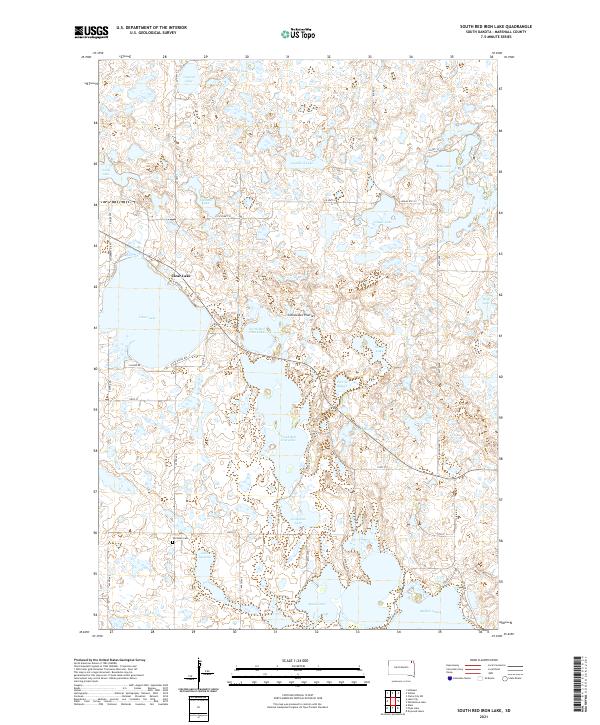 2021 South Red Iron Lake2021 Print · USGSMarshall County's glacial landscape is captured in the early 2020s, showcasing the intricate chain of lakes and wetlands atop the Coteau des Prairies. Local researchers can trace family landmarks like the Old Eden Cem or survey the shorelines of North Red Iron Lake and Clear Lake.
 - 2021 Map of Piyas Lake, 2021 Print
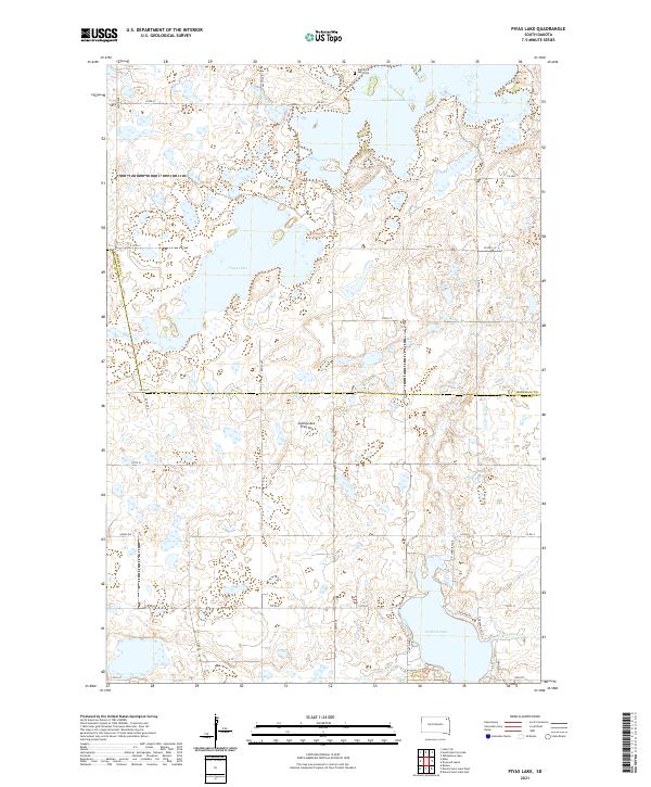 2021 Piyas Lake2021 Print · USGSGlacial lakes and rural section lines define the Marshall and Day County border in the early twenty-first century. Genealogists and local researchers can locate the Buffalo Lake Cem and trace property boundaries near Piyas Lake and Pickerel Lake.
 - 2021 Map of Drywood Lakes, 2021 Print
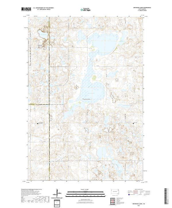 2021 Drywood Lakes2021 Print · USGSThe Coteau des Prairies plateau in the early twenty-first century remains a landscape of glacial lakes and pioneer-era landmarks. Genealogists can trace family history at the Buffalo Lake Lutheran Cem, Bethel Cem, and Zoar Lutheran Church Cem.
 - 2021 Map of Whitestone Lake, 2021 Print
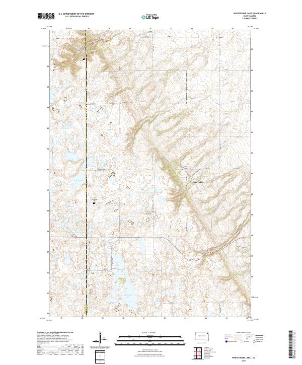 2021 Whitestone Lake2021 Print · USGSThe Roberts County prairie is captured here in the early 21st century, showing a landscape of glacial lakes and deep ravines. Researchers can locate remote family burial sites like Roy Cem and Spring Valley Cem or trace the winding Trail of Spirits Trl through the coulees.
 - 2021 Map of Lake City, 2021 Print
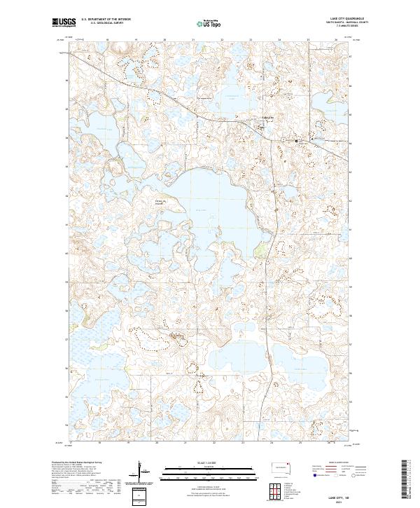 2021 Lake City2021 Print · USGSIn the glacial lake country of Northeast South Dakota, this survey shows the settlement of Lake City surrounded by the unique hydrology of the Coteau des Prairies. Researchers can trace local heritage at Saint Joseph Cem or explore the shorelines of Roy Lake and Fourmile Lake.
 - 2021 Map of Eden, 2021 Print
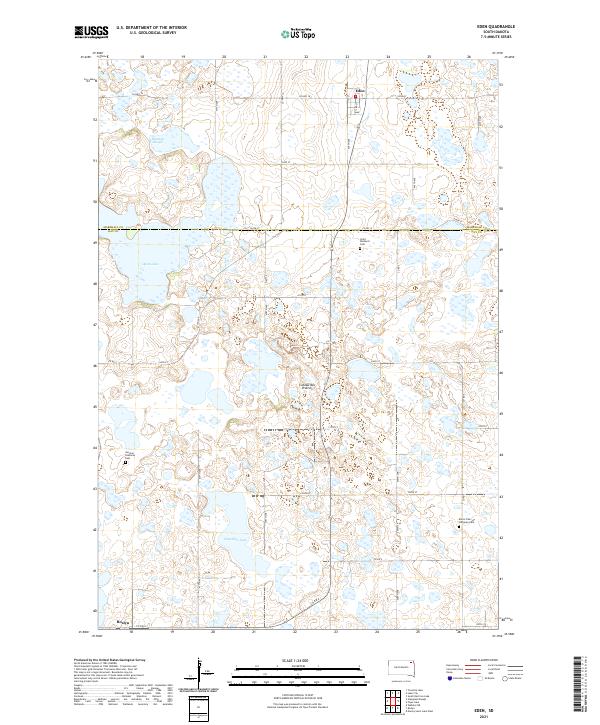 2021 Eden2021 Print · USGSNortheastern South Dakota's glacial landscape is meticulously detailed here, showing the rural communities of Eden and Roslyn in the early 2020s. Researchers can trace family roots through landmarks like Saint Michael's Cem, German Lutheran Cem, and Hazelden Lake.
End of results
Showing maps 1-6 of 6
Top cities near Clear Lake
- Long Hollow historical maps
- Roslyn historical maps
- Old Agency District historical maps
- Eden historical maps
- Grenville historical maps
- Lake City historical maps
Top neighborhoods of Clear Lake
Frequently asked questions
- What are the different types of historical maps available for Clear Lake?
- What is the oldest map of Clear Lake?
- Where can I purchase historical maps of Clear Lake for my home or office?
- Where can I download high-res historical maps of Clear Lake?
- Are there historical topographic maps available for Clear Lake?
- Is there historical aerial imagery available for Clear Lake?
- Where are historical maps of Clear Lake sourced from?