Old Maps of Bend, South Dakota for Hiking & Exploration
Hike through history with 10 historic maps of Bend. Explore old trails, ghost towns, and forgotten backroads — perfect for outdoor adventurers and local explorers.
- Rediscover forgotten places: Map out old mining camps, roads, and footpaths that no longer exist on modern maps.
- Layer with modern tools: Combine with LiDAR or satellite views to plan hikes through historical terrain.
- Made for exploration: Popular among hikers, overlanders, and local history lovers.
Use these maps to find adventure and explore the hidden past of Bend.
Bend, SD maps
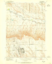
(10)- 1893 Map of Rapid
 1893 Rapid1893 Print · USGSThe Black Hills frontier comes alive in the late nineteenth century as rail lines and military outposts shape the territory. Genealogists and researchers can trace the early layout of Rapid, locate Fort Meade, and find family-named landmarks like Doe Dotie Ranch or Piedmont.2 unique versions available
 - 1898 Map of Rapid
 1898 Rapid1898 Print · USGSThe Black Hills foothills come alive in the 1890s, where early railroads meet military outposts and pioneer settlements. Trace the early streets of Rapid City, the grounds of Fort Meade, and localized landmarks like Crystal Cave.2 unique versions available
 - 1903 Map of Rapid
 1903 Rapid1903 Print · USGSThe Black Hills transition from mountains to plains at the turn of the century, centered on the growing rail hub of Rapid. Researchers can trace the early rail corridor of the Fremont Elkhorn and Missouri Valley through Fort Meade and Piedmont.4 unique versions available
 - 1953 Map of Bend, 1954 Print
 1953 Bend1954 Print · USGSMeade and Pennington Counties were undergoing significant change in the early fifties as military infrastructure expanded into the rural landscape. Researchers can trace the development of Ellsworth Air Force Base and locate community landmarks like Bend Sch and Elk Dale Sch.2 unique versions available
 - 1953 Map of Rapid City, 1964 Print
 1953 Rapid City1964 Print · USGSWestern South Dakota's transition from the Black Hills to the open prairie is captured here during the mid-fifties. Researchers can trace the development of Ellsworth Air Force Base alongside historic landmarks like Bear Butte and the Lower Alkali School.3 unique versions available
 - 1957 Map of Rapid City
 1957 Rapid City1957 Print · USGSWestern South Dakota in the mid-fifties reveals a landscape of high-altitude forests and growing military installations. Researchers can trace the development of Ellsworth Air Force Base, locate the Theodore Roosevelt Monument, and find rural landmarks like Lower Alkali School.
 - 2012 Map of Bend, 2012 Print
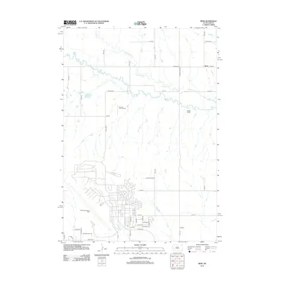 2012 Bend2012 Print · USGSCovers Bend, including Box Elder, Pennington County, and other nearby areas
 - 2015 Map of Bend, 2015 Print
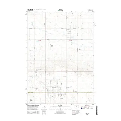 2015 Bend2015 Print · USGSCovers Bend, including Box Elder, Pennington County, and other nearby areas
 - 2017 Map of Bend, 2017 Print
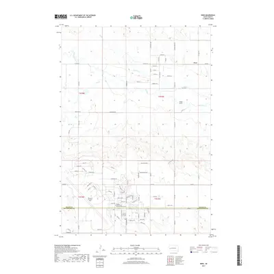 2017 Bend2017 Print · USGSCovers Bend, including Box Elder, Pennington County, and other nearby areas
 - 2021 Map of Bend, 2021 Print
 2021 Bend2021 Print · USGSNear the turn of the twenty-first century, this area of Meade County illustrates the proximity between rural ranching life and the sprawl of Ellsworth Air Force Base. Researchers can trace the development of Box Elder and find quiet landmarks like the settlement of Bend and Sweet Gulch.
End of results
Showing maps 1-10 of 10
Top cities near Bend
Frequently asked questions
- What are the different types of historical maps available for Bend?
- What is the oldest map of Bend?
- Where can I purchase historical maps of Bend for my home or office?
- Where can I download high-res historical maps of Bend?
- Are there historical topographic maps available for Bend?
- Is there historical aerial imagery available for Bend?
- Where are historical maps of Bend sourced from?