1970s Maps of Canova Township, South Dakota
Explore 4 historic maps of Canova Township from the 1970s. These maps offer a rare glimpse into what life looked like during the 1970s — showing old roads, neighborhoods, homes, and landmarks that have changed or disappeared over time.
Whether you're researching your family's past, planning a metal detecting trip, or studying how Canova Township's landscape evolved across the 1970s, these high-resolution maps are a powerful tool for exploring the history of this region.
- Focus on a specific era: All maps on this page are from the 1970s, giving you a focused view of this time period.
- See what’s changed: Compare century-old streets, trails, and buildings to today's modern landscape using overlays and satellite layers.
- Research with precision: Use these maps for genealogy, historical research, land use analysis, or educational projects.
- View, download, or print: Maps are fully viewable online in high resolution, and can be downloaded or printed for your own records.
Start exploring Canova Township's history through authentic maps from the 1970s. This is your window into the past.
Canova Township, SD maps
(4)- 1971 Map of Canova East, 1974 Print
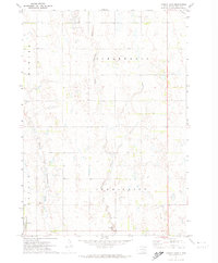 1971 Canova East1974 Print · USGSMiner County farming and rail life are centered around the prairie town of Canova in the early 1970s. Trace the path of the C M St P & P railroad or locate local landmarks like the Canova Cem and Union Ch along the winding river forks.
 - 1971 Map of Unityville, 1974 Print
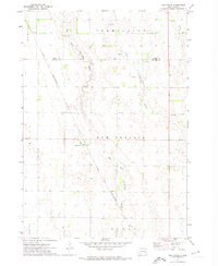 1971 Unityville1974 Print · USGSThe rural prairie of McCook and Miner counties comes into focus in the early 1970s, showcasing a landscape of river forks and rail lines. Genealogists and historians can trace local landmarks like Unityville, the Sun Prairie Ch, and the Olsen Cem.
 - 1973 Map of Canova SE, 1978 Print
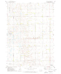 1973 Canova SE1978 Print · USGSEastern South Dakota in the 1970s shows a landscape of highly structured prairie farming and conservation efforts. Genealogists and local historians can locate early landmarks like Edgerton, Immanuel Ch, and Pleasant Hill Cem.
 - 1973 Map of Canova West, 1978 Print
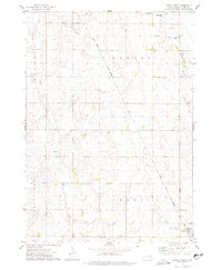 1973 Canova West1978 Print · USGSMiner County in the 1970s shows a classic prairie landscape defined by the Chicago and North Western railroad. Genealogists and local historians can trace the outskirts of Vilas and Canova, alongside rural landmarks like St Pauls Cem.
End of results
Showing maps 1-4 of 4
Top cities near Canova Township
- Salem historical maps
- Howard historical maps
- Winfred historical maps
- Spencer historical maps
- Canova historical maps
- Farmer historical maps
See more
Top neighborhoods of Canova Township
Frequently asked questions
- What are the different types of historical maps available for Canova Township?
- What is the oldest map of Canova Township?
- Where can I purchase historical maps of Canova Township for my home or office?
- Where can I download high-res historical maps of Canova Township?
- Are there historical topographic maps available for Canova Township?
- Is there historical aerial imagery available for Canova Township?
- Where are historical maps of Canova Township sourced from?