Old Maps of Minnehaha County, South Dakota for Genealogy
Trace your family roots with 133 historic maps of Minnehaha County. These high-res maps reveal old neighborhoods, homesites, landmarks, and streets — helping you uncover where your ancestors lived and how the area evolved over time.
- Explore historic neighborhoods: Identify where your relatives may have lived in the 1800s or 1900s.
- Compare maps over time: Trace the changes in streets, buildings, and landmarks for multi-generational research.
- Perfect for genealogy & ancestry research: Used by family historians and researchers to map out lineage and migration.
These maps are an incredible resource for exploring your personal connection to Minnehaha County's past.
Minnehaha County, SD maps
(133)- 1897 Map of Canton, 1954 Print
 1897 Canton1954 Print · USGSSoutheastern South Dakota and the Iowa borderlands were undergoing a railway-driven expansion during the 1890s. Genealogists and historians can trace early settlements like Beloit, Centerville, and Lennox as they grew along the Big Sioux River.
 - 1898 Map of Parker
 1898 Parker1898 Print · USGSSoutheastern South Dakota in the late nineteenth century shows a landscape defined by the expansion of the Chicago and Northwestern railroad. Genealogists and local historians can trace early settlements and pioneer-era post offices like Idylwilde, Hurley, and the prominent rise of Turkey Ridge.4 unique versions available
 - 1900 Map of Canton
 1900 Canton1900 Print · USGSSoutheastern South Dakota and the Iowa borderlands are captured here at a peak of late-nineteenth-century rail expansion. Genealogists can trace the early foundations of towns like Canton, Centerville, and Beresford along the Big Sioux River.2 unique versions available
 - 1955 Map of Sioux Falls, 1967 Print
 1955 Sioux Falls1967 Print · USGSThe eastern South Dakota and western Minnesota borderlands come alive in the mid-fifties, showing the vital rail-to-river connections of the era. Genealogists can trace family footprints across townships like Madison and Pipestone, while following the paths of the Big Sioux River and the Chicago and North Western line.3 unique versions available
 - 1958 Map of Sioux Falls
 1958 Sioux Falls1958 Print · USGSThe tri-state borderlands of South Dakota, Minnesota, and Iowa are captured here during the mid-century peak of the regional rail network. Genealogists and historians can trace local landmarks like Augustana Academy, the St Marys Cem, and the path of the Illinois Central through Rock Rapids.
 - 1962 Map of Colton SE, 1963 Print
 1962 Colton SE1963 Print · USGSMinnehaha County's rural townships are captured in the early sixties as they balanced traditional agriculture with evolving transport. Trace local genealogy and infrastructure through the Willow Creek Ch, Burk Cem, and an Old Railroad Grade.2 unique versions available
 - 1962 Map of Dell Rapids, 1963 Print
 1962 Dell Rapids1963 Print · USGSDell Rapids and the Big Sioux River valley are captured in the early sixties, showing a landscape shaped by water and rail. Trace family roots at Nelson Cem and St Olaf Cem, or locate the rural Carothers Sch No 86 and the local Quarry.2 unique versions available
 - 1962 Map of Renner, 1964 Print
 1962 Renner1964 Print · USGSMinnehaha County's rural townships are captured in the early sixties as they functioned before modern suburban growth. Genealogists and historians can trace family roots through the Pioneer Cem, St Pauls Ch, and old schools like Renner Sch.2 unique versions available
 - 1962 Map of Brandon, 1964 Print
 1962 Brandon1964 Print · USGSThe South Dakota and Iowa borderlands come to life in this early sixties survey of the Big Sioux River valley. Genealogists and historians can trace the early layouts of Brandon and Rowena, or locate family sites at Beaver Valley Ch and local Quarries.2 unique versions available
 - 1962 Map of Sioux Falls East, 1964 Print
 1962 Sioux Falls East1964 Print · USGSMid-century Minnehaha County is captured during a period of significant growth as new interstates reach the city. Genealogists can trace family roots through numerous sites like Woodlawn Cemetery, Augustana College, and the State Prison Farm.3 unique versions available
 - 1962 Map of Hartford South, 1964 Print
 1962 Hartford South1964 Print · USGSMinnehaha County in the early sixties shows a rural landscape on the cusp of change as the interstate highway system reaches the prairie. Researchers can trace dozens of family-named landmarks and country schools like Muchow Sch, Sunshine Sch, and Lakeview Sch.2 unique versions available
 - 1962 Map of Garretson West, 1964 Print
 1962 Garretson West1964 Print · USGSIn the early 1960s, the eastern plains of South Dakota remained a landscape of rural schoolhouses and rail-dependent towns. Genealogists and historians can trace family ties through Norway Ch, Summit Hill Cem, and local landmarks like Palisades Sch.2 unique versions available
 - 1962 Map of Lennox NW, 1964 Print
 1962 Lennox NW1964 Print · USGSThe rural landscape of Turner County comes into focus in the early sixties, showing a region of dense family farms and township schools. Researchers can locate many local landmarks, from the Norwegian Cem and Chancellor Cem to the tracks of the Great Northern railroad.2 unique versions available
 - 1962 Map of Hartford North, 1964 Print
 1962 Hartford North1964 Print · USGSMinnehaha County in the early 1960s shows a landscape of productive farmsteads and rural schools near Hartford. Trace the Chicago and North Western rail line or locate local landmarks like Scotts Slough and McLeod Sch.
 - 1962 Map of Sioux Falls West, 1964 Print
 1962 Sioux Falls West1964 Print · USGSThe western edge of Sioux Falls was rapidly evolving in the early sixties as infrastructure expanded across the South Dakota prairie. Researchers can trace the development of suburban institutions like O'Gorman High Sch or locate rural landmarks such as Bethel Cem and Ellis.3 unique versions available
 - 1962 Map of Crooks, 1970 Print
 1962 Crooks1970 Print · USGSMinnehaha County's agricultural heartland is captured here in the early sixties, showing the rural landscape around Lyons and Crooks. Genealogists and local historians can trace family roots through landmarks like Lyons Cem, West Nidaros Ch, and the Burlington Northern rail line.2 unique versions available
 - 1964 Map of Montrose, 1966 Print
 1964 Montrose1966 Print · USGSThe McCook County prairie centered on Montrose is captured here during the mid-1960s, showing a well-established network of farms and rail lines. Genealogists and local historians can locate St Patricks Cem, School No 39, and the winding East Fork Vermillion River.
 - 1964 Map of Grass Lake, 1966 Print
 1964 Grass Lake1966 Print · USGSMinnehaha County's rural townships are captured in the mid-1960s, showing a landscape of prairie sloughs and small farm communities. Genealogists can locate family land near Union Center, Pumpkin Center, and local institutions like Midwest Sch No 71.
 - 1964 Map of Humboldt, 1966 Print
 1964 Humboldt1966 Print · USGSHumboldt and the surrounding prairie of Minnehaha County are captured here in the mid-1960s as Interstate 90 began to reshape the landscape. Local historians can trace family roots through sites like Mt Pleasant Sch, the town Cem, and the busy Chicago and North Western rail line.
 - 1964 Map of East Vermillion Lake, 1966 Print
 1964 East Vermillion Lake1966 Print · USGSMcCook County agriculture and water management are front and center in the mid-1960s as East Vermillion Lake fills the valley. Researchers can locate many rural landmarks including Spring Valley Cem and several numbered schoolhouses.
 - 1967 Map of Valley Springs, 1968 Print
 1967 Valley Springs1968 Print · USGSThe tri-state border region of the Upper Midwest is captured in the late sixties, showcasing the intersection of rail and road. Trace family roots and vanished landmarks near Valley Springs, Benclare, and the Nerison Cem.2 unique versions available
 - 1967 Map of Garretson East, 1968 Print
 1967 Garretson East1968 Print · USGSThe South Dakota and Minnesota borderlands are captured here in the late sixties, centered on the railroad hub of Garretson. Researchers can locate several pioneer-era burial grounds including Sherman Cem and Springwater Cem, alongside the winding Devils Gulch.
 - 1967 Map of Jasper, 1968 Print
 1967 Jasper1968 Print · USGSThe tri-state border region of Minnesota and South Dakota was a busy rail and quarrying hub in the late sixties. Researchers can trace the Great Northern rail lines and locate family sites at Rosendal Cem or the village of Sherman.
 - 1968 Map of Colton, 1970 Print
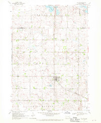 1968 Colton1970 Print · USGSMinnehaha and Lake counties are shown here in the late sixties as the agricultural landscape of southeastern South Dakota continued its steady growth. Researchers can find numerous family-history sites like Taopi Cem and Huntimer or trace the Great Northern rail line.
 - 1968 Map of Buffalo Trading Post, 1970 Print
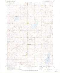 1968 Buffalo Trading Post1970 Print · USGSThe prairie lake country of Lake and Minnehaha counties is captured here in the late sixties, showing a landscape of rural homesteads and glacial waters. Genealogists can locate family landmarks like St Jacobs Cem, Bethany Cem, and the historic Buffalo Trading Post.
Showing maps 1-25 of 133
Top cities of Minnehaha County
Frequently asked questions
- What are the different types of historical maps available for Minnehaha County?
- What is the oldest map of Minnehaha County?
- Where can I purchase historical maps of Minnehaha County for my home or office?
- Where can I download high-res historical maps of Minnehaha County?
- Are there historical topographic maps available for Minnehaha County?
- Is there historical aerial imagery available for Minnehaha County?
- Where are historical maps of Minnehaha County sourced from?