Old Maps of Bixby, South Dakota for Academic Research
Study the evolution of Bixby with 8 high-resolution historic maps. Whether you're teaching, researching, or modeling changes in land use, these maps provide essential visual documentation of urban, environmental, and geographic change.
- Analyze long-term change: Track patterns in development, transportation, and natural features.
- Ideal for environmental or urban studies: Support academic projects with primary historical map data.
- Use in the classroom or lab: Educators and researchers rely on these maps to bring historical context to life.
These maps are a powerful tool for teaching, research, and visualizing how Bixby has changed over the decades.
Bixby, SD maps
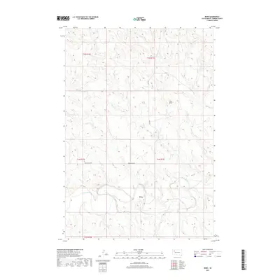
(8)- 1951 Map of Bixby, 1955 Print
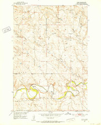 1951 Bixby1955 Print · USGSPerkins County ranchlands are documented here in the early 1950s as the Missouri River Basin development program was underway. Researchers can trace rural family legacies at the Fisher Ranch, locate the old Bixby P O, or find the Stony Butte Sch.
 - 1954 Map of Lemmon, 1964 Print
 1954 Lemmon1964 Print · USGSThe high plains of South Dakota and North Dakota are documented here during the mid-twentieth century. Family researchers can trace dozens of country school sites like Green Cabin School and Bierke School alongside landmarks like The Castles.2 unique versions available
 - 1957 Map of Lemmon
 1957 Lemmon1957 Print · USGSThe northwestern plains of South Dakota and North Dakota are captured here in the mid-fifties, centered on the rail hub of Lemmon. Genealogists and historians can trace dozens of rural schoolhouses and vanished sites like Imogene and the Shadehill Reservoir area.
 - 1984 Map of Faith
 1984 Faith1984 Print · USGSWestern South Dakota's open plains and river breaks appear here in the mid-1980s, centered on the ranching country around Faith. Researchers can trace remote settlements and essential water infrastructure like Sorum, Bixby Gaging Station, and Mourine Lake.3 unique versions available
 - 2012 Map of Bixby, 2012 Print
 2012 Bixby2012 Print · USGSCovers Bixby, including Perkins County, United States, and other nearby areas
 - 2015 Map of Bixby, 2015 Print
 2015 Bixby2015 Print · USGSCovers Bixby, including Perkins County, United States, and other nearby areas
 - 2017 Map of Bixby, 2017 Print
 2017 Bixby2017 Print · USGSCovers Bixby, including Perkins County, United States, and other nearby areas
 - 2021 Map of Bixby, 2021 Print
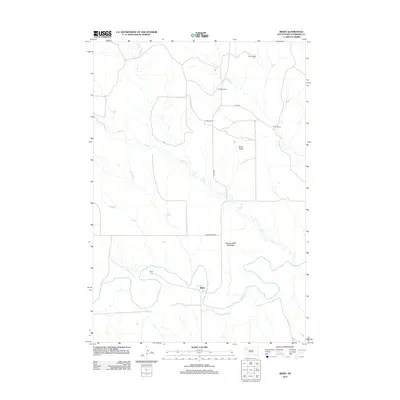
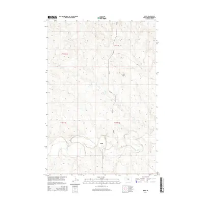
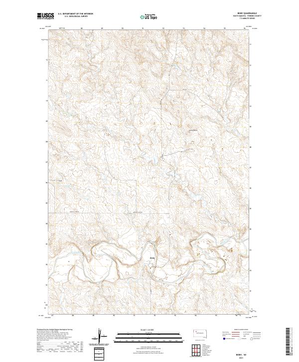 2021 Bixby2021 Print · USGSThe Perkins County ranchlands and the winding Moreau River are documented here in the early 2020s. Genealogists and local historians can trace the rural settlement at Bixby and navigate family-named routes like Kari Rd and Bixby Rd.
End of results
Showing maps 1-8 of 8
Frequently asked questions
- What are the different types of historical maps available for Bixby?
- What is the oldest map of Bixby?
- Where can I purchase historical maps of Bixby for my home or office?
- Where can I download high-res historical maps of Bixby?
- Are there historical topographic maps available for Bixby?
- Is there historical aerial imagery available for Bixby?
- Where are historical maps of Bixby sourced from?