Old Maps of Perkins County, South Dakota
Explore 358 old maps of Perkins County, spanning from 1951 to today. These high-resolution historic maps reveal how streets, neighborhoods, landmarks, and natural features evolved over time — perfect for genealogy, metal detecting, research, and local history exploration.
What you can do with these maps:
- See how Perkins County changed over time: Compare historical maps to modern-day views to trace roads, homesites, rail lines & more.
- View detailed metadata: Each map includes creators, publishers, year, scale, and archive source.
- Overlay maps with satellite & LiDAR: Visualize the past alongside modern tools to explore terrain & human change.
- Trusted historical sources: Maps sourced from the USGS, Library of Congress, and other archives.
- Access maps your way: View online, download high-res files, or order prints for personal or research use.
Start exploring old maps of Perkins County to uncover forgotten places, hidden landmarks, and the deep history beneath your feet.
Perkins County, SD maps
(358)- 1951 Map of Cedar Canyon, 1953 Print
 1951 Cedar Canyon1953 Print · USGSThe Perkins and Meade County borderlands come into focus during the early fifties, showing a remote prairie landscape defined by deep draws and ranching infrastructure. Genealogists can locate family landmarks like the Prairie Home Ch, Horse Butte Sch, and the Ben Ash Historical Monument.2 unique versions available
 - 1951 Map of Maurine, 1953 Print
 1951 Maurine1953 Print · USGSPerkins and Meade counties meet on this early 1950s survey of the South Dakota high plains near Maurine. Genealogists and local historians can locate several country schoolhouses, such as Mildrew Sch and Fox Ridge Sch, alongside the winding Deep Creek.
 - 1951 Map of Faith NE, 1953 Print
 1951 Faith NE1953 Print · USGSPerkins and Ziebach counties are captured in the early 1950s just as Missouri River Basin development was underway. Genealogists and local historians can trace the early educational landscape through the Arrowhead Sch (Abandoned) and the area's geography along the Moreau River.
 - 1951 Map of Imogene, 1953 Print
 1951 Imogene1953 Print · USGSPerkins County ranch land and the meandering Moreau River are captured here in the early fifties. Genealogists and local historians can locate family landmarks like Stillwell Ranch, Nelson Farm, and the rural School No 73 near Beck Lake.
 - 1951 Map of Deep Creek NW, 1953 Print
 1951 Deep Creek NW1953 Print · USGSPerkins County ranching country is documented here in the early fifties, following the path of the river through a quiet agricultural landscape. Genealogists and local historians can locate family holdings like Marks Ranch and Kari Ranch or trace the site of the Weedman Sch (Abandoned).
 - 1951 Map of Bixby, 1955 Print
 1951 Bixby1955 Print · USGSPerkins County ranchlands are documented here in the early 1950s as the Missouri River Basin development program was underway. Researchers can trace rural family legacies at the Fisher Ranch, locate the old Bixby P O, or find the Stony Butte Sch.
 - 1952 Map of Deep Creek SE
 1952 Deep Creek SE1952 Print · USGSThe Perkins and Meade county line in the early 1950s showcases the remote ranching character of western South Dakota. Researchers can trace the winding paths of Deep Creek and Flint Rock Creek or locate isolated range landmarks like the Windmill.2 unique versions available
 - 1952 Map of Signal Butte, 1954 Print
 1952 Signal Butte1954 Print · USGSThe Perkins and Meade county line in the early fifties shows a sparsely settled ranching landscape dominated by Signal Butte. Researchers can trace the early educational and travel geography of the plains through the Cottonwood Sch and a creek Ford.2 unique versions available
 - 1952 Map of Deep Creek NE, 1954 Print
 1952 Deep Creek NE1954 Print · USGSThe Missouri River Basin development era is captured in this mid-century survey of Perkins County, centered on the winding Moreau River. Researchers can trace the landscape across family-named landmarks like Chaudoin and find old river crossings like the southern Ford.2 unique versions available
 - 1952 Map of Faith NW, 1954 Print
 1952 Faith NW1954 Print · USGSPerkins County's prairie landscape is defined by the winding Moreau River in the early fifties. Genealogists and historians can trace the remote settlement of Usta and sparse landmarks like a lone Windmill or the Englewood uplands.
 - 1953 Map of McIntosh, 1965 Print
 1953 McIntosh1965 Print · USGSThe north-central Dakota prairie is captured here during the mid-fifties, showing the vast Standing Rock Indian Reservation and the newly formed Oah E Reservoir. Genealogists and historians can trace the Chicago Milwaukee St Paul and Pacific rail line through stops like McIntosh, Walker, and Eagle Butte.3 unique versions available
 - 1954 Map of Lemmon, 1964 Print
 1954 Lemmon1964 Print · USGSThe high plains of South Dakota and North Dakota are documented here during the mid-twentieth century. Family researchers can trace dozens of country school sites like Green Cabin School and Bierke School alongside landmarks like The Castles.2 unique versions available
 - 1957 Map of Lemmon
 1957 Lemmon1957 Print · USGSThe northwestern plains of South Dakota and North Dakota are captured here in the mid-fifties, centered on the rail hub of Lemmon. Genealogists and historians can trace dozens of rural schoolhouses and vanished sites like Imogene and the Shadehill Reservoir area.
 - 1958 Map of McIntosh
 1958 McIntosh1958 Print · USGSThe north-central Dakotas appear here in the mid-1950s as massive engineering projects and rail lines shaped the plains. Researchers can trace tribal lands within the Standing Rock Indian Reservation and locate local landmarks like the Keller Mine or the Virginia Siding.
 - 1972 Map of Black Horse Butte NW, 1975 Print
 1972 Black Horse Butte NW1975 Print · USGSThe Standing Rock Indian Reservation in the early seventies is shown here as a landscape of broad plateaus and winding prairie rivers. You can trace early water crossings at the Ford on the Grand River or locate landmarks like River View and Delaney.
 - 1974 Map of Hettinger South, 1978 Print
 1974 Hettinger South1978 Print · USGSThe North Dakota and South Dakota borderlands come into focus in the mid-1970s, centered on the expansion of Hettinger. Genealogists and researchers can trace the drainages of Billy Young Creek and Hook Creek or locate local landmarks like Mirror Lake and the Claypit.
 - 1974 Map of Cow Butte, 1978 Print
 1974 Cow Butte1978 Print · USGSThe Dakota borderlands come into focus in the mid-1970s at the intersection of four counties. Genealogists and local historians can locate rural landmarks like Mamre Ch and Golden Valley Ch Cem along the North Fork Grand River.
 - 1974 Map of Cow Butte NE, 1978 Print
 1974 Cow Butte NE1978 Print · USGSThe Dakota borderlands come into focus during the 1970s, where rural townships meet along the North Fork Grand River. Genealogists and local historians can locate family landmarks such as the North Grand Ch, a local Cem, and numerous named watercourses like Lightning Creek.
 - 1974 Map of White Butte, 1978 Print
 1974 White Butte1978 Print · USGSThe North and South Dakota borderlands come alive in the mid-seventies, showing a landscape shaped by the Milwaukee Road. Researchers can trace the rail settlements of White Butte and Petrel, finding local landmarks like the Petrel Cem and a rural Townhall.
 - 1974 Map of Kid Rich Butte, 1978 Print
 1974 Kid Rich Butte1978 Print · USGSThe high plains of the North Dakota-South Dakota border come into focus in the mid-1970s, showing a landscape defined by river forks and rail lines. Researchers can trace the path of the Chicago Milwaukee St Paul and Pacific railroad or locate landmarks like Kid Rich Butte and Castle Butte.
 - 1974 Map of Lemmon, 1978 Print
 1974 Lemmon1978 Print · USGSThe borderlands of the Dakotas come into focus during the mid-seventies, centered on the railroad town of Lemmon. Local historians can trace the Chicago Milwaukee St Paul and Pacific rail line and locate landmarks like the North Lemmon Sch and Green Hill Cem.
 - 1974 Map of Lemmon NE, 1978 Print
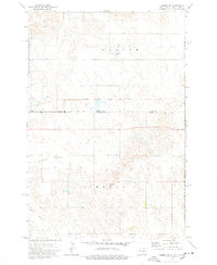 1974 Lemmon NE1978 Print · USGSThe North and South Dakota borderlands are captured here in the 1970s, where the rail-and-ranch economy defines the landscape. Researchers can trace the path of the Chicago Milwaukee St Paul and Pacific railroad and the Standing Rock Indian Reservation Boundary.
 - 1974 Map of Haynes, 1978 Print
 1974 Haynes1978 Print · USGSThe border between the Dakotas comes alive in the mid-1970s, showing the intersection of rail transport and prairie industry. Genealogists and historians can locate the Haynes Cem, the local Townhall, and the prominent Strip Mine north of town.
 - 1980 Map of Beverly Creek, 1981 Print
 1980 Beverly Creek1981 Print · USGSWest of the Moreau River in the early 1980s, this region captures the high plains at the meeting point of three counties. Genealogists and historians can trace the isolated settlement at Mud Butte and rural road networks near Beverly Creek and Cabin Creek.
 - 1980 Map of McIntosh, 1981 Print
 1980 McIntosh1981 Print · USGSThe northern plains of the Standing Rock Indian Reservation are shown here as they appeared in the early 1980s. You can trace the railroad history of Corson County along the Chicago Milwaukee St Paul and Pacific line, connecting settlements like Watauga and Morristown.
Showing maps 1-25 of 358
Top cities of Perkins County
- Lemmon historical maps
- Bison historical maps
- Strool historical maps
- Lodgepole historical maps
- Chance historical maps
- Meadow historical maps
See more
Frequently asked questions
- What are the different types of historical maps available for Perkins County?
- What is the oldest map of Perkins County?
- Where can I purchase historical maps of Perkins County for my home or office?
- Where can I download high-res historical maps of Perkins County?
- Are there historical topographic maps available for Perkins County?
- Is there historical aerial imagery available for Perkins County?
- Where are historical maps of Perkins County sourced from?