1970s Maps of Perkins County, South Dakota
Explore 9 historic maps of Perkins County from the 1970s. These maps offer a rare glimpse into what life looked like during the 1970s — showing old roads, neighborhoods, homes, and landmarks that have changed or disappeared over time.
Whether you're researching your family's past, planning a metal detecting trip, or studying how Perkins County's landscape evolved across the 1970s, these high-resolution maps are a powerful tool for exploring the history of this region.
- Focus on a specific era: All maps on this page are from the 1970s, giving you a focused view of this time period.
- See what’s changed: Compare century-old streets, trails, and buildings to today's modern landscape using overlays and satellite layers.
- Research with precision: Use these maps for genealogy, historical research, land use analysis, or educational projects.
- View, download, or print: Maps are fully viewable online in high resolution, and can be downloaded or printed for your own records.
Start exploring Perkins County's history through authentic maps from the 1970s. This is your window into the past.
Perkins County, SD maps
(9)- 1972 Map of Black Horse Butte NW, 1975 Print
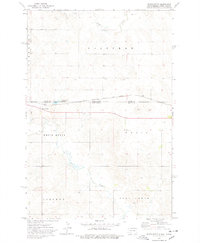
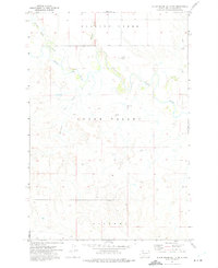 1972 Black Horse Butte NW1975 Print · USGSThe Standing Rock Indian Reservation in the early seventies is shown here as a landscape of broad plateaus and winding prairie rivers. You can trace early water crossings at the Ford on the Grand River or locate landmarks like River View and Delaney.
 - 1974 Map of Hettinger South, 1978 Print
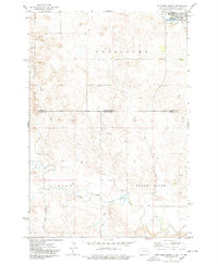 1974 Hettinger South1978 Print · USGSThe North Dakota and South Dakota borderlands come into focus in the mid-1970s, centered on the expansion of Hettinger. Genealogists and researchers can trace the drainages of Billy Young Creek and Hook Creek or locate local landmarks like Mirror Lake and the Claypit.
 - 1974 Map of Cow Butte, 1978 Print
 1974 Cow Butte1978 Print · USGSThe Dakota borderlands come into focus in the mid-1970s at the intersection of four counties. Genealogists and local historians can locate rural landmarks like Mamre Ch and Golden Valley Ch Cem along the North Fork Grand River.
 - 1974 Map of Cow Butte NE, 1978 Print
 1974 Cow Butte NE1978 Print · USGSThe Dakota borderlands come into focus during the 1970s, where rural townships meet along the North Fork Grand River. Genealogists and local historians can locate family landmarks such as the North Grand Ch, a local Cem, and numerous named watercourses like Lightning Creek.
 - 1974 Map of White Butte, 1978 Print
 1974 White Butte1978 Print · USGSThe North and South Dakota borderlands come alive in the mid-seventies, showing a landscape shaped by the Milwaukee Road. Researchers can trace the rail settlements of White Butte and Petrel, finding local landmarks like the Petrel Cem and a rural Townhall.
 - 1974 Map of Kid Rich Butte, 1978 Print
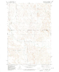
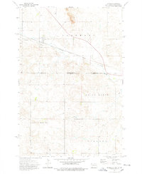
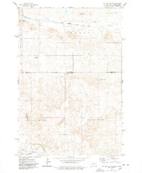 1974 Kid Rich Butte1978 Print · USGSThe high plains of the North Dakota-South Dakota border come into focus in the mid-1970s, showing a landscape defined by river forks and rail lines. Researchers can trace the path of the Chicago Milwaukee St Paul and Pacific railroad or locate landmarks like Kid Rich Butte and Castle Butte.
 - 1974 Map of Lemmon, 1978 Print
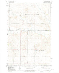
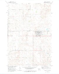 1974 Lemmon1978 Print · USGSThe borderlands of the Dakotas come into focus during the mid-seventies, centered on the railroad town of Lemmon. Local historians can trace the Chicago Milwaukee St Paul and Pacific rail line and locate landmarks like the North Lemmon Sch and Green Hill Cem.
 - 1974 Map of Lemmon NE, 1978 Print
 1974 Lemmon NE1978 Print · USGSThe North and South Dakota borderlands are captured here in the 1970s, where the rail-and-ranch economy defines the landscape. Researchers can trace the path of the Chicago Milwaukee St Paul and Pacific railroad and the Standing Rock Indian Reservation Boundary.
 - 1974 Map of Haynes, 1978 Print
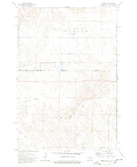
 1974 Haynes1978 Print · USGSThe border between the Dakotas comes alive in the mid-1970s, showing the intersection of rail transport and prairie industry. Genealogists and historians can locate the Haynes Cem, the local Townhall, and the prominent Strip Mine north of town.
End of results
Showing maps 1-9 of 9
Top cities of Perkins County
- Lemmon historical maps
- Bison historical maps
- Strool historical maps
- Lodgepole historical maps
- Chance historical maps
- Meadow historical maps
See more
Frequently asked questions
- What are the different types of historical maps available for Perkins County?
- What is the oldest map of Perkins County?
- Where can I purchase historical maps of Perkins County for my home or office?
- Where can I download high-res historical maps of Perkins County?
- Are there historical topographic maps available for Perkins County?
- Is there historical aerial imagery available for Perkins County?
- Where are historical maps of Perkins County sourced from?