
1980 Map of Beverly Creek
USGS Topo · Published 1981About this map
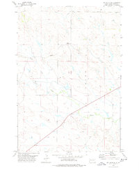
Mud Butte serves as a lone point of settlement in this northern plains landscape, situated at the junction of three South Dakota counties. Surveyed in the late 1970s, the map reveals a remote ranching and grazing region where the South Fork Moreau River meanders across the northern sections, fed by a series of ephemeral drainages including Cabin Creek and Hay Creek. The convergence of Butte, Perkins, and Meade counties near the southern edge emphasizes the borderland nature of this territory. This 1:25,000 scale study captures the distribution of rural structures and the network of unimproved roads branching away from Highway 212, which cuts across the southern portion of the quadrangle. The terrain is marked by distinct geographical areas such as Vrooman and Meade, showing a landscape dictated by water access near Beverly Creek and Mud Creek.
Find a feature on this map
13 named features on this map. Tap any name to fly to it.
Don’t see what you’re looking for? This feature index may not catch every label — zoom into the map to look around manually.
Map Details
Editions of this 1980 Beverly Creek Map
This is the sole edition of this map. No revisions or reprints were ever made.
Other maps of this area

1913 · Newell
USGS Topo · 1:125,000

1935 · Hoover
USGS Topo · 1:125,000

1951 · Cedar Canyon
USGS Topo · 1:24,000

1951 · Imogene
USGS Topo · 1:24,000

1953 · Rapid City
USGS Topo · 1:250,000

1954 · Lemmon
USGS Topo · 1:250,000

1957 · Lemmon
USGS Topo · 1:250,000

1957 · Rapid City
USGS Topo · 1:250,000

1973 · Frozen Man Creek
USGS Topo · 1:24,000
1978 · Owl Butte NE
USGS Topo · 1:24,000