Old Maps of Victor, Lake Traverse District for Hiking & Exploration
Hike through history with 9 historic maps of Victor. Explore old trails, ghost towns, and forgotten backroads — perfect for outdoor adventurers and local explorers.
- Rediscover forgotten places: Map out old mining camps, roads, and footpaths that no longer exist on modern maps.
- Layer with modern tools: Combine with LiDAR or satellite views to plan hikes through historical terrain.
- Made for exploration: Popular among hikers, overlanders, and local history lovers.
Use these maps to find adventure and explore the hidden past of Victor.
Victor, Lake Traverse District maps
(9)- 1917 Map of New Effington
 1917 New Effington1917 Print · USGSThe Dakota borderlands come alive in this survey from the mid-1910s, capturing the early rail-and-reservation era. Genealogists can locate family-named landmarks like Shafts School and Wymen School along the Minneapolis St Paul and Sault Ste Marie line.2 unique versions available
 - 1953 Map of Milbank, 1958 Print
 1953 Milbank1958 Print · USGSThe tri-state border region of South Dakota, North Dakota, and Minnesota is shown here during the early fifties, a landscape defined by glacial lakes and the Sisseton Indian Reservation. Researchers can trace the legacy of the western railroads, locating old stops along the Great Northern and settlements like Milbank, Webster, and Sisseton.3 unique versions available
 - 1958 Map of Milbank
 1958 Milbank1958 Print · USGSThe northern Great Plains in the late fifties show a landscape of glacial lakes and reservation lands shaped by the Great Northern railroad. Genealogists and local historians can trace the grid of settlements from Britton to Milbank and locate landmarks like Enemy Swim Lake and the Sisseton Indian Reservation.
 - 1972 Map of Victor, 1974 Print
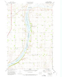 1972 Victor1974 Print · USGSThe rural landscape of Roberts County is captured here in the early 1970s, focused on the small community of Victor. Researchers can trace the path of the Soo Line railroad and explore numerous wetlands like Cottonwood Lake and Big Slough.
 - 1985 Map of Wheaton
 1985 Wheaton1985 Print · USGSThe tri-state border region of Minnesota and the Dakotas is captured in the mid-1980s, defined by its prairie wetlands and rail-fed farming towns. Researchers can trace the Burlington Northern line through Wheaton and Graceville or locate family-named landmarks like Carlson Island.2 unique versions available
 - 2012 Map of Victor, 2012 Print
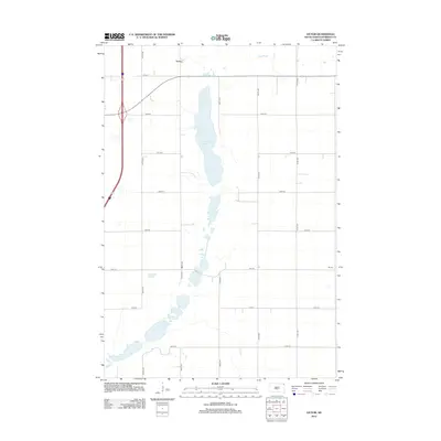 2012 Victor2012 Print · USGSCovers Victor, including Lake Traverse District, Roberts County, and other nearby areas
 - 2015 Map of Victor, 2015 Print
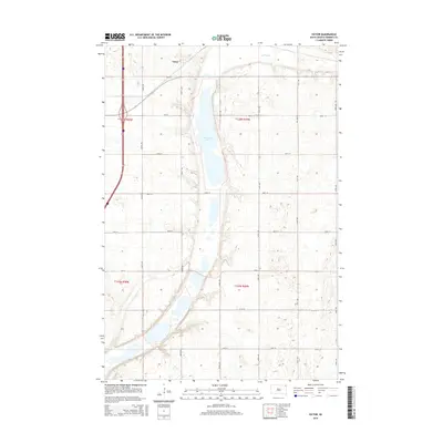 2015 Victor2015 Print · USGSCovers Victor, including Lake Traverse District, Roberts County, and other nearby areas
 - 2017 Map of Victor, 2017 Print
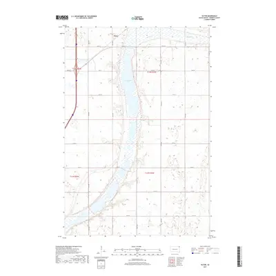 2017 Victor2017 Print · USGSCovers Victor, including Lake Traverse District, Roberts County, and other nearby areas
 - 2021 Map of Victor, 2021 Print
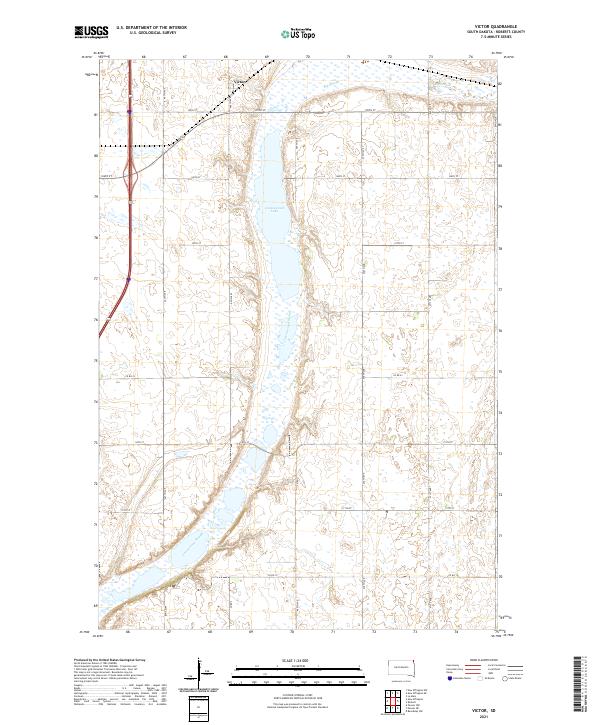 2021 Victor2021 Print · USGSThe northern edge of Roberts County in the early 2020s is defined by its expansive prairie wetlands and the small settlement of Victor. Researchers can trace the drainage patterns of Cottonwood Lake and the Cottonwood Slough as they intersect the local road grid.
End of results
Showing maps 1-9 of 9
Top cities near Victor
- Sisseton historical maps
- Hankinson historical maps
- Rosholt historical maps
- Fairmount historical maps
- New Effington historical maps
Frequently asked questions
- What are the different types of historical maps available for Victor?
- What is the oldest map of Victor?
- Where can I purchase historical maps of Victor for my home or office?
- Where can I download high-res historical maps of Victor?
- Are there historical topographic maps available for Victor?
- Is there historical aerial imagery available for Victor?
- Where are historical maps of Victor sourced from?