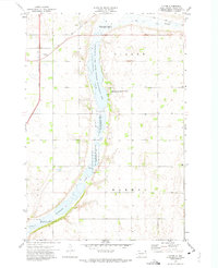
1972 Map of Victor
USGS Topo · Published 1974About this map
Victor stands as the primary settlement on this Northeast South Dakota landscape, positioned along the diagonal route of the Soo Line railroad. This 1972 survey reveals a terrain defined by its complex hydrology and conservation efforts, characterized by the long, narrow corridor of Cottonwood Lake and the marshy expanses of Big Slough and Cottonwood Slough. The region is extensively managed for natural resources, as evidenced by a chain of conservation lands including the Victor State Wildlife Management Area, Crawford State Wildlife Management Area, and the dual units of Dry Run No 1 and No 2. These managed areas highlight the importance of the local wetlands within the glacial till of the Coteau des Prairies. This map provides a clear view of the rural township boundaries of Victor, Lien, and Harmon during the early 1970s.
Find a feature on this map
15 named features on this map. Tap any name to fly to it.
Don’t see what you’re looking for? This feature index may not catch every label — zoom into the map to look around manually.
Map Details
Editions of this 1972 Victor Map
This is the sole edition of this map. No revisions or reprints were ever made.
Other maps of this area

1915 · White Rock
USGS Topo · 1:62,500

1916 · Peever
USGS Topo · 1:62,500

1916 · Beardsley
USGS Topo · 1:62,500

1917 · New Effington
USGS Topo · 1:62,500

1918 · Peever
USGS Topo · 1:62,500

1918 · White Rock
USGS Topo · 1:62,500

1918 · Beardsley
USGS Topo · 1:62,500

1953 · Milbank
USGS Topo · 1:250,000

1958 · Milbank
USGS Topo · 1:250,000
1971 · Peever NW
USGS Topo · 1:24,000