
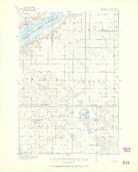
1916 Map of Beardsley
USGS Topo · Published 1968About this map
Beardsley and Barry anchor the southern landscape of this 1916 survey, situated along the Great Northern (Browns Valley Line) railroad. The region is defined by a dense network of local education, with numerous numbered and family-named schoolhouses such as Avery School, Wyman School, and the Round Mound School serving the farming townships of Browns Valley and Parnell. The border between South Dakota and Minnesota is marked by the waters of Lake Traverse, where the small settlements of Dakomin and Diamond sit near the shoreline. This geography illustrates a rural prairie economy organized around the rail line and a highly localized system of country schools, many of which were the primary social centers for early twentieth-century residents in Big Stone and Traverse counties.
Find a feature on this map
38 named features on this map. Tap any name to fly to it.
Don’t see what you’re looking for? This feature index may not catch every label — zoom into the map to look around manually.
Map Details
Editions of this 1916 Beardsley Map
2 editions found
Other maps of this area

1915 · White Rock
USGS Topo · 1:62,500

1916 · Peever
USGS Topo · 1:62,500

1917 · New Effington
USGS Topo · 1:62,500

1918 · Peever
USGS Topo · 1:62,500

1918 · White Rock
USGS Topo · 1:62,500

1918 · Beardsley
USGS Topo · 1:62,500

1950 · Graceville
USGS Topo · 1:62,500

1951 · Wheaton
USGS Topo · 1:62,500

1953 · Ortonville
USGS Topo · 1:62,500

1953 · Milbank
USGS Topo · 1:250,000