
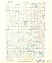
1950 Map of Graceville
USGS Topo · Published 1950About this map
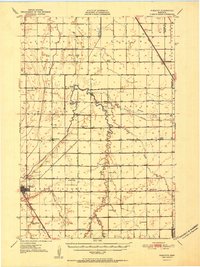
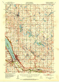
Graceville serves as the focal point of this west-central Minnesota survey, where the Chicago Milwaukee St Paul and Pacific and Great Northern railroads intersect near Toqua Lakes State Park. The landscape is defined by its agrarian organization, evidenced by the high density of rural schoolhouses such as Golden Rule Sch and Trinity Sch, which are dispersed across townships like Dollymount and Leonardville.
Find a feature on this map
50 named features on this map. Tap any name to fly to it.
Don’t see what you’re looking for? This feature index may not catch every label — zoom into the map to look around manually.
Map Details
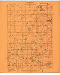
Editions of this 1950 Graceville Map
This is the sole edition of this map. No revisions or reprints were ever made.
Other maps of this area
1910 · Chokio
USGS Topo · 1:62,500

1911 · Herman
USGS Topo · 1:62,500
1912 · Chokio
USGS Topo · 1:62,500

1915 · White Rock
USGS Topo · 1:62,500
1916 · Beardsley
USGS Topo · 1:62,500

1918 · White Rock
USGS Topo · 1:62,500
1918 · Beardsley
USGS Topo · 1:62,500
1951 · Wheaton
USGS Topo · 1:62,500
1953 · Ortonville
USGS Topo · 1:62,500

1953 · Milbank
USGS Topo · 1:250,000