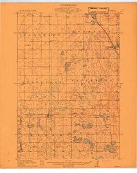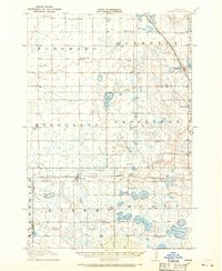
1910 Map of Chokio
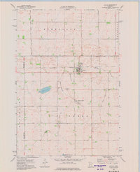
USGS Topo · Published 1968About this map
Chokio and Alberta serve as primary hubs along the Great Northern R R (Browns Valley Branch) in this 1910 survey of western Stevens County. The landscape is a distinct grid of agricultural townships including El Dorado, Donnelly, Everglade, and Pepperton. This era is defined by a dense network of one-room schoolhouses, such as School No 55 and School No 62, illustrating the early 20th-century settlement pattern where education was localized within walking distance of rural farmsteads.
Find a feature on this map
42 named features on this map. Tap any name to fly to it.
Don’t see what you’re looking for? This feature index may not catch every label — zoom into the map to look around manually.
Map Details
Editions of this 1910 Chokio Map
This is the sole edition of this map. No revisions or reprints were ever made.
Historical Maps of Chokio Through Time
8 maps found