Old Maps of Stevens County, Minnesota
Explore 142 old maps of Stevens County, spanning from 1910 to today. These high-resolution historic maps reveal how streets, neighborhoods, landmarks, and natural features evolved over time — perfect for genealogy, metal detecting, research, and local history exploration.
What you can do with these maps:
- See how Stevens County changed over time: Compare historical maps to modern-day views to trace roads, homesites, rail lines & more.
- View detailed metadata: Each map includes creators, publishers, year, scale, and archive source.
- Overlay maps with satellite & LiDAR: Visualize the past alongside modern tools to explore terrain & human change.
- Trusted historical sources: Maps sourced from the USGS, Library of Congress, and other archives.
- Access maps your way: View online, download high-res files, or order prints for personal or research use.
Start exploring old maps of Stevens County to uncover forgotten places, hidden landmarks, and the deep history beneath your feet.
Stevens County, MN maps
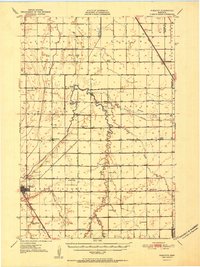
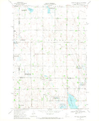
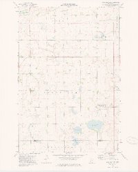
(142)- 1910 Map of Chokio, 1968 Print
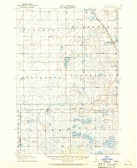 1910 Chokio1968 Print · USGSStevens County is shown here at the height of its rail-and-schoolhouse era in the early twentieth century. Genealogists can locate specific rural properties near landmarks like Harstad Slough, Town Hall, and over twenty numbered school sites including School No 35.
 - 1911 Map of Barrett
 1911 Barrett1911 Print · USGSGrant County is a mosaic of prairie lakes and early rail towns at the dawn of the twentieth century. Genealogists can locate over twenty numbered school sites and early settlements like Thorsborg, Erdahl, and the lake-front village of Barrett.2 unique versions available
 - 1911 Map of Herman
 1911 Herman1911 Print · USGSThe junction of two major rail lines at Herman defines this prairie landscape during a period of steady agricultural growth. Researchers can locate nearly twenty numbered rural schoolhouses and trace the original paths of the Great Northern RR and the Mustinka River.3 unique versions available
 - 1912 Map of Chokio
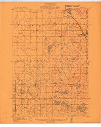 1912 Chokio1912 Print · USGSWestern Minnesota prairie life is centered on the rail lines of Donnelly and Chokio during the early twentieth century. Genealogists and researchers can trace local school districts from School No 56 to School No 42 and locate landmarks like the Town Hall and Harstad Slough.
 - 1912 Map of Morris
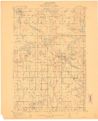
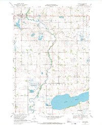
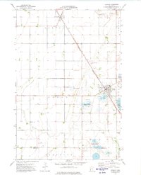
 1912 Morris1912 Print · USGSThe rail hub of Morris and the surrounding Stevens County prairie are captured here at the height of the steam era. Genealogists and historians can trace dozens of early rural schoolhouses, the North Star Mill, and pioneer worship sites like Scandia Church.3 unique versions available
 - 1950 Map of Graceville
 1950 Graceville1950 Print · USGSBig Stone and Traverse counties come alive in this mid-century survey of the Minnesota prairie at the peak of its rail-and-farm economy. Local historians can trace the foundations of Graceville and identify vanished rural landmarks like Golden Rule Sch and the Trinity Sch.
 - 1951 Map of Wheaton
 1951 Wheaton1951 Print · USGSTraverse County farming communities and the rail hub of Wheaton are captured here in the early fifties. Genealogists can trace family footprints across dozens of country schools like School No 46 and sacred sites including St Johns Cem.2 unique versions available
 - 1953 Map of Milbank, 1958 Print
 1953 Milbank1958 Print · USGSThe tri-state border region of South Dakota, North Dakota, and Minnesota is shown here during the early fifties, a landscape defined by glacial lakes and the Sisseton Indian Reservation. Researchers can trace the legacy of the western railroads, locating old stops along the Great Northern and settlements like Milbank, Webster, and Sisseton.3 unique versions available
 - 1953 Map of Saint Cloud, 1968 Print
 1953 Saint Cloud1968 Print · USGSCentral Minnesota's lake country and the Mississippi River valley are caught in a period of steady mid-century growth. Researchers can trace historic rail lines, old granite works, and local landmarks like St. Johns University, Camp Ripley, and the shores of Lake Minnewaska.3 unique versions available
 - 1957 Map of Saint Cloud
 1957 Saint Cloud1957 Print · USGSCentral Minnesota's lake country and rail corridors are meticulously detailed in the mid-1950s. Genealogists and researchers can trace the growth of towns like Alexandria, Willmar, and Saint Cloud along the Great Northern railroad line.
 - 1958 Map of Milbank
 1958 Milbank1958 Print · USGSThe northern Great Plains in the late fifties show a landscape of glacial lakes and reservation lands shaped by the Great Northern railroad. Genealogists and local historians can trace the grid of settlements from Britton to Milbank and locate landmarks like Enemy Swim Lake and the Sisseton Indian Reservation.
 - 1958 Map of Saint Cloud
 1958 Saint Cloud1958 Print · USGSCentral Minnesota in the mid-1950s shows a landscape of growing regional hubs and hundreds of glacial lakes connected by an extensive rail network. Genealogists and historians can trace the early footprints of Saint Cloud, Alexandria, and Willmar along the Great Northern Railway.
 - 1968 Map of Cyrus, 1970 Print
 1968 Cyrus1970 Print · USGSCyrus and the surrounding lake country of Pope and Stevens Counties are captured here in the late sixties. Genealogists and local historians can trace the Northern Pacific rail corridor and find family sites at St Petri Cem, Lake Emily Cem, and the Townhall in Walden.
 - 1968 Map of Dry Wood Lake, 1970 Print
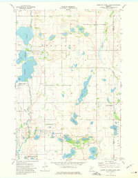
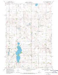 1968 Dry Wood Lake1970 Print · USGSThe Stevens and Swift County borderlands are preserved here in the late sixties, a landscape defined by glacial lakes and wildlife conservation. Genealogists and researchers can trace rural community hubs like Trinity Ch Cem, St Agnes Ch, and the shores of Dry Wood Lake.
 - 1968 Map of Hancock, 1970 Print
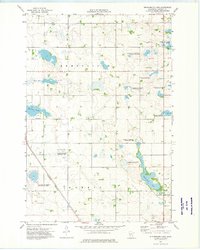
 1968 Hancock1970 Print · USGSHancock and the surrounding Stevens County prairies are documented here in the late sixties as the region balanced farming with conservation. Researchers can trace the Great Northern rail line and locate community landmarks like Bethel Ch, Byrne Lake, and the local Townhall.
 - 1968 Map of Artichoke Lake NW, 1970 Print
 1968 Artichoke Lake NW1970 Print · USGSThe Stevens County prairie during the late 1960s is revealed here as a landscape of managed wetlands and quiet rural outposts. Local historians can locate School No 142, the Artichoke Lake Ch, and the central Townhall in Baker.
 - 1968 Map of Clontarf North, 1970 Print
 1968 Clontarf North1970 Print · USGSPope and Swift Counties were defined by rail-side settlements and prairie wetlands in the late sixties. Genealogists and local historians can trace the foundations of Clontarf along the Great Northern tracks and locate family sites near St Malachy Cem.
 - 1968 Map of Hancock NW, 1970 Print
 1968 Hancock NW1970 Print · USGSStevens and Swift Counties are captured in the late sixties, showing a landscape defined by the Pomme De Terre River and rural townships. Genealogists can locate family landmarks like Zion Cem, the Apostolic Ch, and the settlement of Fairfield.2 unique versions available
 - 1973 Map of Alberta, 1975 Print
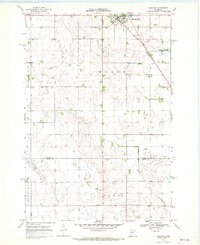
 1973 Alberta1975 Print · USGSStevens County agriculture and conservation meet in the early seventies near the small rail town of Alberta. Genealogists and local researchers can trace the rural layout of Scott Twp, locating landmarks like the Townhall, Pepperton Ch Cem, and the Burlington Northern tracks.
 - 1973 Map of Patchen Lake, 1975 Print
 1973 Patchen Lake1975 Print · USGSThe wetlands and prairie townships of Grant and Stevens Counties are meticulously detailed in the early 1970s. Researchers can trace rural cemeteries and local boundaries like Roseville Cem or explore the numerous ponds within the National Waterfowl Production Area.
 - 1973 Map of Herman, 1975 Print
 1973 Herman1975 Print · USGSWestern Minnesota’s agricultural prairie and rail-side settlements are captured here in the early 1970s. Trace local history through landmarks like Herman, Norcross, and the Eden Reformed Cem along the diagonal Burlington Northern line.
 - 1973 Map of Morris, 1975 Print
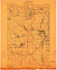
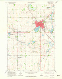 1973 Morris1975 Print · USGSThe Stevens County seat in the early 1970s is a hub of education and conservation. Genealogists and historians can trace the town's core from the University of Minnesota at Morris to Summit Cem and the Pomme de Terre River.2 unique versions available
 - 1973 Map of Donnelly, 1975 Print
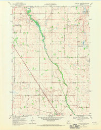
 1973 Donnelly1975 Print · USGSDonnelly and the surrounding prairie wetlands of Stevens County are captured here in the mid-1970s. Researchers can trace local genealogy at Kongsvinger Ch or explore the rail-linked landscape near Harstad Slough and the Burlington Northern tracks.
 - 1973 Map of Pomme De Terre Lakes, 1975 Print
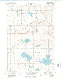
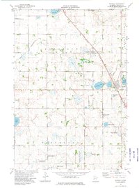
 1973 Pomme De Terre Lakes1975 Print · USGSStretching across the Stevens and Pope county line in the 1970s, this region shows a quiet landscape of glacial lakes and prairie wetlands. Researchers can trace rural lineages at Scandia Cemetery, Aeneas Church, and the many family-named waters like Bjork Lake.
 - 1973 Map of Wintermute Lake, 1975 Print
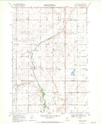
 1973 Wintermute Lake1975 Print · USGSStevens County in the early seventies reveals a landscape shaped by conservation and rail, centered on the townships of Rendsville and Morris. Researchers can trace the Burlington Northern rail line as it skirts Harstad Slough and the protected Wintermute Lake.
Showing maps 1-25 of 142
Top cities of Stevens County
- Morris historical maps
- Hancock historical maps
- Chokio historical maps
- Donnelly historical maps
- Alberta historical maps
Frequently asked questions
- What are the different types of historical maps available for Stevens County?
- What is the oldest map of Stevens County?
- Where can I purchase historical maps of Stevens County for my home or office?
- Where can I download high-res historical maps of Stevens County?
- Are there historical topographic maps available for Stevens County?
- Is there historical aerial imagery available for Stevens County?
- Where are historical maps of Stevens County sourced from?