1970s Maps of Stevens County, Minnesota
Explore 15 historic maps of Stevens County from the 1970s. These maps offer a rare glimpse into what life looked like during the 1970s — showing old roads, neighborhoods, homes, and landmarks that have changed or disappeared over time.
Whether you're researching your family's past, planning a metal detecting trip, or studying how Stevens County's landscape evolved across the 1970s, these high-resolution maps are a powerful tool for exploring the history of this region.
- Focus on a specific era: All maps on this page are from the 1970s, giving you a focused view of this time period.
- See what’s changed: Compare century-old streets, trails, and buildings to today's modern landscape using overlays and satellite layers.
- Research with precision: Use these maps for genealogy, historical research, land use analysis, or educational projects.
- View, download, or print: Maps are fully viewable online in high resolution, and can be downloaded or printed for your own records.
Start exploring Stevens County's history through authentic maps from the 1970s. This is your window into the past.
Stevens County, MN maps
(15)- 1973 Map of Alberta, 1975 Print
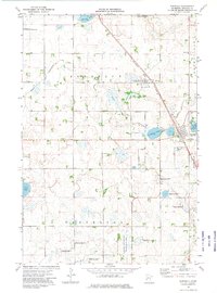
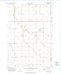
 1973 Alberta1975 Print · USGSStevens County agriculture and conservation meet in the early seventies near the small rail town of Alberta. Genealogists and local researchers can trace the rural layout of Scott Twp, locating landmarks like the Townhall, Pepperton Ch Cem, and the Burlington Northern tracks.
 - 1973 Map of Patchen Lake, 1975 Print
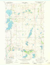
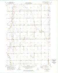
 1973 Patchen Lake1975 Print · USGSThe wetlands and prairie townships of Grant and Stevens Counties are meticulously detailed in the early 1970s. Researchers can trace rural cemeteries and local boundaries like Roseville Cem or explore the numerous ponds within the National Waterfowl Production Area.
 - 1973 Map of Herman, 1975 Print
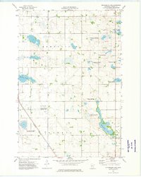
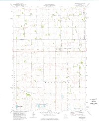
 1973 Herman1975 Print · USGSWestern Minnesota’s agricultural prairie and rail-side settlements are captured here in the early 1970s. Trace local history through landmarks like Herman, Norcross, and the Eden Reformed Cem along the diagonal Burlington Northern line.
 - 1973 Map of Morris, 1975 Print
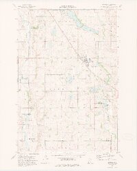
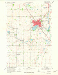 1973 Morris1975 Print · USGSThe Stevens County seat in the early 1970s is a hub of education and conservation. Genealogists and historians can trace the town's core from the University of Minnesota at Morris to Summit Cem and the Pomme de Terre River.2 unique versions available
 - 1973 Map of Donnelly, 1975 Print
 1973 Donnelly1975 Print · USGSDonnelly and the surrounding prairie wetlands of Stevens County are captured here in the mid-1970s. Researchers can trace local genealogy at Kongsvinger Ch or explore the rail-linked landscape near Harstad Slough and the Burlington Northern tracks.
 - 1973 Map of Pomme De Terre Lakes, 1975 Print
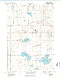
 1973 Pomme De Terre Lakes1975 Print · USGSStretching across the Stevens and Pope county line in the 1970s, this region shows a quiet landscape of glacial lakes and prairie wetlands. Researchers can trace rural lineages at Scandia Cemetery, Aeneas Church, and the many family-named waters like Bjork Lake.
 - 1973 Map of Wintermute Lake, 1975 Print
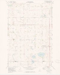
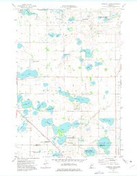
 1973 Wintermute Lake1975 Print · USGSStevens County in the early seventies reveals a landscape shaped by conservation and rail, centered on the townships of Rendsville and Morris. Researchers can trace the Burlington Northern rail line as it skirts Harstad Slough and the protected Wintermute Lake.
 - 1973 Map of Hoffman, 1975 Print
 1973 Hoffman1975 Print · USGSGrant County in the early seventies is defined by the rail-side community of Hoffman and its surrounding wetlands. Researchers can trace family history through sites like Bethel Cem or study the landscape of the Chippewa State Wildlife Management Area.
 - 1973 Map of Niemackl Lakes, 1975 Print
 1973 Niemackl Lakes1975 Print · USGSGrant and Stevens counties were shaped by a glacial landscape of prairie potholes and rail lines in the 1970s. Researchers can locate St Charles Cem, follow the Burlington Northern tracks, or trace the shores of Big Lake and Ohlsrud Lake.
 - 1973 Map of Chokio NW, 1975 Print
 1973 Chokio NW1975 Print · USGSWestern Minnesota prairie and wetlands are preserved here during the 1970s, showcasing a landscape of managed conservation and small-scale industry. Researchers can trace the courses of Twelvemile Creek and find legacy sites like the Thedin State Wildlife Management Area and local Gravel Pits.
 - 1973 Map of Page Lake, 1975 Print
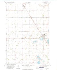
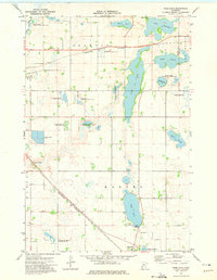 1973 Page Lake1975 Print · USGSHancock and the surrounding glacial prairies of Stevens County are captured here in the early 1970s. Trace the diagonal route of the Burlington Northern past local landmarks like Page Lake and the Lakeside Cem.
 - 1973 Map of Chokio, 1975 Print
 1973 Chokio1975 Print · USGSThe town of Chokio and its surrounding prairie townships are captured here in the early seventies as a key stop along the Burlington Northern railroad. Genealogists and local historians can locate St Marys Cem, Chokio Cem, and natural landmarks like Gravel Lake and Jipson Slough.
 - 1974 Map of Graceville NE, 1976 Print
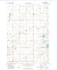
 1974 Graceville NE1976 Print · USGSTraverse and Stevens counties are captured here in the mid-1970s, showing a prairie landscape defined by massive townships and managed water. Trace local history through a Townhall and family farmsteads in Dollymount and Leonardsville.
 - 1974 Map of Wheaton SE, 1976 Print
 1974 Wheaton SE1976 Print · USGSTraverse and Grant counties are captured here in the mid-1970s, showcasing a meticulously drained prairie landscape shaped by agriculture. Researchers can trace local history through sites like Zion Cem, the Simpson Landing Strip, and the winding path of Twelvemile Creek.
 - 1974 Map of Johnson, 1976 Print
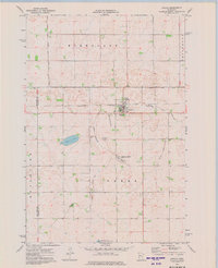
 1974 Johnson1976 Print · USGSWestern Minnesota farmland near the Traverse and Big Stone county line is captured here in the mid-seventies. Genealogists and researchers can trace the rail corridor through Johnson, locate the Trinity Ch, and explore the drainage of Moonshine Lakebed.
End of results
Showing maps 1-15 of 15
Top cities of Stevens County
- Morris historical maps
- Hancock historical maps
- Chokio historical maps
- Donnelly historical maps
- Alberta historical maps
Frequently asked questions
- What are the different types of historical maps available for Stevens County?
- What is the oldest map of Stevens County?
- Where can I purchase historical maps of Stevens County for my home or office?
- Where can I download high-res historical maps of Stevens County?
- Are there historical topographic maps available for Stevens County?
- Is there historical aerial imagery available for Stevens County?
- Where are historical maps of Stevens County sourced from?