
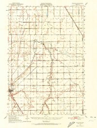
1951 Map of Wheaton
USGS Topo · Published 1951About this map
The Wheaton townsite sits at the heart of this agricultural survey, serving as a hub where the Great Northern and Chicago Milwaukee St Paul and Pacific railroads converge. The surrounding landscape in Lake Valley and Monson townships is defined by the intricate hydrology of the Mustinka River and its various tributaries, including the West Branch Mustinka River and the Mustinka Ditch. This network suggests an era focused on managed water for large-scale farming.
Find a feature on this map
44 named features on this map. Tap any name to fly to it.
Don’t see what you’re looking for? This feature index may not catch every label — zoom into the map to look around manually.
Map Details
Editions of this 1951 Wheaton Map
2 editions found
Other maps of this area

1904 · Wahpeton
USGS Topo · 1:125,000

1910 · Wendell
USGS Topo · 1:62,500

1910 · Chokio
USGS Topo · 1:62,500

1911 · Herman
USGS Topo · 1:62,500

1912 · Chokio
USGS Topo · 1:62,500

1913 · Wendell
USGS Topo · 1:62,500

1915 · White Rock
USGS Topo · 1:62,500

1916 · Beardsley
USGS Topo · 1:62,500

1918 · White Rock
USGS Topo · 1:62,500

1918 · Beardsley
USGS Topo · 1:62,500