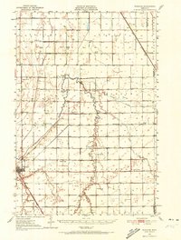
1951 Map of Wheaton
USGS Topo · Published 1972About this map
The town of Wheaton serves as the focal point of this Traverse County landscape, situated at the junction of the Great Northern and the Chicago Milwaukee St Paul and Pacific railroads. The era’s agricultural character is defined by an exceptionally high density of numbered rural school districts, ranging from School No 27 in the north to School No 55 in the south, suggesting a once-populous farming community. The Mustinka River and its various channels, including the Mustinka Ditch and the West Branch, carve through the prairie, regulated in part by a Gaging Station near the town center.
Find a feature on this map
39 named features on this map. Tap any name to fly to it.
Don’t see what you’re looking for? This feature index may not catch every label — zoom into the map to look around manually.
Map Details
Editions of this 1951 Wheaton Map
2 editions found

Other maps of this area

1904 · Wahpeton
USGS Topo · 1:125,000

1910 · Wendell
USGS Topo · 1:62,500

1910 · Chokio
USGS Topo · 1:62,500

1911 · Herman
USGS Topo · 1:62,500

1912 · Chokio
USGS Topo · 1:62,500

1913 · Wendell
USGS Topo · 1:62,500

1915 · White Rock
USGS Topo · 1:62,500

1916 · Beardsley
USGS Topo · 1:62,500

1918 · White Rock
USGS Topo · 1:62,500

1918 · Beardsley
USGS Topo · 1:62,500