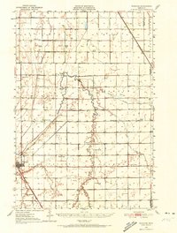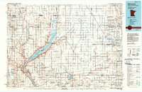
1985 Map of Wheaton
USGS Topo · Published 1990About this map
Lake Traverse and the Bois de Sioux River form a natural boundary on this 1985 survey, marking the intersection of Minnesota, South Dakota, and North Dakota. This landscape is defined by the glacial legacy of the Mustinka River basin and an extensive network of conservation areas, including numerous National Waterfowl Production Areas and the Mustinka State Wildlife Management Area. The map captures the agricultural and transportation infrastructure of the mid-1980s, anchored by the Burlington Northern Railroad which connects prairie elevators in towns like Wheaton, Graceville, and Chokio. Beyond the township grids of Traverse and Big Stone counties, the map delineates a portion of the Sisseton Indian Reservation in the west. Local landmarks such as St Marys Church and the Wheaton Municipal Airport provide specific points of reference for genealogists and local historians studying the rural development of this tri-state border region.
Find a feature on this map
123 named features on this map. Tap any name to fly to it.
Don’t see what you’re looking for? This feature index may not catch every label — zoom into the map to look around manually.
Map Details
Editions of this 1985 Wheaton Map
2 editions found