
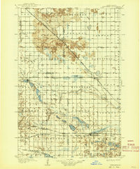
1907 Map of Wyndmere
USGS Topo · Published 1907About this map
The Sheyenne River meanders through the northern plains of this early twentieth-century landscape, carving a valley flanked by prominent Sand Dunes near Sandoun Mc Leod P O. This era was defined by the aggressive expansion of the prairie rail network, with the Northern Pacific RR (Fergus Falls Branch) and the Minneapolis St Paul and Sault Ste Marie RR intersecting at the village of Wyndmere.
Find a feature on this map
63 named features on this map. Tap any name to fly to it.
Don’t see what you’re looking for? This feature index may not catch every label — zoom into the map to look around manually.
Map Details
Editions of this 1907 Wyndmere Map
2 editions found
Other maps of this area

1895 · Fargo
USGS Topo · 1:125,000

1895 · Casselton
USGS Topo · 1:125,000

1897 · Fargo
USGS Topo · 1:125,000

1897 · Tower
USGS Topo · 1:125,000

1897 · Casselton
USGS Topo · 1:125,000

1904 · Wahpeton
USGS Topo · 1:125,000

1917 · New Effington
USGS Topo · 1:62,500

1953 · Milbank
USGS Topo · 1:250,000

1953 · Fargo
USGS Topo · 1:250,000

1956 · Fargo
USGS Topo · 1:250,000