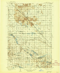
1907 Map of Wyndmere
USGS Topo · Published 1941About this map
The Sheyenne River cuts through the northern reaches of this prairie landscape, where the early 20th-century economy was defined by an expanding network of competing railroads. Geographer H.M. Wilson and his team documented a region in transition, where small hubs like Wyndmere and Milnor served as vital collection points for agricultural goods. The southern portion of the map is dominated by a complex system of glacial lakes, including Sand Lake, Swan Lake, and Tewaukon Lake, as well as the northern boundary of the Sisseton and Wahpeton Indian Reservation.
Find a feature on this map
59 named features on this map. Tap any name to fly to it.
Don’t see what you’re looking for? This feature index may not catch every label — zoom into the map to look around manually.
Map Details
Editions of this 1907 Wyndmere Map
2 editions found
Other maps of this area

1895 · Fargo
USGS Topo · 1:125,000

1895 · Casselton
USGS Topo · 1:125,000

1897 · Fargo
USGS Topo · 1:125,000

1897 · Tower
USGS Topo · 1:125,000

1897 · Casselton
USGS Topo · 1:125,000

1904 · Wahpeton
USGS Topo · 1:125,000

1907 · Wyndmere
USGS Topo · 1:125,000

1917 · New Effington
USGS Topo · 1:62,500

1953 · Milbank
USGS Topo · 1:250,000

1953 · Fargo
USGS Topo · 1:250,000