2020s Maps of Jefferson Township, South Dakota
Explore 6 historic maps of Jefferson Township from the 2020s. These maps offer a rare glimpse into what life looked like during the 2020s — showing old roads, neighborhoods, homes, and landmarks that have changed or disappeared over time.
Whether you're researching your family's past, planning a metal detecting trip, or studying how Jefferson Township's landscape evolved across the 2020s, these high-resolution maps are a powerful tool for exploring the history of this region.
- Focus on a specific era: All maps on this page are from the 2020s, giving you a focused view of this time period.
- See what’s changed: Compare century-old streets, trails, and buildings to today's modern landscape using overlays and satellite layers.
- Research with precision: Use these maps for genealogy, historical research, land use analysis, or educational projects.
- View, download, or print: Maps are fully viewable online in high resolution, and can be downloaded or printed for your own records.
Start exploring Jefferson Township's history through authentic maps from the 2020s. This is your window into the past.
Jefferson Township, SD maps
(6)- 2021 Map of Frankfort, 2021 Print
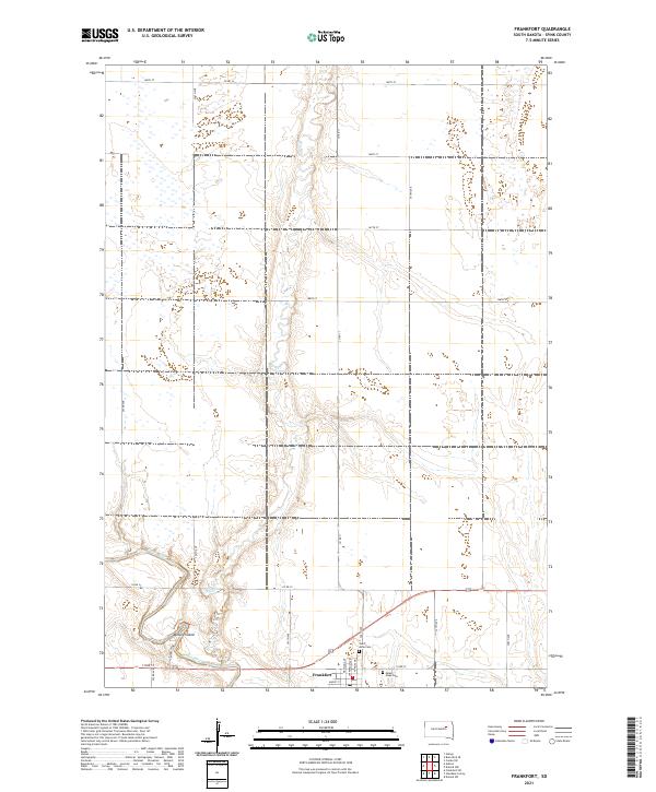 2021 Frankfort2021 Print · USGSThe Spink County prairie near the James River appears here in its modern agricultural form. Researchers can trace the townsite of Frankfort and locate local burial grounds including Saint Anne Cem and Mount Hope Cem.
 - 2021 Map of Ashton, 2021 Print
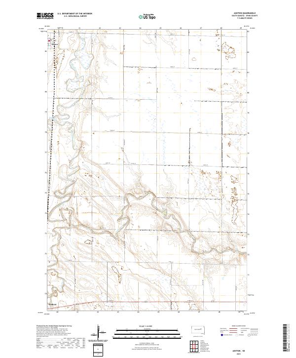 2021 Ashton2021 Print · USGSSpink County's river-bottom lands are captured here during the early twenty-first century as the James River winds between local townships. Genealogists and researchers can trace the rural infrastructure around Ashton, follow the path of Railroad Ln, and locate early homestead sites near Snake Cr.
 - 2021 Map of Gallup, 2021 Print
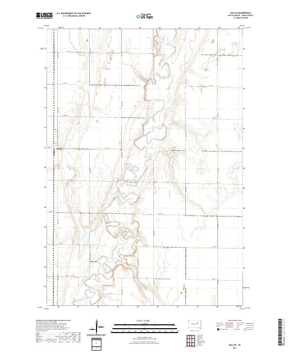 2021 Gallup2021 Print · USGSThe glacial plains of Spink County are captured here in the early twenty-first century, centered on the winding James River. Genealogists and local historians can locate the settlement of Gallup and trace property boundaries across townships like T119N R64W.
 - 2021 Map of Brentford SE, 2021 Print
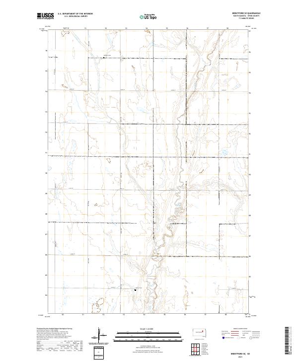 2021 Brentford SE2021 Print · USGSAgricultural life in Spink County remains centered on the prairie and the winding course of Dry Run. Researchers can locate historic family sites at Baldwin Cem and Clifton Cem along the rural grid of 395th Ave.
 - 2021 Map of Athol, 2021 Print
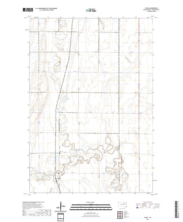 2021 Athol2021 Print · USGSThe rural landscape of Spink County is captured here in the early twenty-first century, centered on the small community of Athol. Genealogists and local historians can locate Saint Mary's Cem and Athol Cem along the winding banks of Snake Creek.
 - 2021 Map of Redfield North, 2021 Print
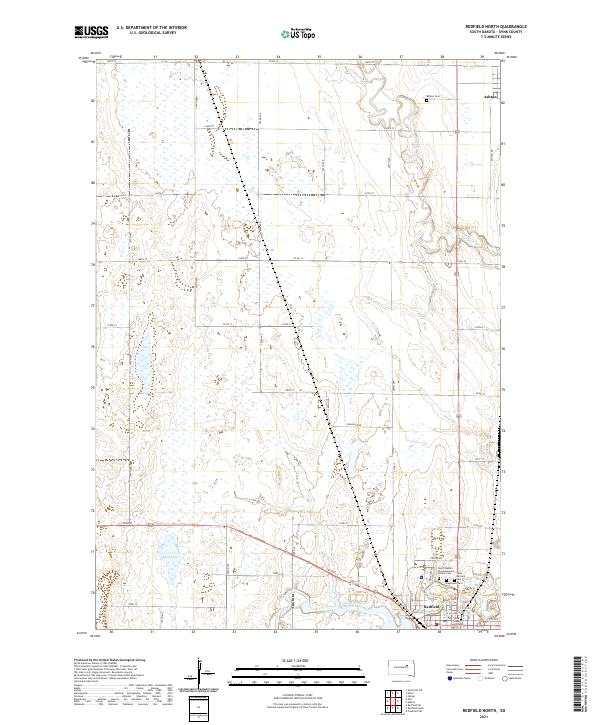 2021 Redfield North2021 Print · USGSSpink County's agricultural heartland is documented here in the early twenty-first century, centered on the plains between Redfield and Ashton. Researchers can trace local landmarks like the Spink County Courthouse or locate family plots at Greenlawn Cem and Saint Bernard Cem.
End of results
Showing maps 1-6 of 6
Top cities near Jefferson Township
- Redfield historical maps
- Mellette historical maps
- Frankfort historical maps
- Ashton historical maps
- Northville historical maps
- Athol historical maps
See more
Top neighborhoods of Jefferson Township
Frequently asked questions
- What are the different types of historical maps available for Jefferson Township?
- What is the oldest map of Jefferson Township?
- Where can I purchase historical maps of Jefferson Township for my home or office?
- Where can I download high-res historical maps of Jefferson Township?
- Are there historical topographic maps available for Jefferson Township?
- Is there historical aerial imagery available for Jefferson Township?
- Where are historical maps of Jefferson Township sourced from?