1950s Maps of Lincoln Township, South Dakota
Explore 6 historic maps of Lincoln Township from the 1950s. These maps offer a rare glimpse into what life looked like during the 1950s — showing old roads, neighborhoods, homes, and landmarks that have changed or disappeared over time.
Whether you're researching your family's past, planning a metal detecting trip, or studying how Lincoln Township's landscape evolved across the 1950s, these high-resolution maps are a powerful tool for exploring the history of this region.
- Focus on a specific era: All maps on this page are from the 1950s, giving you a focused view of this time period.
- See what’s changed: Compare century-old streets, trails, and buildings to today's modern landscape using overlays and satellite layers.
- Research with precision: Use these maps for genealogy, historical research, land use analysis, or educational projects.
- View, download, or print: Maps are fully viewable online in high resolution, and can be downloaded or printed for your own records.
Start exploring Lincoln Township's history through authentic maps from the 1950s. This is your window into the past.
Lincoln Township, SD maps
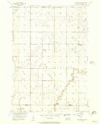
(6)- 1953 Map of Huron, 1959 Print
 1953 Huron1959 Print · USGSCentral South Dakota comes alive in the mid-1950s as a thriving rail and agricultural corridor between the Missouri and James Rivers. Trace the legacy of family farms and prairie towns like Huron, Faulkton, and Wessington Springs along the historic Chicago and North Western rail lines.3 unique versions available
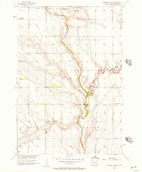
 - 1954 Map of Huron, 1977 Print
 1954 Huron1977 Print · USGSCentral South Dakota was a landscape of grain elevators and river bends during the mid-fifties. Genealogists and historians can trace the development of the James River valley through railroad towns like Redfield and the sprawling Crow Creek Indian Reservation.
 - 1956 Map of Lake Byron NW, 1957 Print
 1956 Lake Byron NW1957 Print · USGSThe glacial till of eastern South Dakota is captured here during the mid-fifties as the Missouri River Basin development program was underway. Researchers can locate several rural school sites like Bluebell Sch and Sunshine Sch, as well as the Irving Cem.
 - 1956 Map of Glendale Colony, 1957 Print
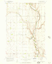
 1956 Glendale Colony1957 Print · USGSSpink County agriculture and river life are captured here in the mid-fifties, centered on the James River. Genealogists can locate rural landmarks like Glendale Colony, Guttenberg Cem, and several schools including the Rosebud Sch.
 - 1956 Map of Spink Colony, 1957 Print
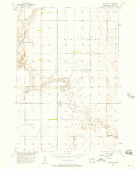
 1956 Spink Colony1957 Print · USGSThe James River valley at the Spink and Beadle county line appears in the mid-fifties as a landscape of rural townships and flowing wells. Genealogists can locate Hillestad Cem and trace the closure of country schools like Lincoln Sch (Abandoned).2 unique versions available
 - 1956 Map of Doland SW, 1957 Print
 1956 Doland SW1957 Print · USGSMid-century Spink County comes into focus in this detailed survey of its prairie townships and rural school districts. Genealogists and local historians can locate the Ebenezer Cem or trace the locations of the Lawrence Sch and Happy Hollow Sch.2 unique versions available
End of results
Showing maps 1-6 of 6
Top cities near Lincoln Township
- Redfield historical maps
- Doland historical maps
- Tulare historical maps
- Frankfort historical maps
- Ashton historical maps
- Hitchcock historical maps
See more
Top neighborhoods of Lincoln Township
Frequently asked questions
- What are the different types of historical maps available for Lincoln Township?
- What is the oldest map of Lincoln Township?
- Where can I purchase historical maps of Lincoln Township for my home or office?
- Where can I download high-res historical maps of Lincoln Township?
- Are there historical topographic maps available for Lincoln Township?
- Is there historical aerial imagery available for Lincoln Township?
- Where are historical maps of Lincoln Township sourced from?