1900s (20th Century) Maps of District 1, South Dakota
Explore 35 historic maps of District 1 from the 1900s (20th Century). These maps offer a rare glimpse into what life looked like during the 1900s — showing old roads, neighborhoods, homes, and landmarks that have changed or disappeared over time.
Whether you're researching your family's past, planning a metal detecting trip, or studying how District 1's landscape evolved across the 1900s, these high-resolution maps are a powerful tool for exploring the history of this region.
- Focus on a specific era: All maps on this page are from the 1900s, giving you a focused view of this time period.
- See what’s changed: Compare century-old streets, trails, and buildings to today's modern landscape using overlays and satellite layers.
- Research with precision: Use these maps for genealogy, historical research, land use analysis, or educational projects.
- View, download, or print: Maps are fully viewable online in high resolution, and can be downloaded or printed for your own records.
Start exploring District 1's history through authentic maps from the 1900s. This is your window into the past.
District 1, SD maps
(35)- 1951 Map of Redelm NE, 1953 Print
 1951 Redelm NE1953 Print · USGSWithin the Cheyenne River Indian Reservation during the early 1950s, the Moreau River meanders through a landscape defined by ranching and traditional land use. Genealogists can locate the Iron Lightning Cem, Iron Lightning Sch, and St Luke Ch along the river's winding path.
 - 1951 Map of Dupree NE, 1953 Print
 1951 Dupree NE1953 Print · USGSZiebach County land within the Cheyenne River Indian Reservation is captured here in the early fifties along the serpentine Moreau River. Genealogists and local historians can trace rural landmarks like Pretty Creek Sch and family-named elevations such as St Patrick Butte.
 - 1951 Map of Redelm NW, 1953 Print
 1951 Redelm NW1953 Print · USGSThe Moreau River cuts through the Cheyenne River Indian Reservation during the early fifties, showing a rural landscape at the border of Ziebach and Perkins counties. Genealogists and historians can trace local landmarks like Junker Sch (Abandoned) and Flint Rock Creek.
 - 1951 Map of Faith NE, 1953 Print
 1951 Faith NE1953 Print · USGSPerkins and Ziebach counties are captured in the early 1950s just as Missouri River Basin development was underway. Genealogists and local historians can trace the early educational landscape through the Arrowhead Sch (Abandoned) and the area's geography along the Moreau River.
 - 1951 Map of Thunder Butte, 1953 Print
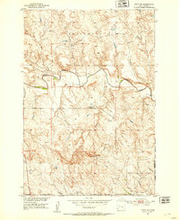
 1951 Thunder Butte1953 Print · USGSThe Cheyenne River Indian Reservation of the early 1950s reveals a landscape of river-bend crossings and rural landmarks. Trace early community sites like High Point Sch and St Luke Cem along the winding Moreau River.2 unique versions available
 - 1952 Map of Lantry NW, 1954 Print
 1952 Lantry NW1954 Print · USGSIn the early 1950s, this area of the Cheyenne River Indian Reservation was a landscape of remote schoolhouses and winding river bends. Local historians can trace the positions of Liebelt Sch, O Donnell Sch, and the winding course of the Moreau River.2 unique versions available
 - 1952 Map of Lantry NE, 1954 Print
 1952 Lantry NE1954 Print · USGSThe Cheyenne River Indian Reservation and the winding Moreau River dominate this early 1950s survey of Dewey County. Genealogists and local historians can trace the settlement at Green Grass and the nearby Green Grass Cem.
 - 1953 Map of McIntosh, 1965 Print
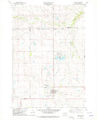
 1953 McIntosh1965 Print · USGSThe north-central Dakota prairie is captured here during the mid-fifties, showing the vast Standing Rock Indian Reservation and the newly formed Oah E Reservoir. Genealogists and historians can trace the Chicago Milwaukee St Paul and Pacific rail line through stops like McIntosh, Walker, and Eagle Butte.3 unique versions available
 - 1954 Map of Lemmon, 1964 Print
 1954 Lemmon1964 Print · USGSThe high plains of South Dakota and North Dakota are documented here during the mid-twentieth century. Family researchers can trace dozens of country school sites like Green Cabin School and Bierke School alongside landmarks like The Castles.2 unique versions available
 - 1957 Map of Lemmon
 1957 Lemmon1957 Print · USGSThe northwestern plains of South Dakota and North Dakota are captured here in the mid-fifties, centered on the rail hub of Lemmon. Genealogists and historians can trace dozens of rural schoolhouses and vanished sites like Imogene and the Shadehill Reservoir area.
 - 1958 Map of McIntosh
 1958 McIntosh1958 Print · USGSThe north-central Dakotas appear here in the mid-1950s as massive engineering projects and rail lines shaped the plains. Researchers can trace tribal lands within the Standing Rock Indian Reservation and locate local landmarks like the Keller Mine or the Virginia Siding.
 - 1978 Map of Isabel SW, 1979 Print
 1978 Isabel SW1979 Print · USGSThe Cheyenne River Indian Reservation interior is shown here in the late seventies as a landscape of remote prairie and winding waterways. Researchers can trace the path of Red Earth Creek across the county line or locate the secluded Jewitt Pond.
 - 1978 Map of Peach Lake, 1979 Print
 1978 Peach Lake1979 Print · USGSDewey County’s high prairie and winding creek beds are meticulously documented in the late 1970s. Researchers can trace the seasonal waterways of Meadow Creek and Redwater Creek, or locate the specific topography surrounding Peach Lake.
 - 1978 Map of Isabel, 1979 Print
 1978 Isabel1979 Print · USGSIn the late 1970s, the community of Isabel was a vital cross-section of South Dakota rail and reservation life. Trace the path of the Chicago Milwaukee St Paul and Pacific railroad or locate family roots at Hillview Cem.
 - 1978 Map of Firesteel, 1979 Print
 1978 Firesteel1979 Print · USGSNear the Standing Rock Reservation in the late seventies, this area shows the rural heart of South Dakota's northern plains. Genealogists and historians can trace the Pacific railroad line through Firesteel and locate Our Savior Cem.
 - 1979 Map of Dupree
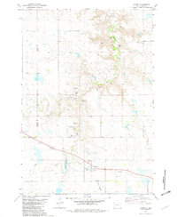
 1979 Dupree1979 Print · USGSThe Ziebach County seat of Dupree is captured in the late seventies as a vital rail and aviation hub on the South Dakota plains. Researchers can trace the Milwaukee Road rail line and locate local landmarks like Bedners Dam and the Dupree Municipal Airport.
 - 1981 Map of Lantry, 1982 Print
 1981 Lantry1982 Print · USGSThe rural landscape of Dewey County is captured here in the early 1980s, centered on the settlement of Lantry. Researchers can trace the path of the Abandoned railroad or locate family roots at St James Cem and Lantry Cem near Bear Creek.
 - 1981 Map of Lantry SE, 1982 Print
 1981 Lantry SE1982 Print · USGSDewey County’s rolling plains come into focus in the early eighties as part of the Cheyenne River Indian Reservation. Local researchers can locate Eagle Butte Cem and trace the winding course of Green Grass Creek through the prairie.
 - 1982 Map of Glad Valley, 1983 Print
 1982 Glad Valley1983 Print · USGSGlad Valley and the northern South Dakota plains are captured in the early eighties as a crossroads of tribal and federal lands. Researchers can trace the section lines and remote landmarks like Glad Valley Dam, Twin Butte, and the local Cem.
 - 1982 Map of Glad Valley SW, 1983 Print
 1982 Glad Valley SW1983 Print · USGSZiebach County was characterized by wide-open prairie and isolated landmarks like Thunder Butte in the early eighties. Genealogists and historians can trace the intricate drainages of Thunder Butte Creek and Surveyor Creek across the reservation lands.
 - 1982 Map of Glad Valley NW, 1983 Print
 1982 Glad Valley NW1983 Print · USGSZiebach County and the surrounding plains are captured in the early eighties as a intersection of tribal and federal lands. Researchers can trace boundary lines for the Standing Rock Indian Reservation and landmarks like Twin Butte.
 - 1982 Map of Irish Creek SW, 1983 Print
 1982 Irish Creek SW1983 Print · USGSZiebach County land within the Cheyenne River Indian Reservation is captured here during the early eighties. Researchers can trace the drainage of Beaver Trap Creek and locate the remote Dorsey Landing Strip in this prairie landscape.
 - 1982 Map of Irish Creek NW, 1983 Print
 1982 Irish Creek NW1983 Print · USGSThe open plains of Ziebach and Corson counties are captured here in the early eighties, where tribal lands meet at a quiet geographic boundary. Researchers can trace the path of Irish Creek across the Standing Rock Indian Reservation during this era of rural mapping.
 - 1982 Map of Red Elm, 1983 Print
 1982 Red Elm1983 Print · USGSZiebach County in the early eighties shows the quiet settlement of Red Elm as it appeared before modernization. Trace local history through family-named landmarks like Sandoz Dam, the isolated Red Elm Cem, and the path of an abandoned roadway.
 - 1982 Map of Glad Valley SE, 1983 Print
 1982 Glad Valley SE1983 Print · USGSZiebach County in the early eighties is characterized by its wide-open prairie and dramatic landforms within the Cheyenne River Indian Reservation. Researchers can trace the elevation changes at Thunder Butte and the winding paths of West Beaver Trap Creek and Thunder Butte Creek.
Showing maps 1-25 of 35
Top cities near District 1
Top neighborhoods of District 1
- Iron Lightning historical maps
- Bear Creek historical maps
- Allison Crossing historical maps
- Red Elm historical maps
- Glad Valley historical maps
- Thunder Butte historical maps
See more
Frequently asked questions
- What are the different types of historical maps available for District 1?
- What is the oldest map of District 1?
- Where can I purchase historical maps of District 1 for my home or office?
- Where can I download high-res historical maps of District 1?
- Are there historical topographic maps available for District 1?
- Is there historical aerial imagery available for District 1?
- Where are historical maps of District 1 sourced from?