Old Maps of Iron Lightning, District 1 for Academic Research
Study the evolution of Iron Lightning with 8 high-resolution historic maps. Whether you're teaching, researching, or modeling changes in land use, these maps provide essential visual documentation of urban, environmental, and geographic change.
- Analyze long-term change: Track patterns in development, transportation, and natural features.
- Ideal for environmental or urban studies: Support academic projects with primary historical map data.
- Use in the classroom or lab: Educators and researchers rely on these maps to bring historical context to life.
These maps are a powerful tool for teaching, research, and visualizing how Iron Lightning has changed over the decades.
Iron Lightning, District 1 maps
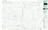
(8)- 1951 Map of Redelm NE, 1953 Print
 1951 Redelm NE1953 Print · USGSWithin the Cheyenne River Indian Reservation during the early 1950s, the Moreau River meanders through a landscape defined by ranching and traditional land use. Genealogists can locate the Iron Lightning Cem, Iron Lightning Sch, and St Luke Ch along the river's winding path.
 - 1953 Map of McIntosh, 1965 Print
 1953 McIntosh1965 Print · USGSThe north-central Dakota prairie is captured here during the mid-fifties, showing the vast Standing Rock Indian Reservation and the newly formed Oah E Reservoir. Genealogists and historians can trace the Chicago Milwaukee St Paul and Pacific rail line through stops like McIntosh, Walker, and Eagle Butte.3 unique versions available
 - 1958 Map of McIntosh
 1958 McIntosh1958 Print · USGSThe north-central Dakotas appear here in the mid-1950s as massive engineering projects and rail lines shaped the plains. Researchers can trace tribal lands within the Standing Rock Indian Reservation and locate local landmarks like the Keller Mine or the Virginia Siding.
 - 1986 Map of Timber Lake
 1986 Timber Lake1986 Print · USGSNorth-central South Dakota in the mid-eighties reveals a landscape of ranching hubs and indigenous lands shaped by the Moreau River and Grand River. Researchers can trace old rail routes near Red Elm and locate remote prairie landmarks like St Patrick Butte or Glad Valley.2 unique versions available
 - 2012 Map of Red Elm NE, 2012 Print
 2012 Red Elm NE2012 Print · USGSCovers Iron Lightning, including District 1, Ziebach County, and other nearby areas
 - 2015 Map of Red Elm NE, 2015 Print
 2015 Red Elm NE2015 Print · USGSCovers Iron Lightning, including District 1, Ziebach County, and other nearby areas
 - 2017 Map of Red Elm NE, 2017 Print
 2017 Red Elm NE2017 Print · USGSCovers Iron Lightning, including District 1, Ziebach County, and other nearby areas
 - 2021 Map of Red Elm NE, 2021 Print
 2021 Red Elm NE2021 Print · USGSThe community of Iron Lightning and the Moreau River bottomlands are captured here in the early twenty-first century. Genealogists and historians can trace local ties at the Iron Lightning Cem or follow the route of Iron Lightning Rd across the prairie.
End of results
Showing maps 1-8 of 8
Top cities near Iron Lightning
Frequently asked questions
- What are the different types of historical maps available for Iron Lightning?
- What is the oldest map of Iron Lightning?
- Where can I purchase historical maps of Iron Lightning for my home or office?
- Where can I download high-res historical maps of Iron Lightning?
- Are there historical topographic maps available for Iron Lightning?
- Is there historical aerial imagery available for Iron Lightning?
- Where are historical maps of Iron Lightning sourced from?