Old Maps of Thunder Butte, District 1 for Genealogy
Trace your family roots with 8 historic maps of Thunder Butte. These high-res maps reveal old neighborhoods, homesites, landmarks, and streets — helping you uncover where your ancestors lived and how the area evolved over time.
- Explore historic neighborhoods: Identify where your relatives may have lived in the 1800s or 1900s.
- Compare maps over time: Trace the changes in streets, buildings, and landmarks for multi-generational research.
- Perfect for genealogy & ancestry research: Used by family historians and researchers to map out lineage and migration.
These maps are an incredible resource for exploring your personal connection to Thunder Butte's past.
Thunder Butte, District 1 maps
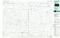
(8)- 1951 Map of Thunder Butte, 1953 Print
 1951 Thunder Butte1953 Print · USGSThe Cheyenne River Indian Reservation of the early 1950s reveals a landscape of river-bend crossings and rural landmarks. Trace early community sites like High Point Sch and St Luke Cem along the winding Moreau River.2 unique versions available
 - 1953 Map of McIntosh, 1965 Print
 1953 McIntosh1965 Print · USGSThe north-central Dakota prairie is captured here during the mid-fifties, showing the vast Standing Rock Indian Reservation and the newly formed Oah E Reservoir. Genealogists and historians can trace the Chicago Milwaukee St Paul and Pacific rail line through stops like McIntosh, Walker, and Eagle Butte.3 unique versions available
 - 1958 Map of McIntosh
 1958 McIntosh1958 Print · USGSThe north-central Dakotas appear here in the mid-1950s as massive engineering projects and rail lines shaped the plains. Researchers can trace tribal lands within the Standing Rock Indian Reservation and locate local landmarks like the Keller Mine or the Virginia Siding.
 - 1986 Map of Timber Lake
 1986 Timber Lake1986 Print · USGSNorth-central South Dakota in the mid-eighties reveals a landscape of ranching hubs and indigenous lands shaped by the Moreau River and Grand River. Researchers can trace old rail routes near Red Elm and locate remote prairie landmarks like St Patrick Butte or Glad Valley.2 unique versions available
 - 2012 Map of Thunder Butte, 2012 Print
 2012 Thunder Butte2012 Print · USGSCovers Thunder Butte, including District 1, Ziebach County, and other nearby areas
 - 2015 Map of Thunder Butte, 2015 Print
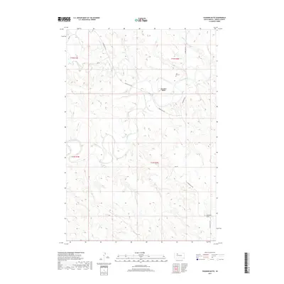
 2015 Thunder Butte2015 Print · USGSCovers Thunder Butte, including District 1, Ziebach County, and other nearby areas
 - 2017 Map of Thunder Butte, 2017 Print
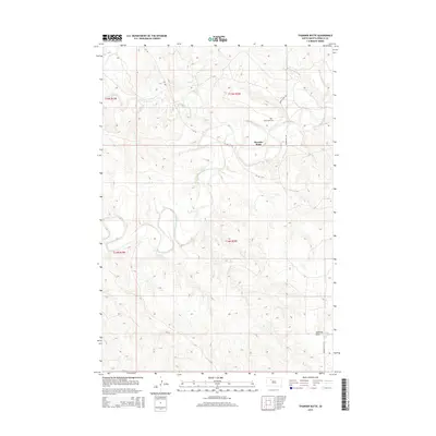
 2017 Thunder Butte2017 Print · USGSCovers Thunder Butte, including District 1, Ziebach County, and other nearby areas
 - 2021 Map of Thunder Butte, 2021 Print
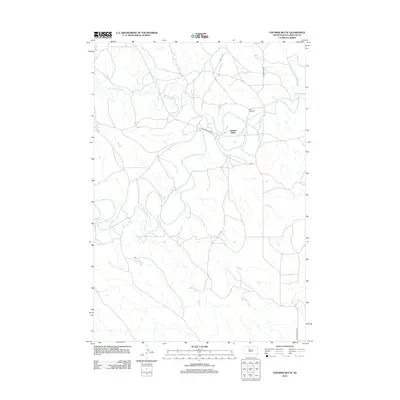
 2021 Thunder Butte2021 Print · USGSZiebach County in 2021 remains a place of wide-open prairie and traditional ranching life near the Moreau River. Genealogists and researchers can trace local family landmarks such as the Saint Luke Cemetery or follow the terrain around Thunder Butte.
End of results
Showing maps 1-8 of 8
Top cities near Thunder Butte
Frequently asked questions
- What are the different types of historical maps available for Thunder Butte?
- What is the oldest map of Thunder Butte?
- Where can I purchase historical maps of Thunder Butte for my home or office?
- Where can I download high-res historical maps of Thunder Butte?
- Are there historical topographic maps available for Thunder Butte?
- Is there historical aerial imagery available for Thunder Butte?
- Where are historical maps of Thunder Butte sourced from?