1980s Maps of Chase, District 2
Explore 2 historic maps of Chase from the 1980s. These maps offer a rare glimpse into what life looked like during the 1980s — showing old roads, neighborhoods, homes, and landmarks that have changed or disappeared over time.
Whether you're researching your family's past, planning a metal detecting trip, or studying how Chase's landscape evolved across the 1980s, these high-resolution maps are a powerful tool for exploring the history of this region.
- Focus on a specific era: All maps on this page are from the 1980s, giving you a focused view of this time period.
- See what’s changed: Compare century-old streets, trails, and buildings to today's modern landscape using overlays and satellite layers.
- Research with precision: Use these maps for genealogy, historical research, land use analysis, or educational projects.
- View, download, or print: Maps are fully viewable online in high resolution, and can be downloaded or printed for your own records.
Start exploring Chase's history through authentic maps from the 1980s. This is your window into the past.
Chase, District 2 maps
(2)- 1982 Map of Diermier Ranch, 1983 Print
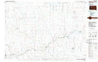
 1982 Diermier Ranch1983 Print · USGSThe Ziebach County rangeland in the early eighties is captured here, showing the remote ranching operations of central South Dakota. Researchers can locate family-named homesteads like Diermier Ranch, Johnson Ranch, and Fields Ranch along the winding West Branch Ash Creek.
 - 1986 Map of Cherry Creek
 1986 Cherry Creek1986 Print · USGSWest-central South Dakota comes to life in the mid-1980s, centered on the Cheyenne River Indian Reservation and the river's winding path. Genealogists and historians can trace the remote settlements of Red Scaffold and Milesville or locate family landmarks like Staple M Cliffs and Robbs Flat.2 unique versions available
End of results
Showing maps 1-2 of 2
Top cities near Chase
Frequently asked questions
- What are the different types of historical maps available for Chase?
- What is the oldest map of Chase?
- Where can I purchase historical maps of Chase for my home or office?
- Where can I download high-res historical maps of Chase?
- Are there historical topographic maps available for Chase?
- Is there historical aerial imagery available for Chase?
- Where are historical maps of Chase sourced from?