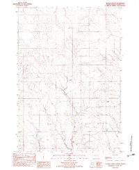
1982 Map of Diermier Ranch
USGS Topo · Published 1983About this map
The high plains of Ziebach County are defined by a complex drainage system shown in this 1982 provisional survey. The landscape is carved by the West Branch Ash Creek and East Branch Ash Creek, which converge as they flow through the open rangeland. This map captures the region when isolated homesteads and ranching operations were the primary markers of human settlement in this part of South Dakota. Named for the Diermier Ranch located centrally along the drainage, the area also features the Johnson Ranch and Fields Ranch to the east. The presence of Girl Creek in the southwest corner further illustrates the intricate network of seasonal and permanent waterways that dictated the placement of these early western holdings. The map’s focus on elevation contours and hydrological features reveals the specific terrain challenges faced by these 20th-century ranchers.
Find a feature on this map
6 named features on this map. Tap any name to fly to it.
Don’t see what you’re looking for? This feature index may not catch every label — zoom into the map to look around manually.
Map Details
Editions of this 1982 Diermier Ranch Map
This is the sole edition of this map. No revisions or reprints were ever made.
Other maps of this area

1953 · McIntosh
USGS Topo · 1:250,000

1954 · Pierre
USGS Topo · 1:250,000

1958 · Pierre
USGS Topo · 1:250,000

1958 · McIntosh
USGS Topo · 1:250,000

1979 · Dupree
USGS Topo · 1:25,000

1982 · Bull Creek 2 NE
USGS Topo · 1:24,000

1982 · Red Scaffold
USGS Topo · 1:24,000

1982 · Miller Dam
USGS Topo · 1:24,000

1982 · Longbrake Ranch
USGS Topo · 1:24,000
1982 · Red Elm
USGS Topo · 1:24,000