
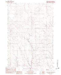
1982 Map of Miller Dam
USGS Topo · Published 1983About this map
Marple Butte rises as a prominent landmark in this prairie landscape, situated near the boundary where Ziebach Co meets Dewey Co. The 1982 provisional survey of the Cheyenne River Indian Reservation area illustrates a water-focused geography, dominated by the drainage systems of Cottonwood Creek and Little Bear Creek. At the center of the sheet lies Miller Dam, an essential piece of water management infrastructure in this semi-arid region. The map captures the territory before modern developments, showing a network of unimproved roads and trails that connect isolated ranching locations across the township lines of the Dakotas. The topographic detail highlights the complex erosion patterns and coulees that feed into the larger creek systems, providing an accurate record of the land surface as it was documented in the mid-1970s field checks.
Find a feature on this map
5 named features on this map. Tap any name to fly to it.
Don’t see what you’re looking for? This feature index may not catch every label — zoom into the map to look around manually.
Map Details
Editions of this 1982 Miller Dam Map
This is the sole edition of this map. No revisions or reprints were ever made.
Other maps of this area

1953 · McIntosh
USGS Topo · 1:250,000

1954 · Pierre
USGS Topo · 1:250,000

1958 · Pierre
USGS Topo · 1:250,000

1958 · McIntosh
USGS Topo · 1:250,000

1979 · Dupree
USGS Topo · 1:25,000

1981 · Lantry
USGS Topo · 1:24,000

1981 · High Elk Hill NW
USGS Topo · 1:24,000

1981 · High Elk Hill SW
USGS Topo · 1:24,000

1982 · Longbrake Ranch
USGS Topo · 1:24,000
1982 · Diermier Ranch
USGS Topo · 1:24,000