
1981 Map of High Elk Hill NW
USGS Topo · Published 1982About this map
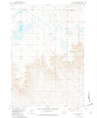
The rolling prairie and high-altitude breaks of the Cheyenne River Indian Reservation are captured here through a 1974 photogrammetric survey. This territory, situated along the county boundary of Dewey Co Ziebach Co, is defined by a network of intermittent watercourses and scattered wells. To the northwest, Little Bear Creek carves a path through the terrain, while the southern reaches are drained by the winding course of Rudy Creek. The map documents a landscape primarily used for grazing and resource extraction, punctuated by several remote well sites. The topography transitions from the flatter uplands in the north to the more complex, dissected hills and draws in the south, reflecting the characteristic erosional patterns of the western South Dakota plains during the early 1980s.
Find a feature on this map
4 named features on this map. Tap any name to fly to it.
Don’t see what you’re looking for? This feature index may not catch every label — zoom into the map to look around manually.
Map Details
Editions of this 1981 High Elk Hill NW Map
This is the sole edition of this map. No revisions or reprints were ever made.
Other maps of this area

1953 · McIntosh
USGS Topo · 1:250,000

1954 · Pierre
USGS Topo · 1:250,000

1958 · Pierre
USGS Topo · 1:250,000

1958 · McIntosh
USGS Topo · 1:250,000

1979 · Dupree
USGS Topo · 1:25,000

1981 · Lantry
USGS Topo · 1:24,000

1981 · High Elk Hill SE
USGS Topo · 1:24,000
1981 · High Elk Hill
USGS Topo · 1:24,000

1981 · High Elk Hill SW
USGS Topo · 1:24,000
1981 · Lantry SE
USGS Topo · 1:24,000