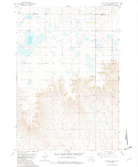
1981 Map of High Elk Hill
USGS Topo · Published 1982About this map
The rolling plains of the Cheyenne River Indian Reservation are captured here in the early 1980s, centered on the prominent rise of High Elk Hill. This West River landscape is defined by its drainage patterns and isolated landmarks, particularly where the East Fork Rudy Creek carves through the southern terrain. Human presence is marked by the St Marks Cem and an electrical Substation, connected by a network of unimproved roads and sections of Abandoned routes. The map documents the political boundary between Dewey Co and Ziebach Co, which bisects the northern part of the quadrangle. For the researcher, this sheet provides a detailed look at the rural infrastructure and land use within the reservation during a period of modern agricultural and utility development.
Find a feature on this map
7 named features on this map. Tap any name to fly to it.
Don’t see what you’re looking for? This feature index may not catch every label — zoom into the map to look around manually.
Map Details
Editions of this 1981 High Elk Hill Map
This is the sole edition of this map. No revisions or reprints were ever made.
Other maps of this area

1953 · McIntosh
USGS Topo · 1:250,000

1954 · Pierre
USGS Topo · 1:250,000

1958 · Pierre
USGS Topo · 1:250,000

1958 · McIntosh
USGS Topo · 1:250,000

1981 · Herbert Creek
USGS Topo · 1:24,000

1981 · Parade SW
USGS Topo · 1:24,000

1981 · Herbert Creek SW
USGS Topo · 1:24,000

1981 · Lantry
USGS Topo · 1:24,000

1981 · High Elk Hill NW
USGS Topo · 1:24,000

1981 · High Elk Hill SE
USGS Topo · 1:24,000