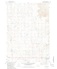
1981 Map of Lantry SE
USGS Topo · Published 1982About this map
Green Grass Creek meanders through this section of the Cheyenne River Indian Reservation, carving a path through the rolling hills of Dewey County. The landscape is primarily defined by its drainage patterns and isolated markers of human activity on the prairie. Near the southern edge of the sheet, the Eagle Butte Cem serves as a significant genealogical landmark for the region, situated just north of the local infrastructure which includes Sewage Disposal Ponds and a Gravel Pit. The map reflects the sparse, rural character of the South Dakota plains in the early 1980s, where small-scale utilities and traditional burial grounds are the primary developments alongside natural watercourses.
Find a feature on this map
7 named features on this map. Tap any name to fly to it.
Don’t see what you’re looking for? This feature index may not catch every label — zoom into the map to look around manually.
Map Details
Editions of this 1981 Lantry SE Map
This is the sole edition of this map. No revisions or reprints were ever made.
Other maps of this area

1952 · Lantry NW
USGS Topo · 1:24,000

1952 · Lantry NE
USGS Topo · 1:24,000

1952 · Parade NW
USGS Topo · 1:24,000

1953 · McIntosh
USGS Topo · 1:250,000

1954 · Pierre
USGS Topo · 1:250,000

1958 · Pierre
USGS Topo · 1:250,000

1958 · McIntosh
USGS Topo · 1:250,000

1981 · Herbert Creek
USGS Topo · 1:24,000

1981 · Parade SW
USGS Topo · 1:24,000

1981 · Lantry
USGS Topo · 1:24,000