
1982 Map of Bull Creek 2 NE
USGS Topo · Published 1983About this map
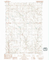
Rattlesnake Butte stands as a prominent landmark in this segment of the Cheyenne River Indian Reservation, presiding over a landscape defined by deeply incised drainage systems. The survey detail illustrates the complex hydrology of Ziebach County, centered on the winding course of Rattlesnake Creek as it moves through the prairie. To the southwest, the appearance of Red Coal Creek suggests the underlying geology that historically supported localized fuel needs in this part of South Dakota. The topography is further marked by the distinctive Squaw Teat Butte and its namesake Squaw Teat Creek in the southeastern portion of the quadrangle. Produced from 1970s aerial photography, this provisional document records the remote ranching terrain and section lines prior to more modern developments, preserving the original place names and landform designations used by the Department of the Interior during the early 1980s.
Find a feature on this map
7 named features on this map. Tap any name to fly to it.
Don’t see what you’re looking for? This feature index may not catch every label — zoom into the map to look around manually.
Map Details
Editions of this 1982 Bull Creek 2 NE Map
2 editions found
Other maps of this area

1953 · McIntosh
USGS Topo · 1:250,000

1954 · Pierre
USGS Topo · 1:250,000

1958 · Pierre
USGS Topo · 1:250,000

1958 · McIntosh
USGS Topo · 1:250,000

1979 · Dupree
USGS Topo · 1:25,000

1982 · Chasing Hawk Draw
USGS Topo · 1:24,000

1982 · Bessie Butte
USGS Topo · 1:24,000

1982 · Red Scaffold
USGS Topo · 1:24,000

1982 · Longbrake Ranch
USGS Topo · 1:24,000
1982 · Diermier Ranch
USGS Topo · 1:24,000