
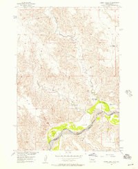
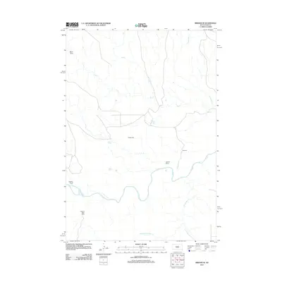
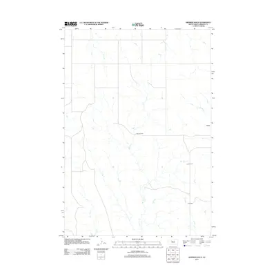
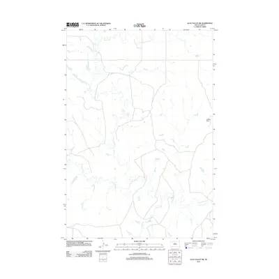
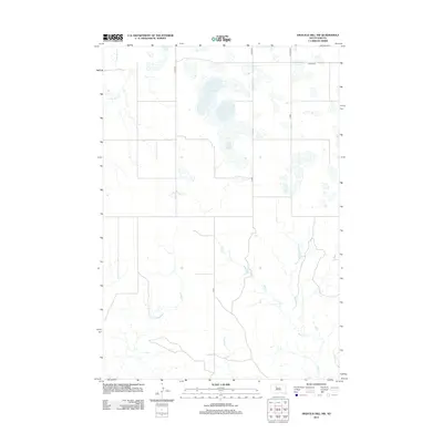
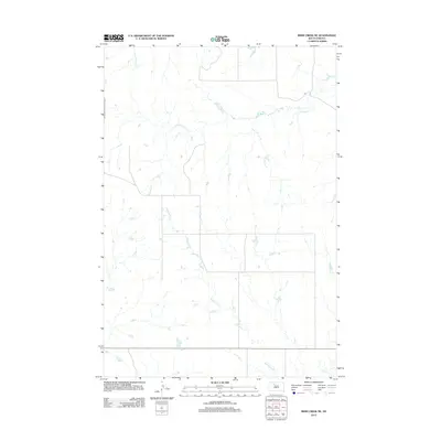
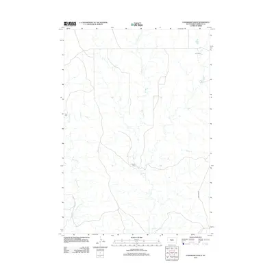
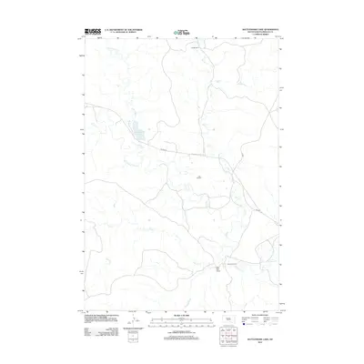
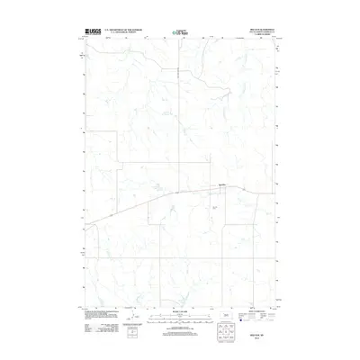
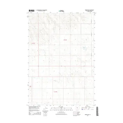
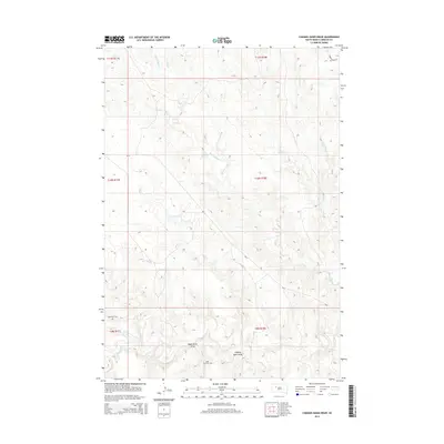
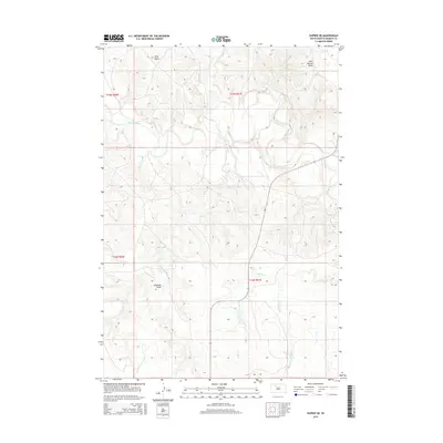
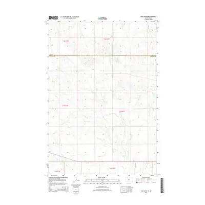
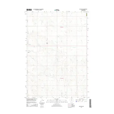
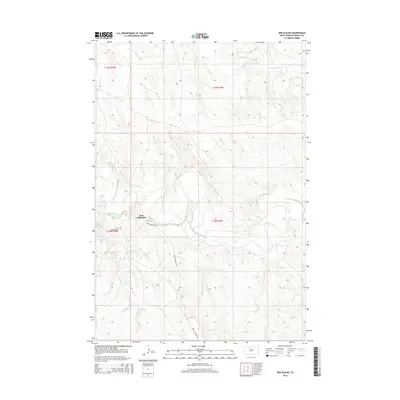
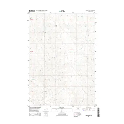
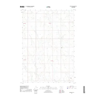
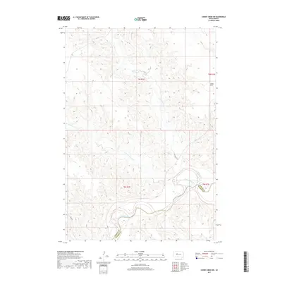
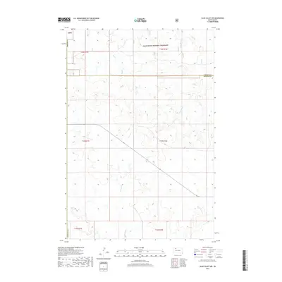
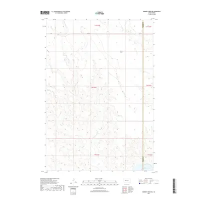
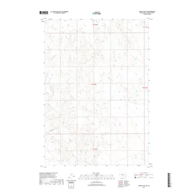
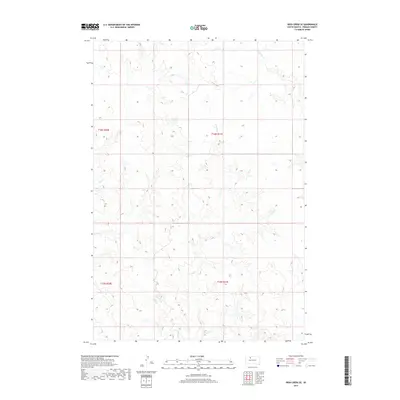
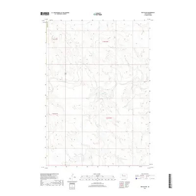
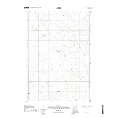
1956 Map of Cherry Creek NW
USGS Topo · Published 1987About this map
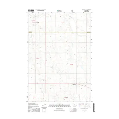
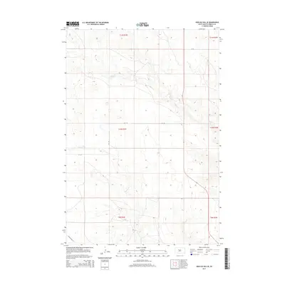
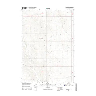
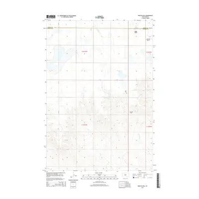
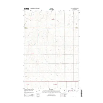
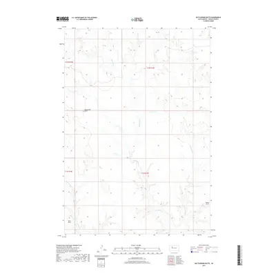
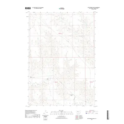
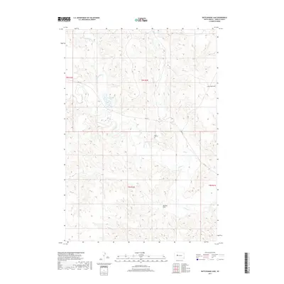
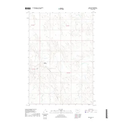
The Cheyenne River Indian Reservation dominates this landscape along the border of Ziebach and Haakon counties. The high plains terrain is defined by the winding course of the Cheyenne River and its major tributaries, including Cottonwood Creek and Deep Creek. This survey captures the ranching character of the mid-20th century, centering on isolated family operations like the Red Fox Ranch, Motley Ranch, and White Cloud Ranch. The presence of Joshua Butte provides a prominent landmark above the dissected breaks and drainage basins. The map illustrates the sparsely populated nature of the region, where life and transit were dictated by the watercourses and the open range, just as modern photographic revisions were beginning to document subtle changes in land use.
Find a feature on this map
10 named features on this map. Tap any name to fly to it.
Don’t see what you’re looking for? This feature index may not catch every label — zoom into the map to look around manually.
Map Details
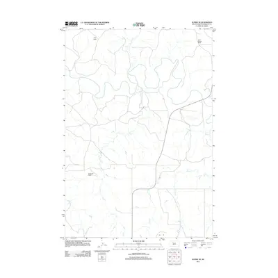
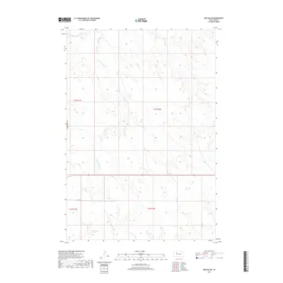
Editions of this 1956 Cherry Creek NW Map
2 editions found
Historical Maps of District 4 Through Time
176 maps found

1951 Dupree NE
Ziebach County, SD

1951 Redelm NE
Ziebach County, SD

1951 Redelm NW
Ziebach County, SD

1951 Thunder Butte
Ziebach County, SD

1955 Bridger SE
Ziebach County, SD

1955 Rattlesnake Lake NE
Ziebach County, SD

1955 Rattlesnake Lake
Ziebach County, SD
1956 Cherry Creek NW
Ziebach County, SD

1981 Herbert Creek SW
Ziebach County, SD

1981 Herbert Creek
Ziebach County, SD

1981 High Elk Hill NW
Ziebach County, SD

1981 High Elk Hill SE
Ziebach County, SD

1981 High Elk Hill SW
Ziebach County, SD

1981 High Elk Hill
Ziebach County, SD

1982 Bessie Butte
Ziebach County, SD

1982 Bridger NE
Ziebach County, SD

1982 Chasing Hawk Draw
Ziebach County, SD

1982 Dead Horse Draw
Ziebach County, SD

1982 Diermier Ranch
Ziebach County, SD

1982 Glad Valley NW
Ziebach County, SD

1982 Glad Valley SE
Ziebach County, SD

1982 Glad Valley SW
Ziebach County, SD

1982 Glad Valley
Ziebach County, SD

1982 Irish Creek NW
Ziebach County, SD

1982 Irish Creek SE
Ziebach County, SD

1982 Irish Creek SW
Ziebach County, SD

1982 Longbrake Ranch
Ziebach County, SD

1982 Miller Dam
Ziebach County, SD

1982 Rattlesnake Butte
Ziebach County, SD

1982 Red Elm SW
Ziebach County, SD

1982 Red Elm
Ziebach County, SD

1982 Red Scaffold
Ziebach County, SD

1982 Sears Dam
Ziebach County, SD

1983 Irish Creek NE
Ziebach County, SD

1998 Glad Valley NW
Ziebach County, SD

1998 Glad Valley
Ziebach County, SD
2012 Bedners Dam
Ziebach County, SD
2012 Bessie Butte
Ziebach County, SD
2012 Bridger NE
Ziebach County, SD
2012 Bridger SE
Ziebach County, SD
2012 Chasing Hawk Draw
Ziebach County, SD
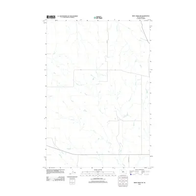
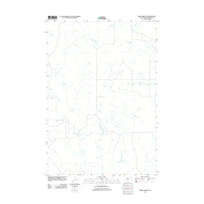
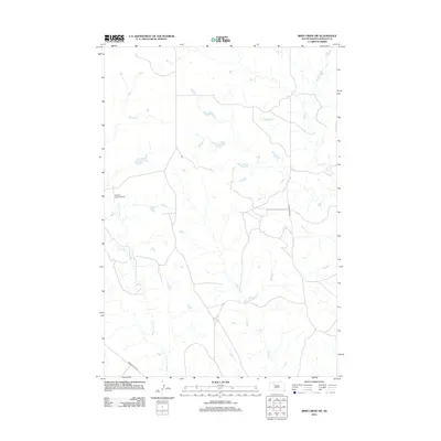
2012 Cherry Creek NW
Ziebach County, SD
2012 Dead Horse Draw
Ziebach County, SD
2012 Diermier Ranch
Ziebach County, SD
2012 Dupree NE
Ziebach County, SD
2012 Glad Valley NW
Ziebach County, SD
2012 Glad Valley SE
Ziebach County, SD
2012 Glad Valley SW
Ziebach County, SD
2012 Glad Valley
Ziebach County, SD
2012 Herbert Creek SW
Ziebach County, SD
2012 Herbert Creek
Ziebach County, SD
2012 High Elk Hill NW
Ziebach County, SD
2012 High Elk Hill SE
Ziebach County, SD
2012 High Elk Hill SW
Ziebach County, SD
2012 High Elk Hill
Ziebach County, SD
2012 Irish Creek NE
Ziebach County, SD
2012 Irish Creek NW
Ziebach County, SD
2012 Irish Creek SE
Ziebach County, SD
2012 Irish Creek SW
Ziebach County, SD
2012 Longbrake Ranch
Ziebach County, SD
2012 Miller Dam
Ziebach County, SD
2012 Rattlesnake Butte
Ziebach County, SD
2012 Rattlesnake Lake NE
Ziebach County, SD
2012 Rattlesnake Lake
Ziebach County, SD
2012 Red Elm NE
Ziebach County, SD
2012 Red Elm NW
Ziebach County, SD
2012 Red Elm SW
Ziebach County, SD
2012 Red Elm
Ziebach County, SD
2012 Red Scaffold
Ziebach County, SD
2012 Sears Dam
Ziebach County, SD
2012 Thunder Butte
Ziebach County, SD
2015 Bedners Dam
Ziebach County, SD
2015 Bessie Butte
Ziebach County, SD
2015 Bridger NE
Ziebach County, SD
2015 Bridger SE
Ziebach County, SD
2015 Chasing Hawk Draw
Ziebach County, SD
2015 Cherry Creek NW
Ziebach County, SD
2015 Dead Horse Draw
Ziebach County, SD
2015 Diermier Ranch
Ziebach County, SD
2015 Dupree NE
Ziebach County, SD
2015 Glad Valley NW
Ziebach County, SD
2015 Glad Valley SE
Ziebach County, SD
2015 Glad Valley SW
Ziebach County, SD
2015 Glad Valley
Ziebach County, SD
2015 Herbert Creek SW
Ziebach County, SD
2015 Herbert Creek
Ziebach County, SD
2015 High Elk Hill NW
Ziebach County, SD
2015 High Elk Hill SE
Ziebach County, SD
2015 High Elk Hill SW
Ziebach County, SD
2015 High Elk Hill
Ziebach County, SD
2015 Irish Creek NE
Ziebach County, SD
2015 Irish Creek NW
Ziebach County, SD
2015 Irish Creek SE
Ziebach County, SD
2015 Irish Creek SW
Ziebach County, SD
2015 Longbrake Ranch
Ziebach County, SD
2015 Miller Dam
Ziebach County, SD
2015 Rattlesnake Butte
Ziebach County, SD
2015 Rattlesnake Lake NE
Ziebach County, SD
2015 Rattlesnake Lake
Ziebach County, SD
2015 Red Elm NE
Ziebach County, SD
2015 Red Elm NW
Ziebach County, SD
2015 Red Elm SW
Ziebach County, SD
2015 Red Elm
Ziebach County, SD
2015 Red Scaffold
Ziebach County, SD
2015 Sears Dam
Ziebach County, SD
2015 Thunder Butte
Ziebach County, SD
2017 Bedners Dam
Ziebach County, SD
2017 Bessie Butte
Ziebach County, SD
2017 Bridger NE
Ziebach County, SD
2017 Bridger SE
Ziebach County, SD
2017 Chasing Hawk Draw
Ziebach County, SD
2017 Cherry Creek NW
Ziebach County, SD
2017 Dead Horse Draw
Ziebach County, SD
2017 Diermier Ranch
Ziebach County, SD
2017 Dupree NE
Ziebach County, SD
2017 Glad Valley NW
Ziebach County, SD
2017 Glad Valley SE
Ziebach County, SD
2017 Glad Valley SW
Ziebach County, SD
2017 Glad Valley
Ziebach County, SD
2017 Herbert Creek SW
Ziebach County, SD
2017 Herbert Creek
Ziebach County, SD
2017 High Elk Hill NW
Ziebach County, SD
2017 High Elk Hill SE
Ziebach County, SD
2017 High Elk Hill SW
Ziebach County, SD
2017 High Elk Hill
Ziebach County, SD
2017 Irish Creek NE
Ziebach County, SD
2017 Irish Creek NW
Ziebach County, SD
2017 Irish Creek SE
Ziebach County, SD
2017 Irish Creek SW
Ziebach County, SD
2017 Longbrake Ranch
Ziebach County, SD
2017 Miller Dam
Ziebach County, SD
2017 Rattlesnake Butte
Ziebach County, SD
2017 Rattlesnake Lake NE
Ziebach County, SD
2017 Rattlesnake Lake
Ziebach County, SD
2017 Red Elm NE
Ziebach County, SD
2017 Red Elm NW
Ziebach County, SD
2017 Red Elm SW
Ziebach County, SD
2017 Red Elm
Ziebach County, SD
2017 Red Scaffold
Ziebach County, SD
2017 Sears Dam
Ziebach County, SD
2017 Thunder Butte
Ziebach County, SD

2021 Bedners Dam
Ziebach County, SD

2021 Bessie Butte
Ziebach County, SD

2021 Bridger NE
Ziebach County, SD

2021 Bridger SE
Ziebach County, SD

2021 Chasing Hawk Draw
Ziebach County, SD

2021 Cherry Creek NW
Ziebach County, SD

2021 Dead Horse Draw
Ziebach County, SD

2021 Diermier Ranch
Ziebach County, SD

2021 Dupree NE
Ziebach County, SD

2021 Glad Valley NW
Ziebach County, SD

2021 Glad Valley SE
Ziebach County, SD

2021 Glad Valley SW
Ziebach County, SD

2021 Glad Valley
Ziebach County, SD

2021 Herbert Creek SW
Ziebach County, SD

2021 Herbert Creek
Ziebach County, SD

2021 High Elk Hill NW
Ziebach County, SD

2021 High Elk Hill SE
Ziebach County, SD

2021 High Elk Hill SW
Ziebach County, SD

2021 High Elk Hill
Ziebach County, SD

2021 Irish Creek NE
Ziebach County, SD

2021 Irish Creek NW
Ziebach County, SD

2021 Irish Creek SE
Ziebach County, SD

2021 Irish Creek SW
Ziebach County, SD

2021 Longbrake Ranch
Ziebach County, SD

2021 Miller Dam
Ziebach County, SD

2021 Rattlesnake Butte
Ziebach County, SD

2021 Rattlesnake Lake NE
Ziebach County, SD

2021 Rattlesnake Lake
Ziebach County, SD

2021 Red Elm NE
Ziebach County, SD

2021 Red Elm NW
Ziebach County, SD

2021 Red Elm SW
Ziebach County, SD

2021 Red Elm
Ziebach County, SD

2021 Red Scaffold
Ziebach County, SD

2021 Sears Dam
Ziebach County, SD

2021 Thunder Butte
Ziebach County, SD