
1955 Map of Rattlesnake Lake
USGS Topo · Published 1956About this map
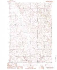
Cherry Creek winds through the heart of this Ziebach County landscape, carving a deep, meandering course through the Missouri River Basin during the mid-1950s. The map highlights the isolation of prairie life, where large ranching operations like Knight Ranch and Samuelson Ranch serve as primary landmarks across the rolling draws. The presence of Rattlesnake Lake and its associated spillway indicates the importance of water management in this semi-arid region, supported by smaller features like Jesse Dam and Little Dog Dam. Genealogy researchers will find significant value in the documentation of the Frazier Ch and the Little Dog Cem, which, along with the small settlement at Felix, anchor the community history of this ranching territory. Notable geographic shifts are recorded in the Old Channel, reflecting the dynamic nature of the local waterways over time.
Find a feature on this map
15 named features on this map. Tap any name to fly to it.
Don’t see what you’re looking for? This feature index may not catch every label — zoom into the map to look around manually.
Map Details
Editions of this 1955 Rattlesnake Lake Map
This is the sole edition of this map. No revisions or reprints were ever made.
Other maps of this area

1954 · Pierre
USGS Topo · 1:250,000

1955 · Rattlesnake Lake SE
USGS Topo · 1:24,000

1955 · Rattlesnake Lake SW
USGS Topo · 1:24,000

1955 · Rattlesnake Lake NE
USGS Topo · 1:24,000

1955 · Bridger SE
USGS Topo · 1:24,000

1958 · Pierre
USGS Topo · 1:250,000

1982 · Bridger NE
USGS Topo · 1:24,000

1982 · Red Scaffold
USGS Topo · 1:24,000

1982 · Longbrake Ranch
USGS Topo · 1:24,000
1982 · Sears Dam
USGS Topo · 1:24,000