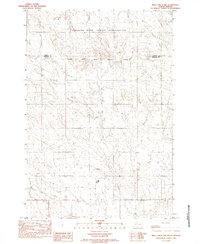
1982 Map of Irish Creek NW
USGS Topo · Published 1983About this map
Standing Rock Indian Reservation lands dominate the northern landscape of this region, meeting the Cheyenne River Indian Reservation Boundary in a sparse, open expanse of the Dakotas. The terrain is defined by the winding course of Irish Creek, which threads through the southern half of the map. This 1982 provisional survey reflects the rural character of the border between Corson Co and Ziebach Co, showing a land primarily organized by township and section lines rather than dense settlement. The map captures the isolation of the northern plains, where natural drainage patterns like those of Irish Creek provided the essential framework for land division and early ranching boundaries in this part of South Dakota.
Find a feature on this map
4 named features on this map. Tap any name to fly to it.
Don’t see what you’re looking for? This feature index may not catch every label — zoom into the map to look around manually.
Map Details
Editions of this 1982 Irish Creek NW Map
This is the sole edition of this map. No revisions or reprints were ever made.
Other maps of this area

1953 · McIntosh
USGS Topo · 1:250,000

1956 · Cottonwood Creek SE
USGS Topo · 1:24,000

1956 · Cottonwood Creek SW
USGS Topo · 1:24,000

1958 · McIntosh
USGS Topo · 1:250,000

1972 · Twin Butte
USGS Topo · 1:24,000

1980 · McIntosh
USGS Topo · 1:100,000

1982 · Glad Valley
USGS Topo · 1:24,000

1982 · Irish Creek SW
USGS Topo · 1:24,000

1982 · Glad Valley SE
USGS Topo · 1:24,000
1982 · Irish Creek SE
USGS Topo · 1:24,000