1960s Maps of Clinton, Tennessee
Explore 2 historic maps of Clinton from the 1960s. These maps offer a rare glimpse into what life looked like during the 1960s — showing old roads, neighborhoods, homes, and landmarks that have changed or disappeared over time.
Whether you're researching your family's past, planning a metal detecting trip, or studying how Clinton's landscape evolved across the 1960s, these high-resolution maps are a powerful tool for exploring the history of this region.
- Focus on a specific era: All maps on this page are from the 1960s, giving you a focused view of this time period.
- See what’s changed: Compare century-old streets, trails, and buildings to today's modern landscape using overlays and satellite layers.
- Research with precision: Use these maps for genealogy, historical research, land use analysis, or educational projects.
- View, download, or print: Maps are fully viewable online in high resolution, and can be downloaded or printed for your own records.
Start exploring Clinton's history through authentic maps from the 1960s. This is your window into the past.
Clinton, TN maps
(2)- 1968 Map of Powell, 1971 Print
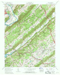 1968 Powell1971 Print · USGSThe Tennessee Valley north of Knoxville comes into focus during the late sixties as suburban growth meets established rural ridges. Researchers can trace family-named burial sites like Mabry Cem, visit the Powell Airfield, or locate the Slave cem near Wolf Valley Creek.
 - 1968 Map of Clinton, 1972 Print
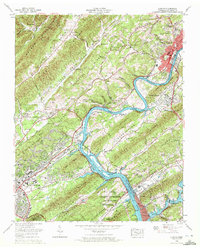 1968 Clinton1972 Print · USGSThe Clinch River Valley in the late sixties reveals the growing footprint of nuclear research and energy production near the industrial city of Clinton. Local historians can trace the development of Oak Ridge neighborhoods and find rural landmarks like Laurel Grove, Jarnigan Chapel, and the Bull Run Steam Plant.3 unique versions available
End of results
Showing maps 1-2 of 2
Top cities near Clinton
- Knoxville historical maps
- Oak Ridge historical maps
- Farragut historical maps
- Powell historical maps
- Halls Crossroads historical maps
- La Follette historical maps
See more
Top neighborhoods of Clinton
- Westwood Estates historical maps
- South Clinton historical maps
- I-75 Industrial Park historical maps
- Eagle Bend Industrial Park historical maps
- Clinch View historical maps
Frequently asked questions
- What are the different types of historical maps available for Clinton?
- What is the oldest map of Clinton?
- Where can I purchase historical maps of Clinton for my home or office?
- Where can I download high-res historical maps of Clinton?
- Are there historical topographic maps available for Clinton?
- Is there historical aerial imagery available for Clinton?
- Where are historical maps of Clinton sourced from?