2020s Maps of Caryville, Tennessee
Explore 4 historic maps of Caryville from the 2020s. These maps offer a rare glimpse into what life looked like during the 2020s — showing old roads, neighborhoods, homes, and landmarks that have changed or disappeared over time.
Whether you're researching your family's past, planning a metal detecting trip, or studying how Caryville's landscape evolved across the 2020s, these high-resolution maps are a powerful tool for exploring the history of this region.
- Focus on a specific era: All maps on this page are from the 2020s, giving you a focused view of this time period.
- See what’s changed: Compare century-old streets, trails, and buildings to today's modern landscape using overlays and satellite layers.
- Research with precision: Use these maps for genealogy, historical research, land use analysis, or educational projects.
- View, download, or print: Maps are fully viewable online in high resolution, and can be downloaded or printed for your own records.
Start exploring Caryville's history through authentic maps from the 2020s. This is your window into the past.
Caryville, TN maps
(4)- 2022 Map of Block, 2022 Print
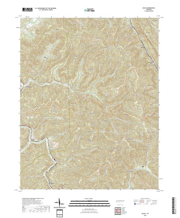 2022 Block2022 Print · USGSThe mountain valleys of Campbell and Scott counties are revealed in this modern survey of the Cumberland Plateau. Researchers can trace historic cemeteries and small settlements like Smoky Junction, Nicks Creek Cem, and Peewee.
 - 2022 Map of Ivydell, 2022 Print
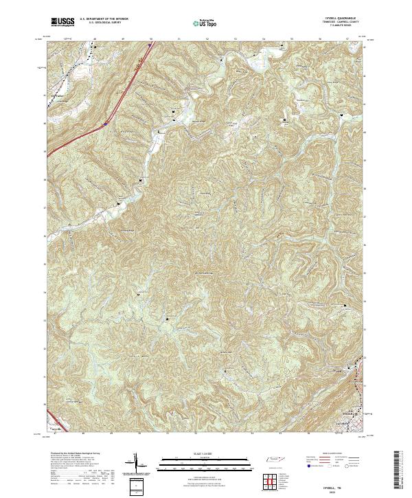 2022 Ivydell2022 Print · USGSCampbell County’s ridge-and-valley landscape is documented here in the early twenty-first century, showing the enduring rural settlement patterns of the region. Genealogists can locate numerous family burial sites like Samp Meredith Cem and Reynolds Cem tucked into the hollows of Pine Mountain.
 - 2022 Map of Pioneer, 2022 Print
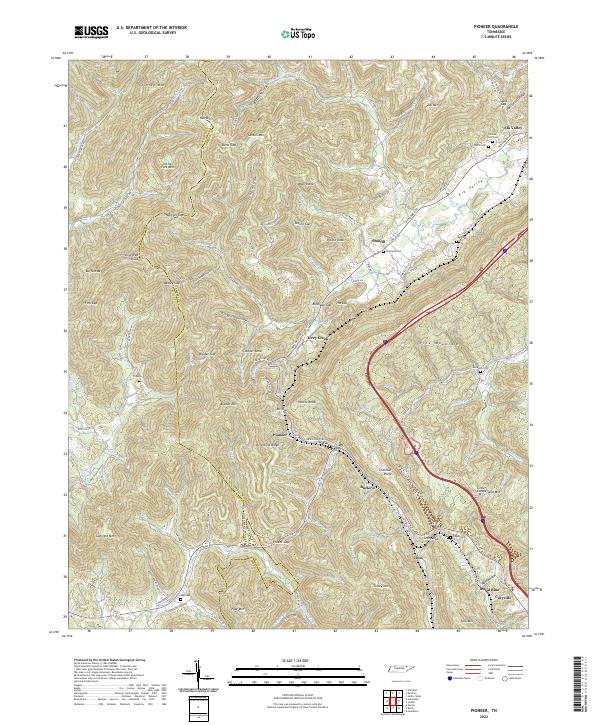 2022 Pioneer2022 Print · USGSUpper East Tennessee mountain life is detailed here as the modern century unfolds across the Campbell County ridges. Genealogists and historians can trace family roots through numerous burial sites like Lay Cemetery and Valley View Cemetery or locate old settlements like Stanfill and Pioneer.
 - 2022 Map of Jacksboro, 2022 Print
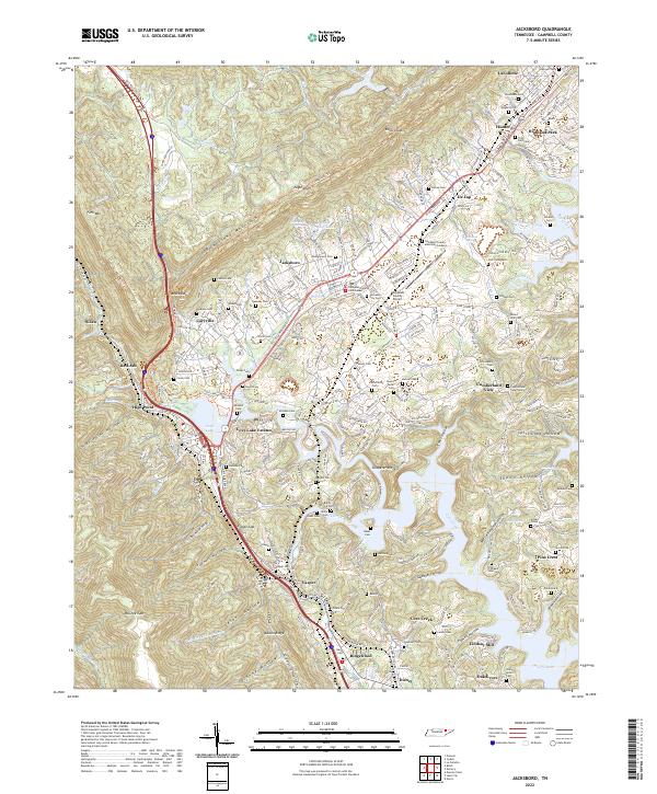 2022 Jacksboro2022 Print · USGSThe Powell Valley is shown here in the 2020s, where the Cumberland Mountains meet the waters of Norris Lake. Researchers can locate numerous family burial sites like Tiller Ford Cem and Poor Farm Cem, or trace the historic CSX RR through Caryville.
End of results
Showing maps 1-4 of 4
Top cities near Caryville
- Clinton historical maps
- LaFollette historical maps
- La Follette historical maps
- Jacksboro historical maps
- Rocky Top historical maps
- Norris historical maps
See more
Top neighborhoods of Caryville
Frequently asked questions
- What are the different types of historical maps available for Caryville?
- What is the oldest map of Caryville?
- Where can I purchase historical maps of Caryville for my home or office?
- Where can I download high-res historical maps of Caryville?
- Are there historical topographic maps available for Caryville?
- Is there historical aerial imagery available for Caryville?
- Where are historical maps of Caryville sourced from?